Precipitous Patangini | Astounding Auden’s | Mesmerizing Mayali

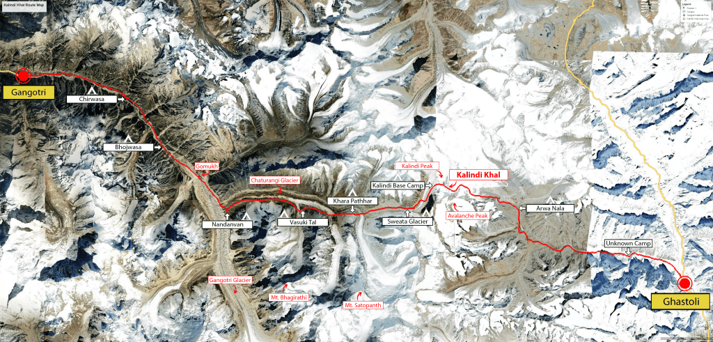
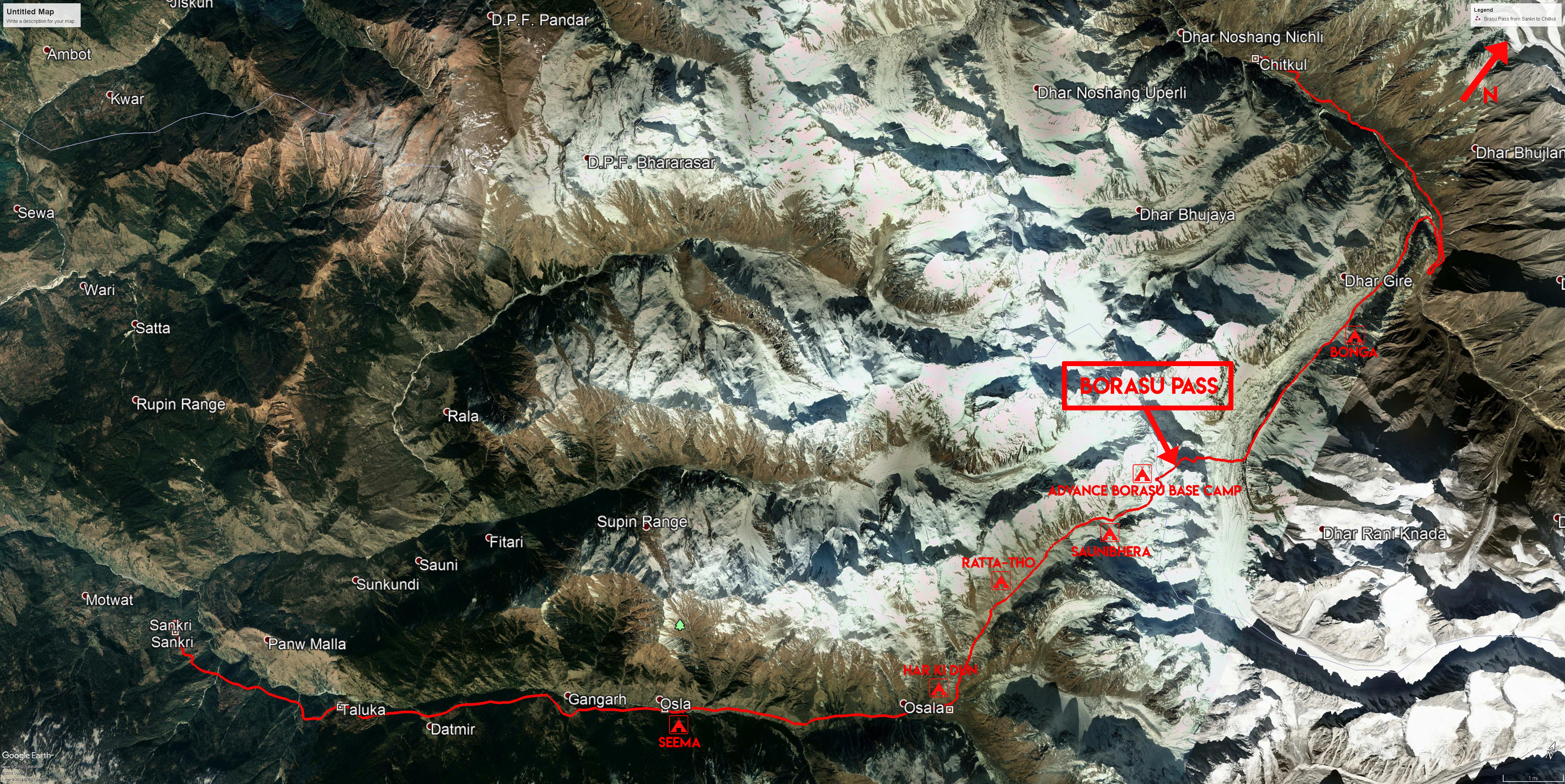
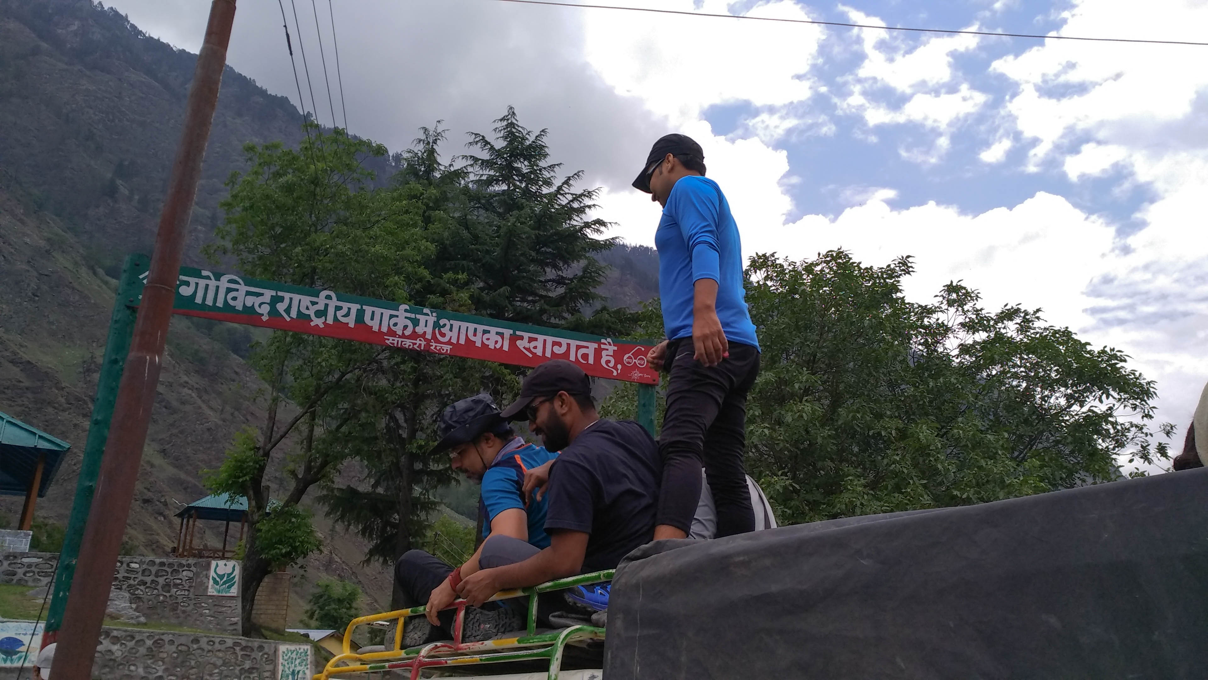
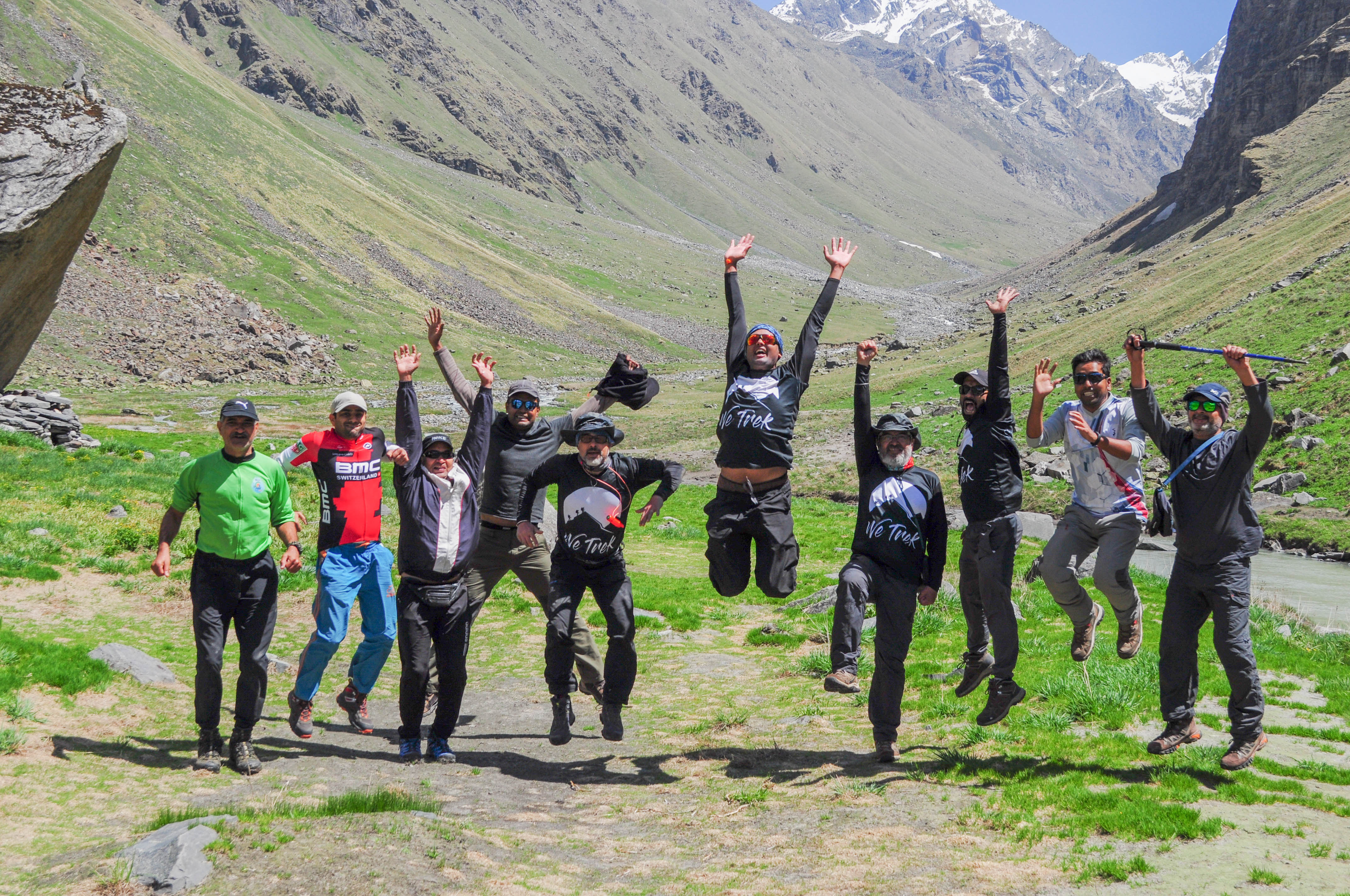
I was never interested in mathematics. Nevertheless, the numbers show that I have an opportunity for a couple of glamorous Himalayan treks. This would happen within a span of just 9 months. I eagerly did all the necessary mathematics. I got an opportunity to join the extraordinary trek from Gangotri Temple to Kedarnath Temple. The trek passed through Patangini Dhar, Auden’s Col, and Mayali Pass. This took place in June 2022. The Kalindi Khal trek was just finished 9 months before in September 2021.

Sonu Negi, the founder, and leader of Raacho trekkers, encounters this significant stretch every year. They come to Harshil from Chitkul, crossing the Lamkhaga pass with his group of support staff and clients. They are an amazing team in many ways.

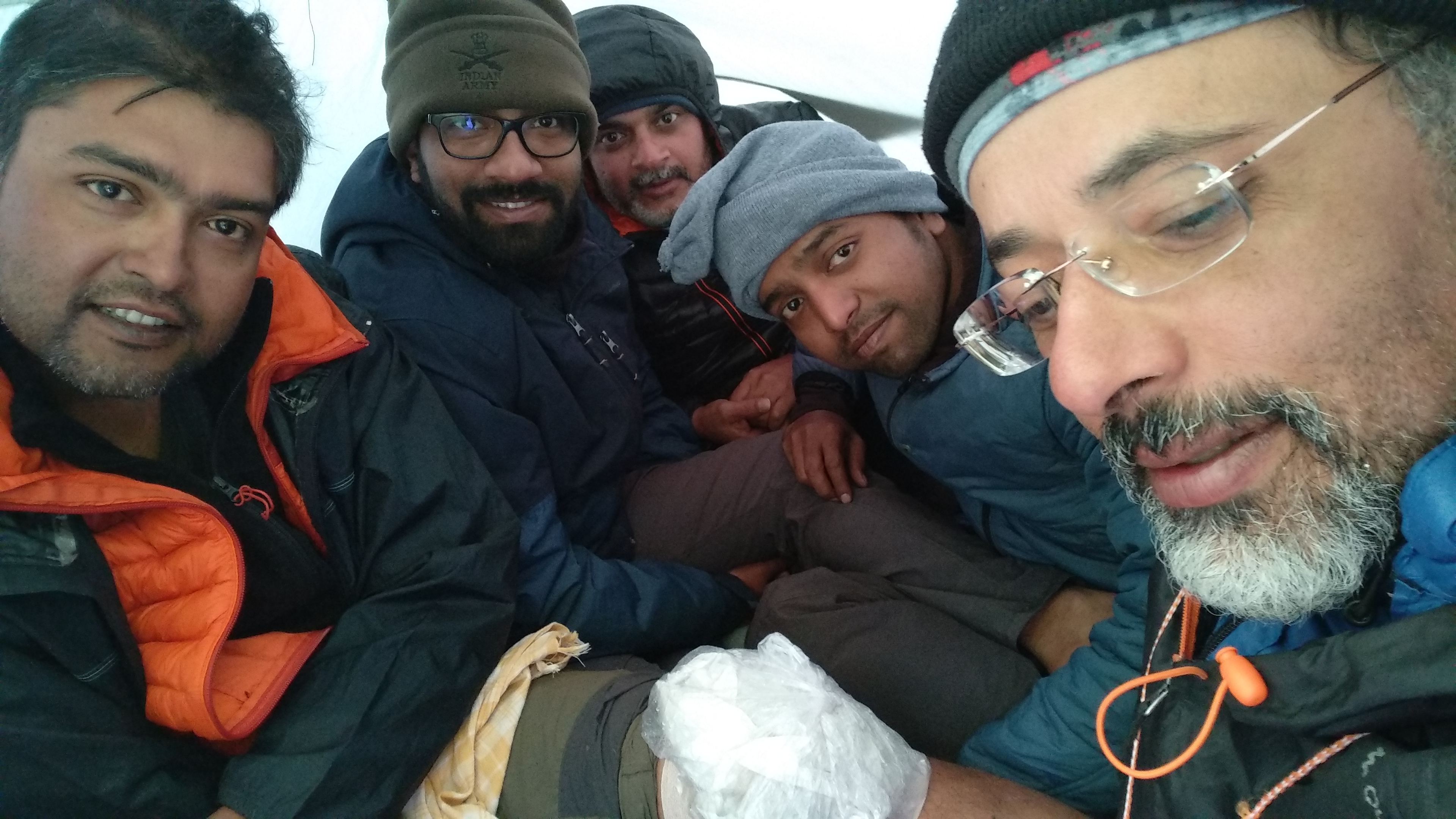
Navtej Ji told me that this would be his last long trek and asked me to join. I was more than ready. The coronavirus scare was ending. Hence, there was some turmoil as I had to join an office in Bangalore. But never really had a break from my workout plan till I came back from Kalindi. Rahul Bhai, Devdutt Ji, Anjan Da, Dr. Sanjay, and Raktim were joining us from our old group. I Shifted to Bangalore a month before the trek. Raktim joined me often for morning workouts and we had some day hikes around Bangalore on the weekends.

Lijo joined me and Raktim in Bangalore airport on 3rd June for an evening flight to Delhi. Lijo is a super silent guy. So, Raktim and I kept blubbering while Lijo acted as a silent listener. Raktim was nervous as it was a trek after a long gap for him. We took a cab from Delhi Airport to Hazrat Nizamuddin, where Navtej Ji, Dr. Sanjay, and Rahul Bhai joined us for the Nanda Devi Express.

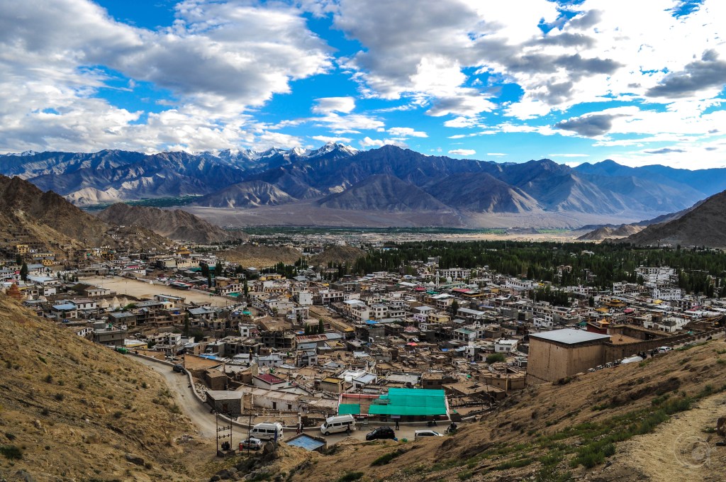
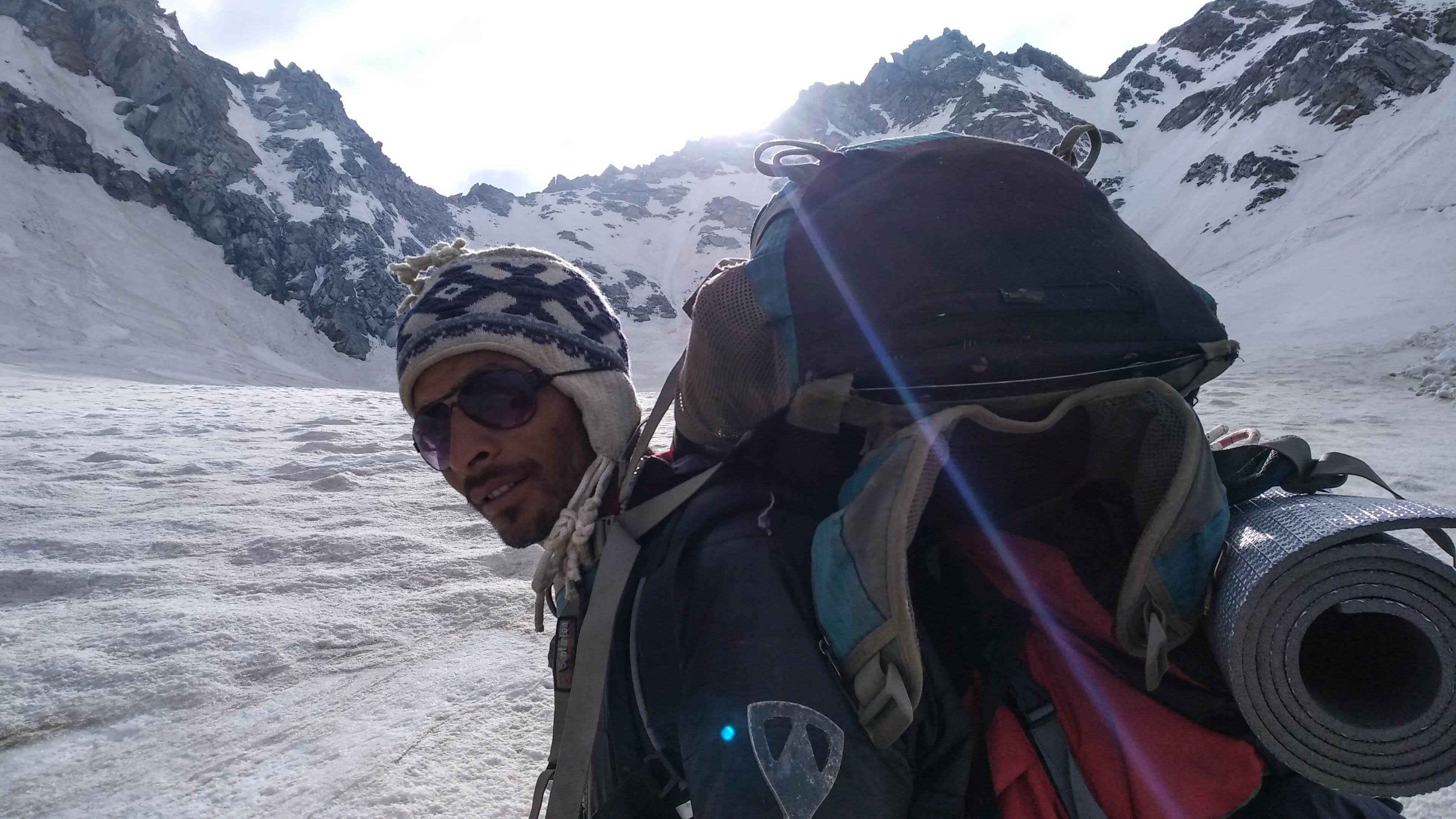
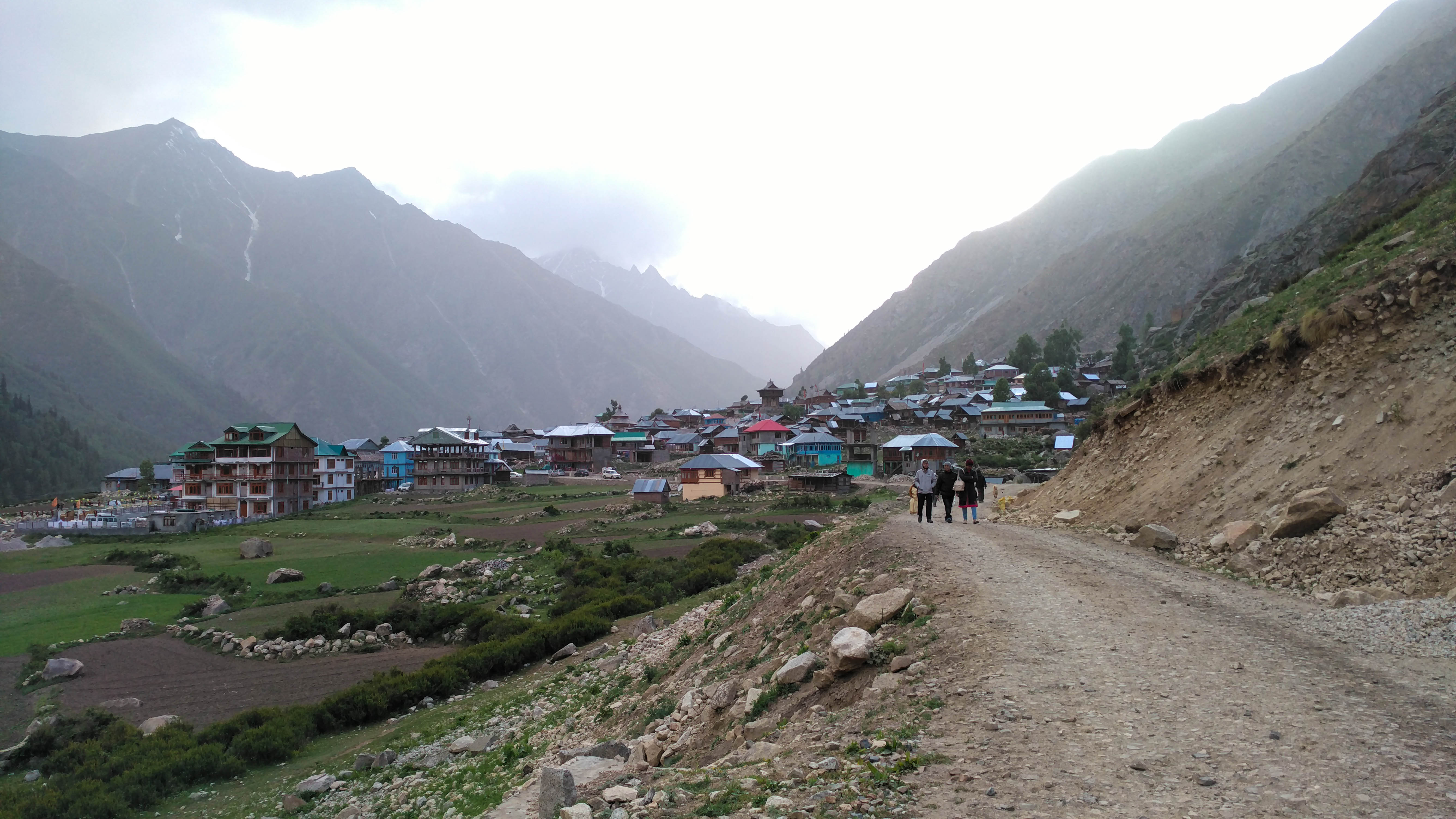
We all were carrying our vaccination certificates. Still, unlike the last time, there was no checking at Dehradun junction on the 4th morning. Anjan Da, who arrived last evening, joined us at the station. Our tempo traveler was waiting outside the station. We arrived at the President Hotel in Doon City, where Devdutt Ji had spent the last night, to freshen up. It was a sixteen-seater tempo, and we were only eight souls to travel. So, our backpacks fit inside easily. We had a couple of breaks for breakfast in Subhakholi and lunch at Bhatwari. The reunion of the old group was so exciting and joyous. We didn’t realize the journey of 250 kilometers on the mountain road. We reached Gangoti at 7pm. Dr. Amit and Jitender reached almost at the same time. They came to Dehradun airport that morning and took a cab to Gangotri directly.

Ever-young Bhagirathi flowing by the Gangotri. P.C. Arpan Sarkar

Sonu and his team were waiting for us at a riverside hotel. They welcomed us with coffee and pakoras. We kept our backpacks in one room and headed to the temple for the evening Aarti. The high mountains around the temple were still amusing me. Me, Raktim, and Lijo had a calming hour sitting in front of the temple. The crowd seemed too much as my last visit was in

Gangotri temple in evening glory. P.C. Arpan Sarkar

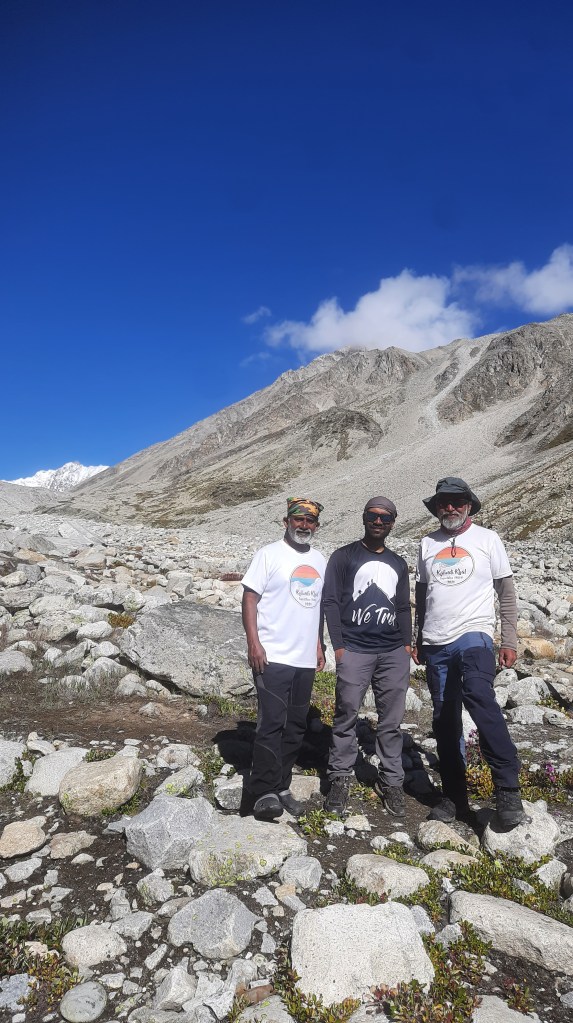
Corona restriction. Me, Raktim, Rahul Bhai, and Anjan Da settled in the GMVN guest house that night. It is located just in front of Surya Kund. Devdutt Ji distributed us the trek t-shirt that I designed for the team. It was a good night’s sleep with a blanket and at some distance from the ground, as the next 13-15 days would have to be rolled in sleeping bags on various kinds of territories.

Surya Kund. P.C. Arpan Sarkar

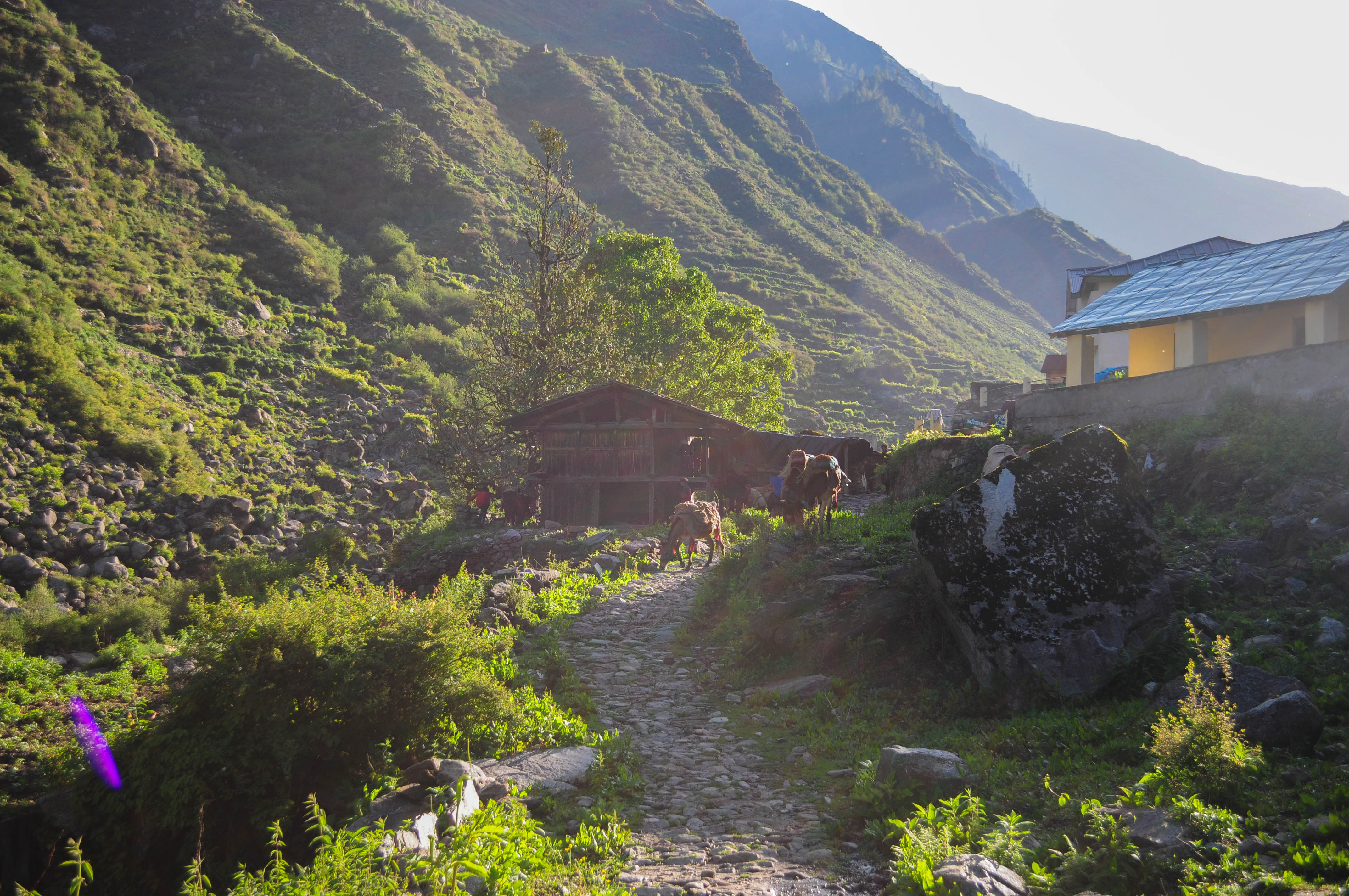
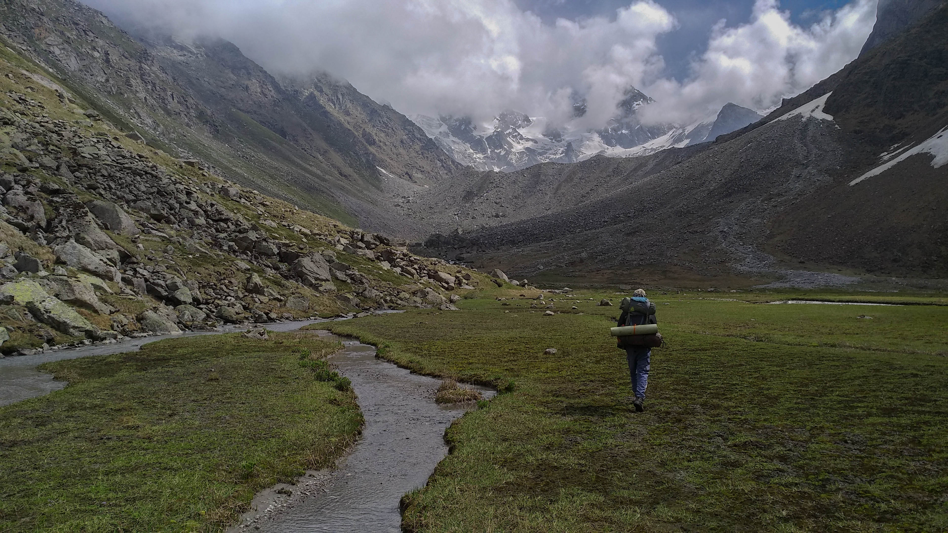
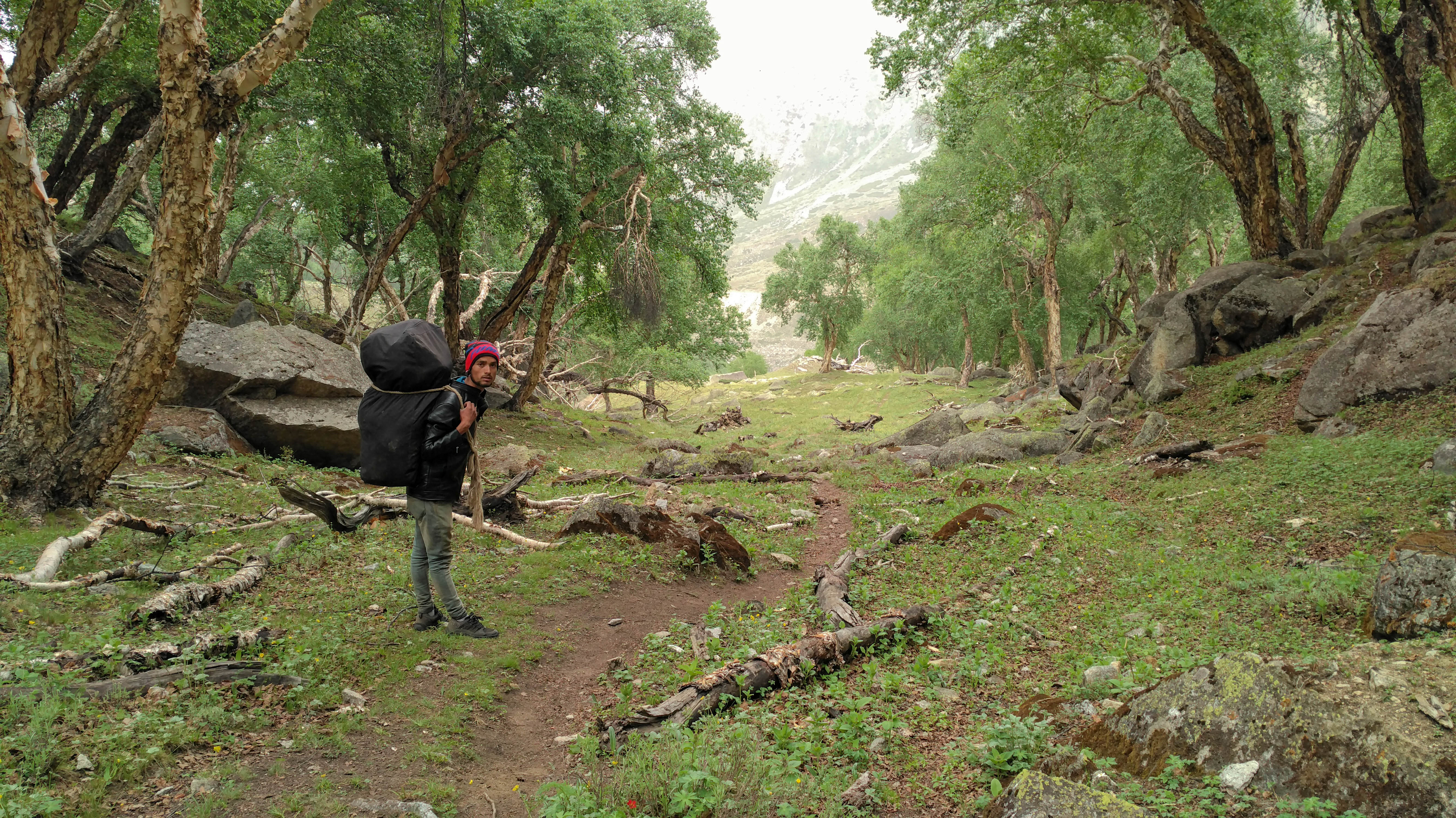
5th June 2022 (Gangotri-3023 mt to Bhuj Khadak-3770 mt; 5.5 km trek)

We woke up early. We packed last night’s items. Then, we met with the rest of the team. They were staying in a homestay just beside the Bhagirathi River. Warm coffee and breakfast were waiting for us. Me and Raktim took a stroll along the market alley for the last round of shopping before

Courtesy: Google Earth

we left civilization and ended up buying some chocolates and smokables. It was a pleasant surprise to find Devram Negi there. Devram was our guide for Kalindi and later on, developed a trekking business with Utkarsh. He was leaving for the Gomukh-Tapovan trek with his clients.

The trail along the Kedar Ganga gorge. P.C. Arpan Sarkar

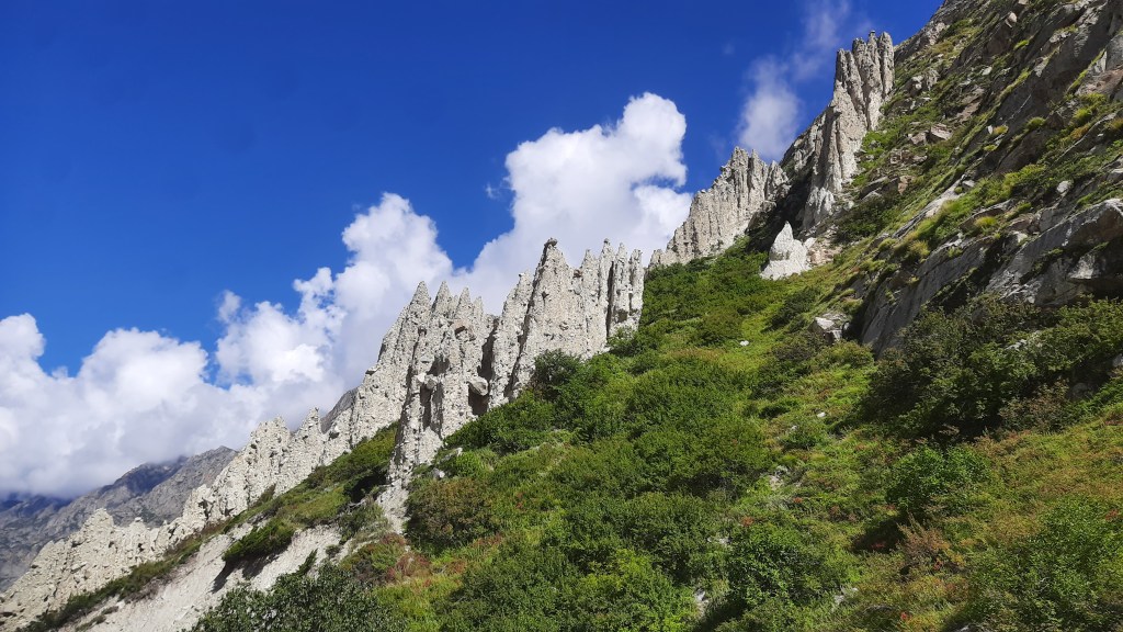
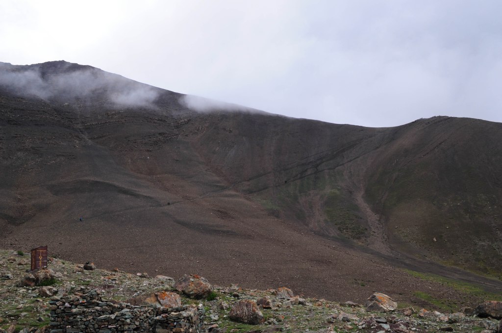
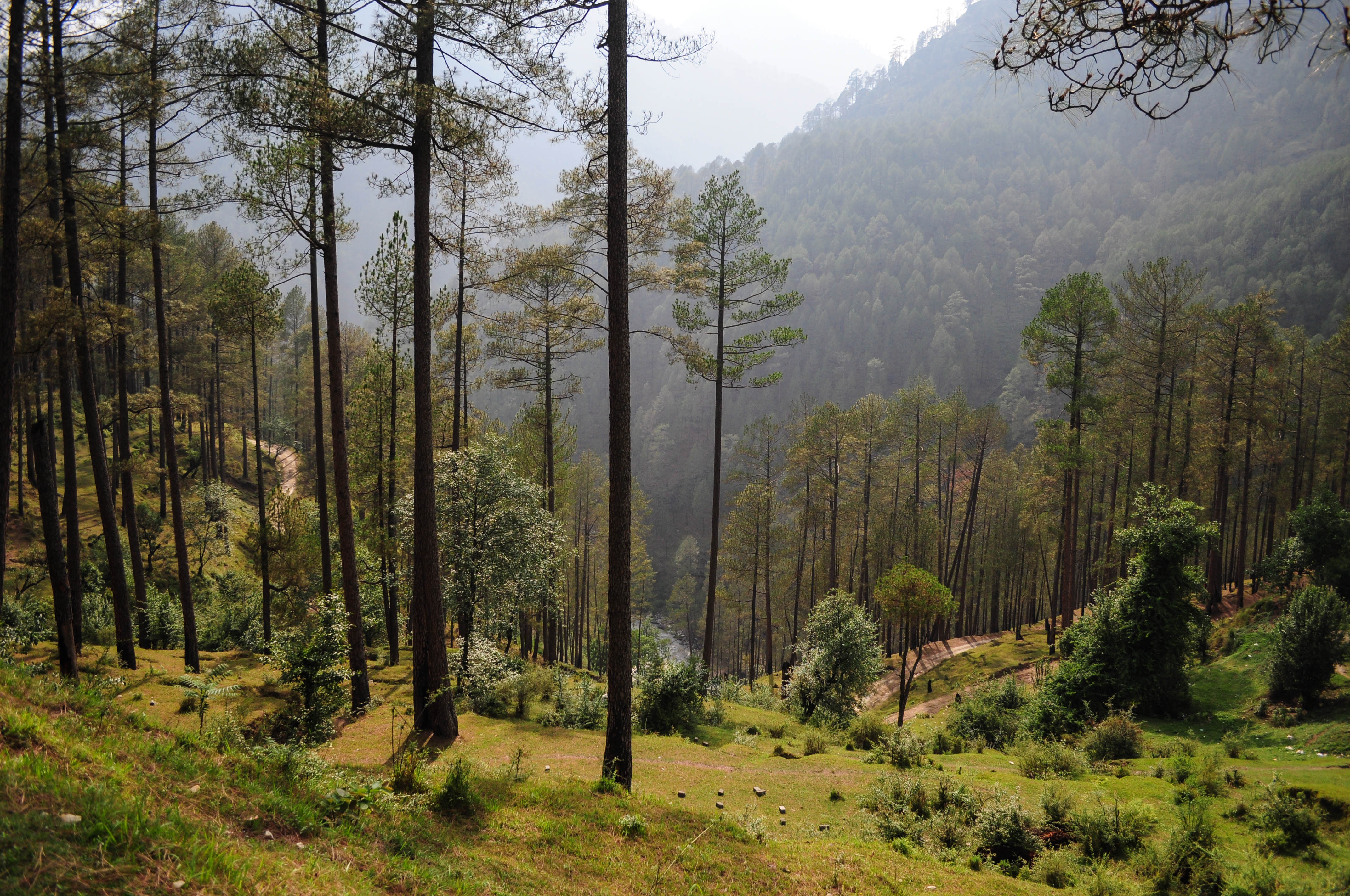
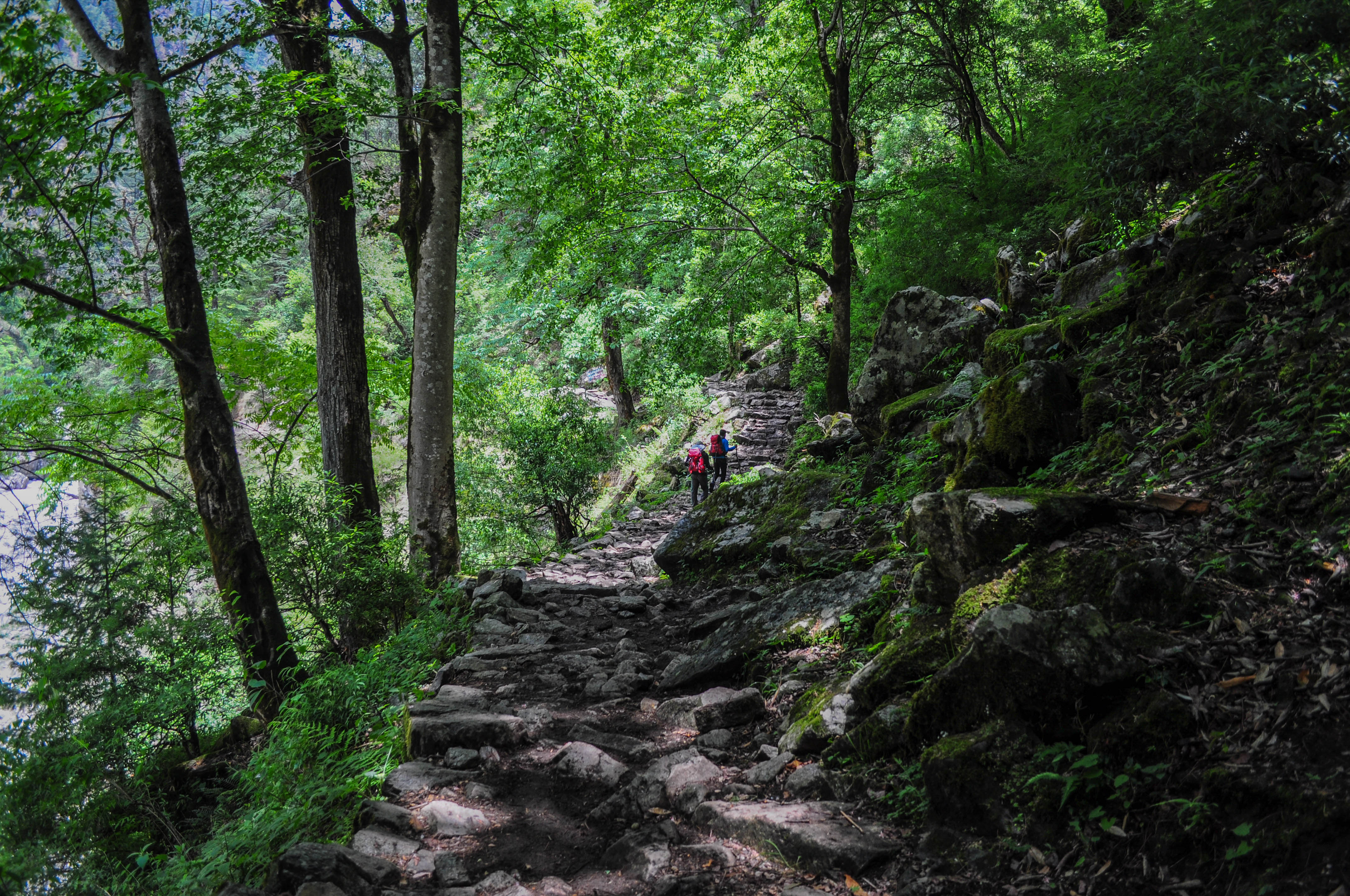
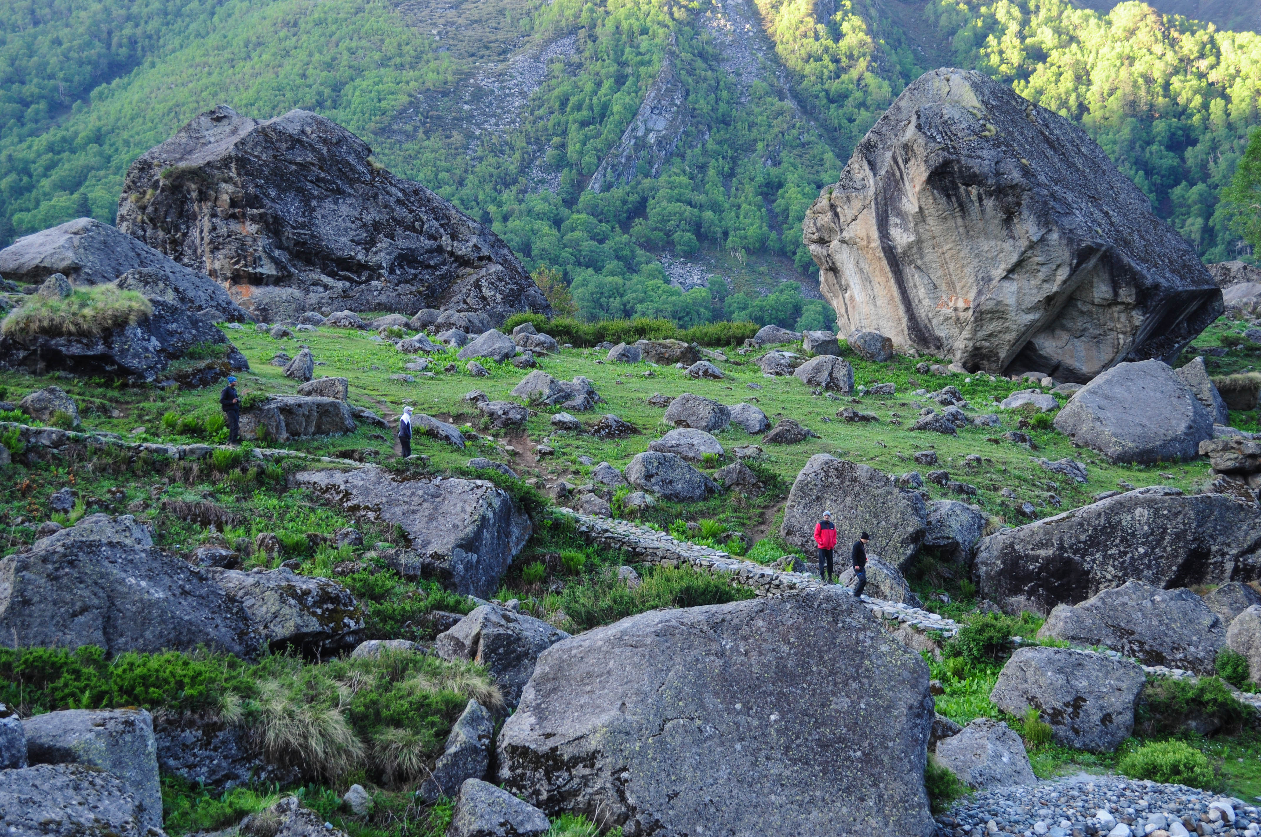
At 8:30 we parted ways with Devram and approached along the left bank of Bhagirathi. Our plan was to reach Kedartal as an acclimatization walk and the real climb to start from there. We took the south route that goes up along the gorge of Kedar Ganga. It was a challenging gradient for the first day of a trek. The route was well-defined and mostly covered with birch trees. Surya Kund was about 20 feet deep from the settlement. Within 30 minutes of the trek, Kedar Ganga descended approximately 350 feet into the gorge. Spider Wall was one of the infamous sections in this route, but we found it manageable. It was a big monolith that used to be without any gripping hole. Trekkers struggled a lot with this section in the past. However, we found it cracked

The crack between Spider Wall. P.C. Arpan Sarkar

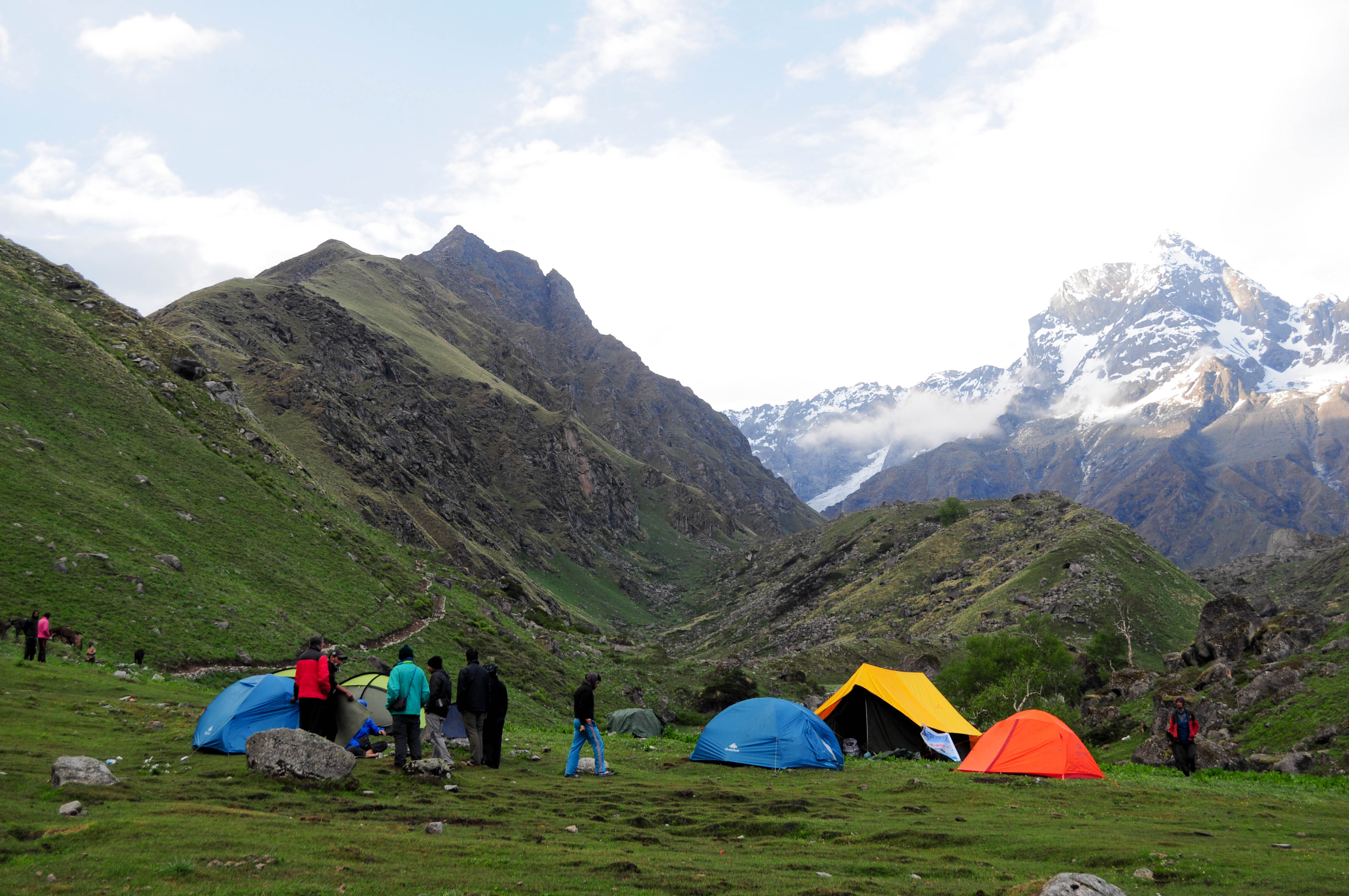
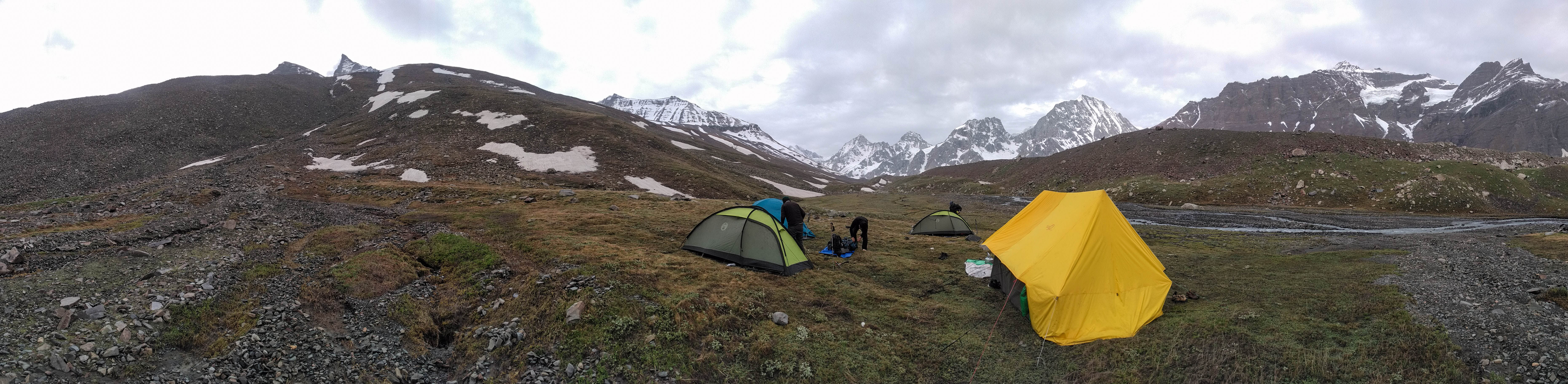
in the middle, which gave us a way to cross it easily. Mt. Thalaysagar started playing hide and seek. There was one loose rockfall section just before the campsite that needed some extra attention. We took intermediate halts with some chitchats and reached the campsite at 12:30. It was a small, plain ground just after the end of the treeline. It barely fit all of us. Big bushes of wild spinach surrounded it. Within a couple of hours, we lost the sunlight. A big sharp mountain wall on our west in the narrow gorge blocked it.

The loose section before the campsite. P.C. Arpan Sarkar

The evening was comparatively colder, accompanied by the nice snacks and soups coming out of the kitchen tent. Another team consisted of two members from Kolkata and one support staff. They camped on a nearby plain with the intention to trek Kedartal.

Mt. Talaysagar peeking from behind. P.C. Arpan Sarkar

We took an acclimatization walk just to support the theory “climb high, sleep low”. The star-gazing night was amazing to welcome us on the first day into the wild.

The Bhuj Khadak campsite. P.C. Arpan Sarkar

6th June 2022 (Bhuj Khadak to Kedar Khadak-4323 mt; 3.75 km trek)

Rays of hope. P.C. Arpan Sarkar

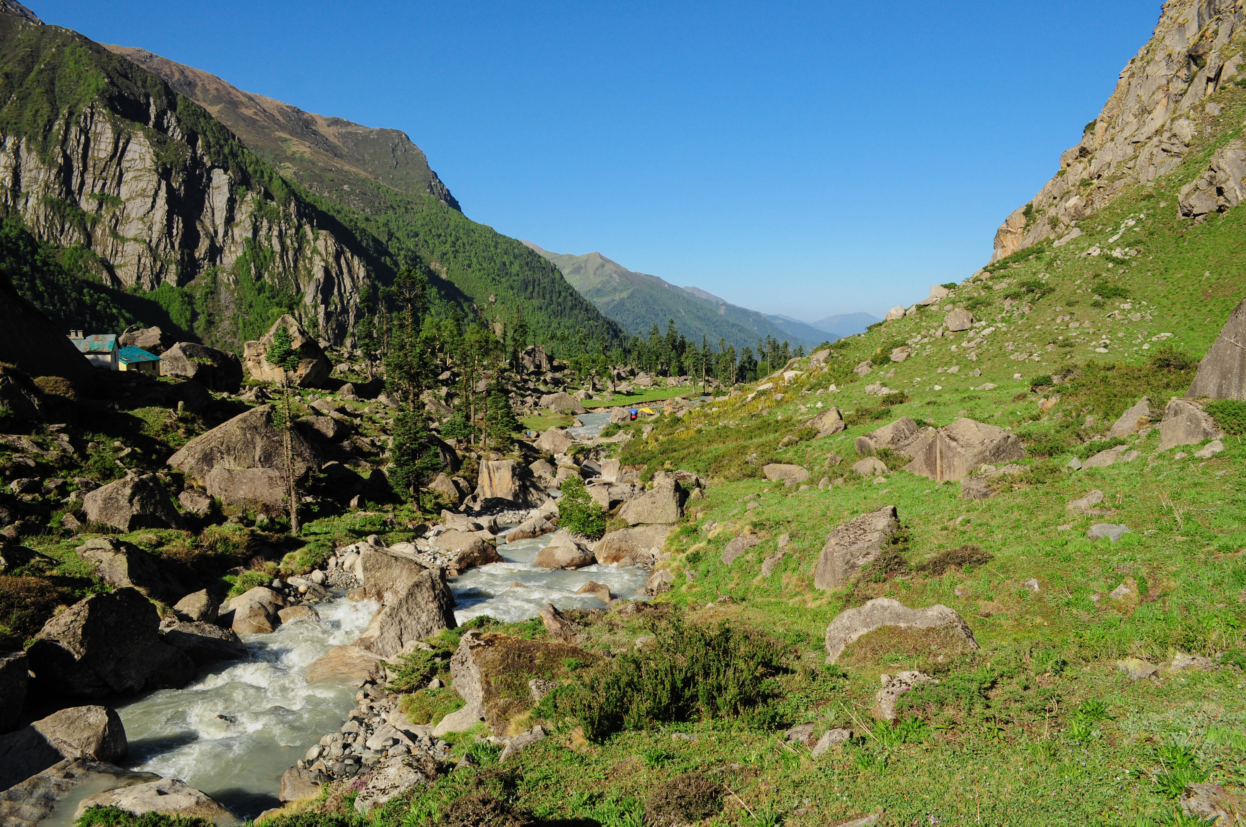
We started early at 8:20 just after breakfast. The light beams through the high mountains kept us motivated. The gradient was like the last day. Still, the loose earth patches in between kept us reminded that it was not the same day or altitude anymore. Some mountain goats were standing higher than us on a loose section. They kept kicking rocks down. This made it more challenging. The route continued along the gorge with the river lying deep down.

Leaving the tree line behind. P.C. Arpan Sarkar

Sunlight hit us quite late because of the narrow gorge with high walls. The gorge opened up in a while. Along with it, the snow-capped wonders started to show up one after another. After one and a half hours of walking, we reached the side of the river. We continued walking along with it. The ground was mostly loose and the Kedar Ganga was flowing in high volume.

Wide open valley and a prominent trail. P.C. Arpan Sarkar
We came down to the river bank. P.C. Arpan Sarkar

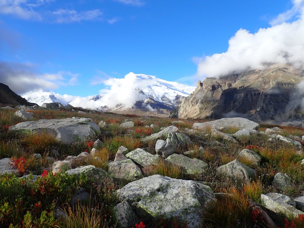
We reached the campsite at 12. It was one of the most spectacular campsites I have ever been to. Manda group, Brigupanth, Thalaysagar, Jogin group, and the wall of Patangini range were all around us. It felt like sitting in a huge amphitheater with the grandest view of tall white wonders. The incline of Patanging Dhar was lying on the west. It was a sunny day and there was no place

The magnificent Kedar Khadak campsite. P.C. Arpan Sarkar

to hide from it in that open ground. We kept roaming around and clicking pictures. There was a narrow and shallow stream flowing across the place. Some of our support staff pitched their tents on the other side of where we camped. The ground was so huge that it could fit a cricket stadium in it. After lunch, we started searching for mobile networks on a suggested spot but couldn’t find any.

The amphitheater. P.C. Arpan Sarkar

Once the sun went down party mood took over. A happy and healthy camp went to sleep late that night.

7th June 2022 (Kedar Khadak to Kedartal-4823 mt and back to Kedar Khadak; 6 km Trek)

The vibe in the morning was of a lazy Sunday. The only job was to stroll to Kedartal and come back before lunch. We had a heavy breakfast and started at 8 with only water bottles in hand. The direction was to follow Mt. Thalaysagar. Everyone was in a holiday mood, so the number of photographs captured was comparatively higher than the other days. Me, Rahul bhai, and Raktim were walking together. It was majorly a walk through a long dried glacier. Some of the glacial pools were still there, probably fed by fresh snowfall. As we approached the Kedartal, the

On the way to Kedar Tal. P.C. Arpan Sarkar
Part of the team. P.C. Raktim Duttagupta

grandeur of the place kept opening. Once reached the top of the last ridge, I was spellbound. Kedartal was probably the most serene place I have ever been to. The sparkling lake of turquoise blue color was surrounded by snow-bodied giants leaving me wondering for a long time. I slowly started descending to the lake. I sat on a big boulder by the side of the waterbed. I didn’t speak to anyone. I didn’t feel blubbering, just wanted to feel the tranquility.

Kedar Tal and surrounding. P.C. Arpan Sarkar

Kapil, one of our guides, went to Thalaysagar Base Camp. He went to meet his friends who were attempting the summit. It was about a kilometer away from us. We all felt that a camp on the bank of Kedartal would have been overwhelming. On a clear night, watching the astronomical activities would be an unearthly experience. Nonetheless, camping there is banned these days. I never felt like leaving that place. But with the team, I also started the returning stroll.

Historical! P.C. Arpan Sarkar
Kedar Tal. P.C. Arpan Sarkar

I was mentally overwhelmed but my belly was not synchronizing with it. So, had a decent lunch on our return to the campsite. Lijo was feeling down and wanted to return to Gangotri. Navtej Ji and Dr. Sanjay motivated him to continue. They promised him that if he felt the same after the next day, he could return through Rudragaira Valley. This arrangement would be made. We roamed around the place. We kept gazing toward the incline of Patangini Dhar. It looked like a super challenging morning was coming up next. There was no patch of snow visible on the gradient. However, later Sonu sent us photographs taken on the 2023 expedition. They showed that the incline and the summit were all covered with snow. Kapil returned a little late. He informed us that his friends were planning to wrap up the Thalaysagar summit attempt. The reason was a shortage of ropes, strange!

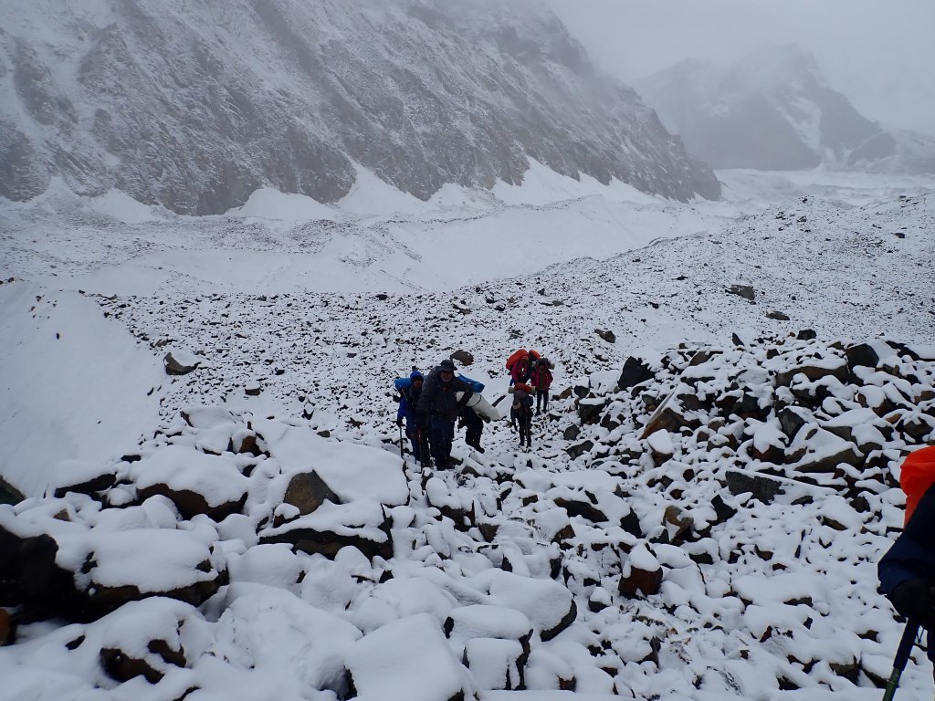
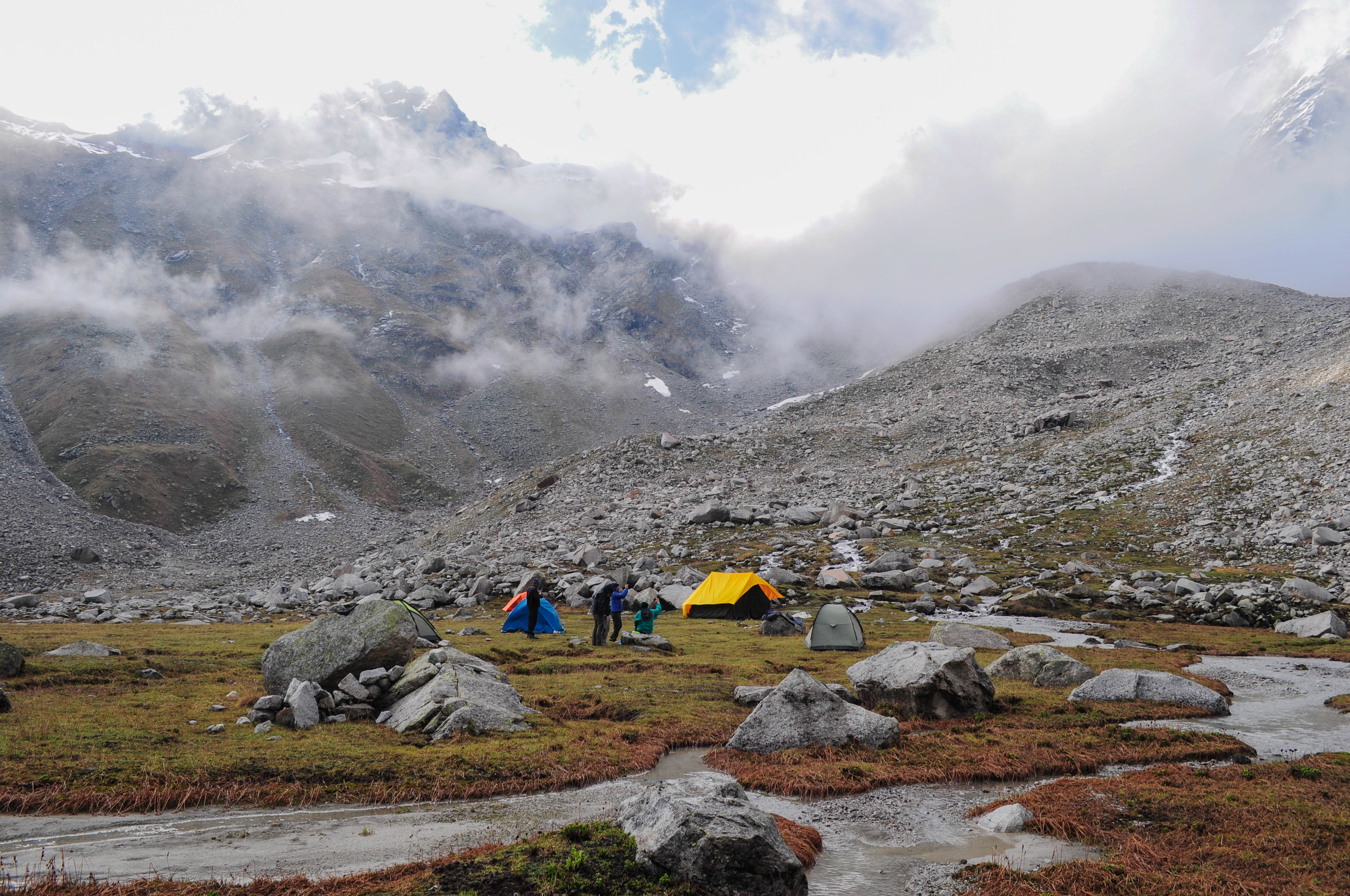
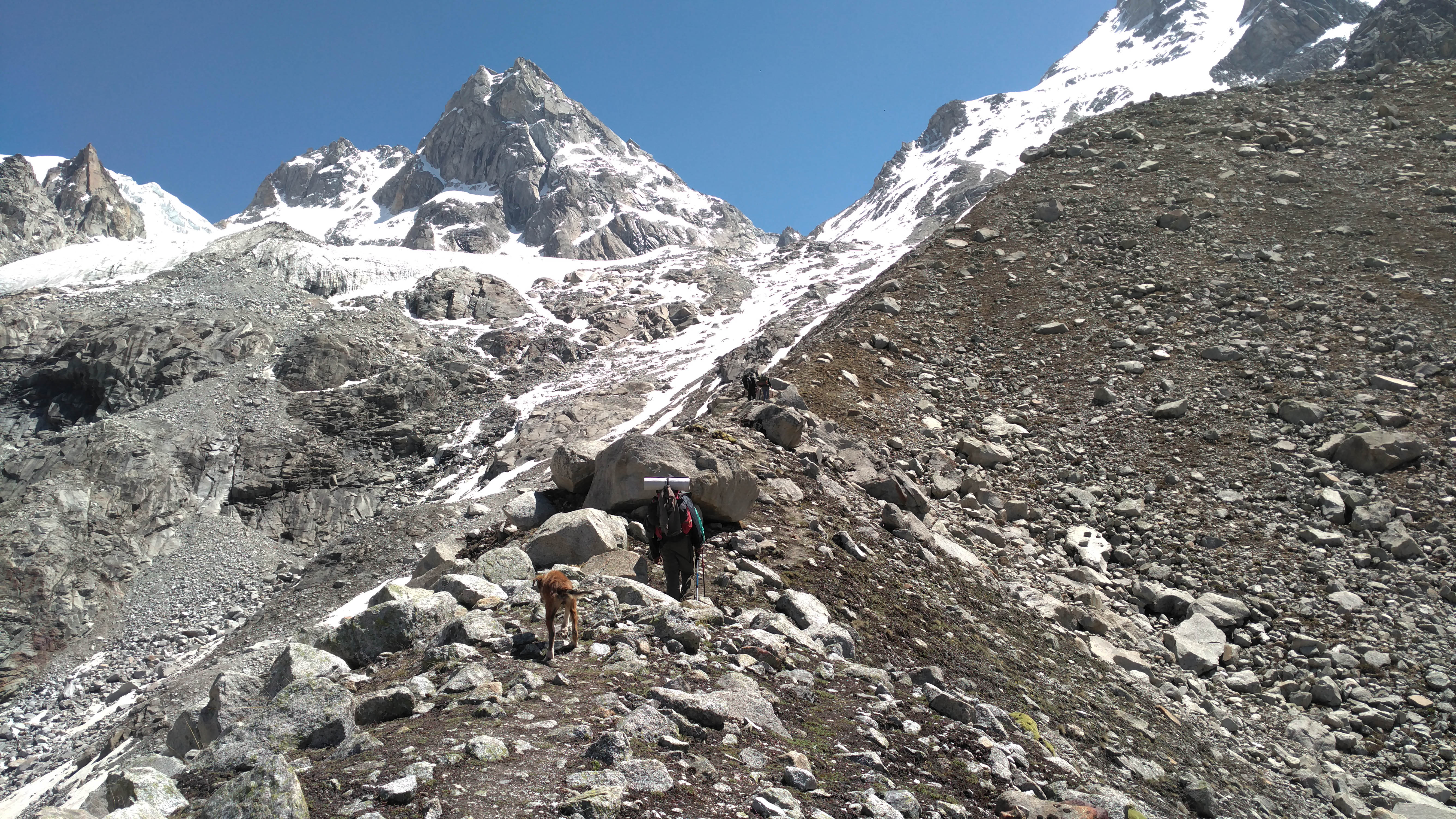
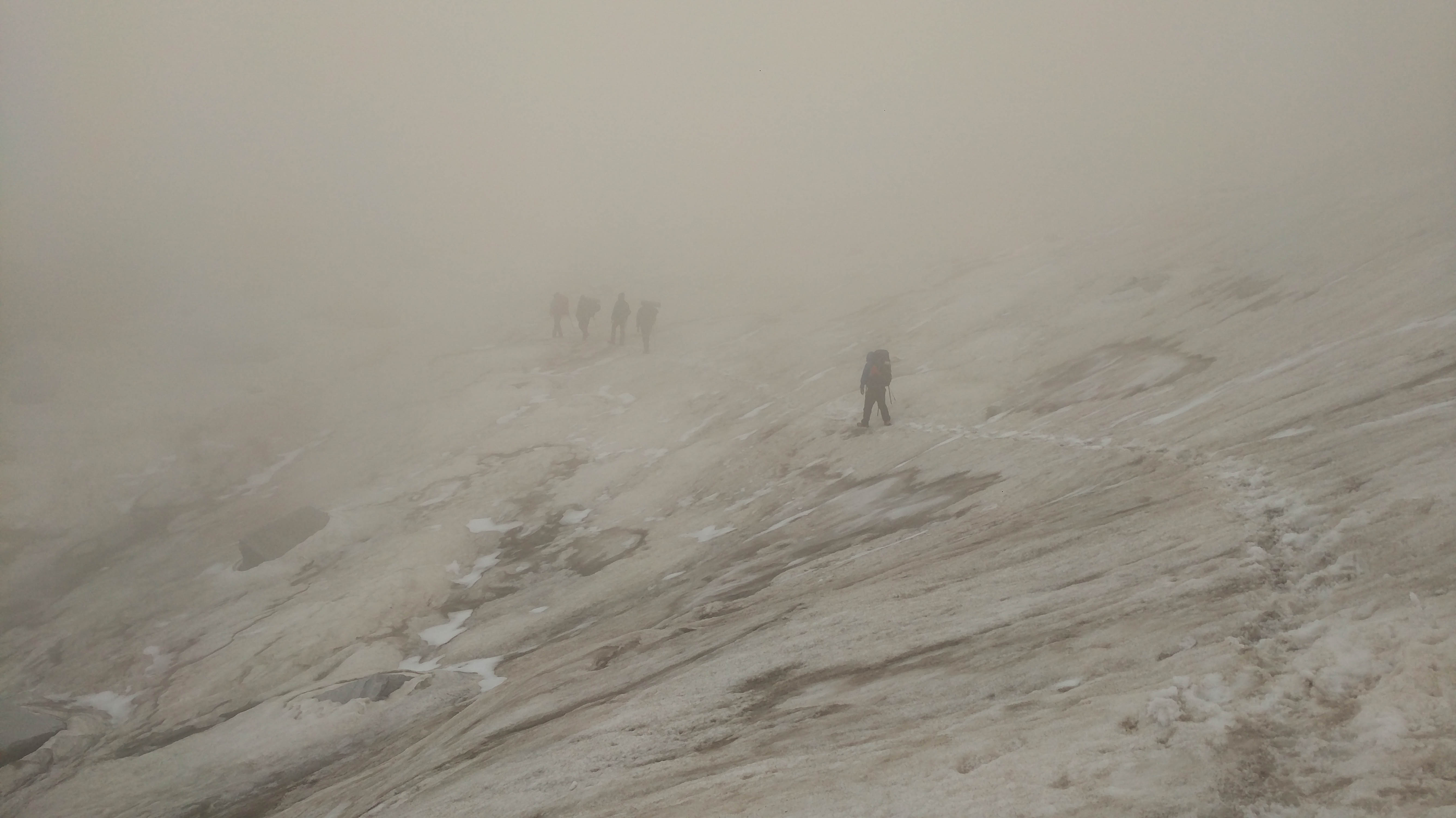
8th June 2022 (Bhuj Khadak to Dabba-4702 mt through Patangini Dhar-5190 mt; 7.1 km trek)

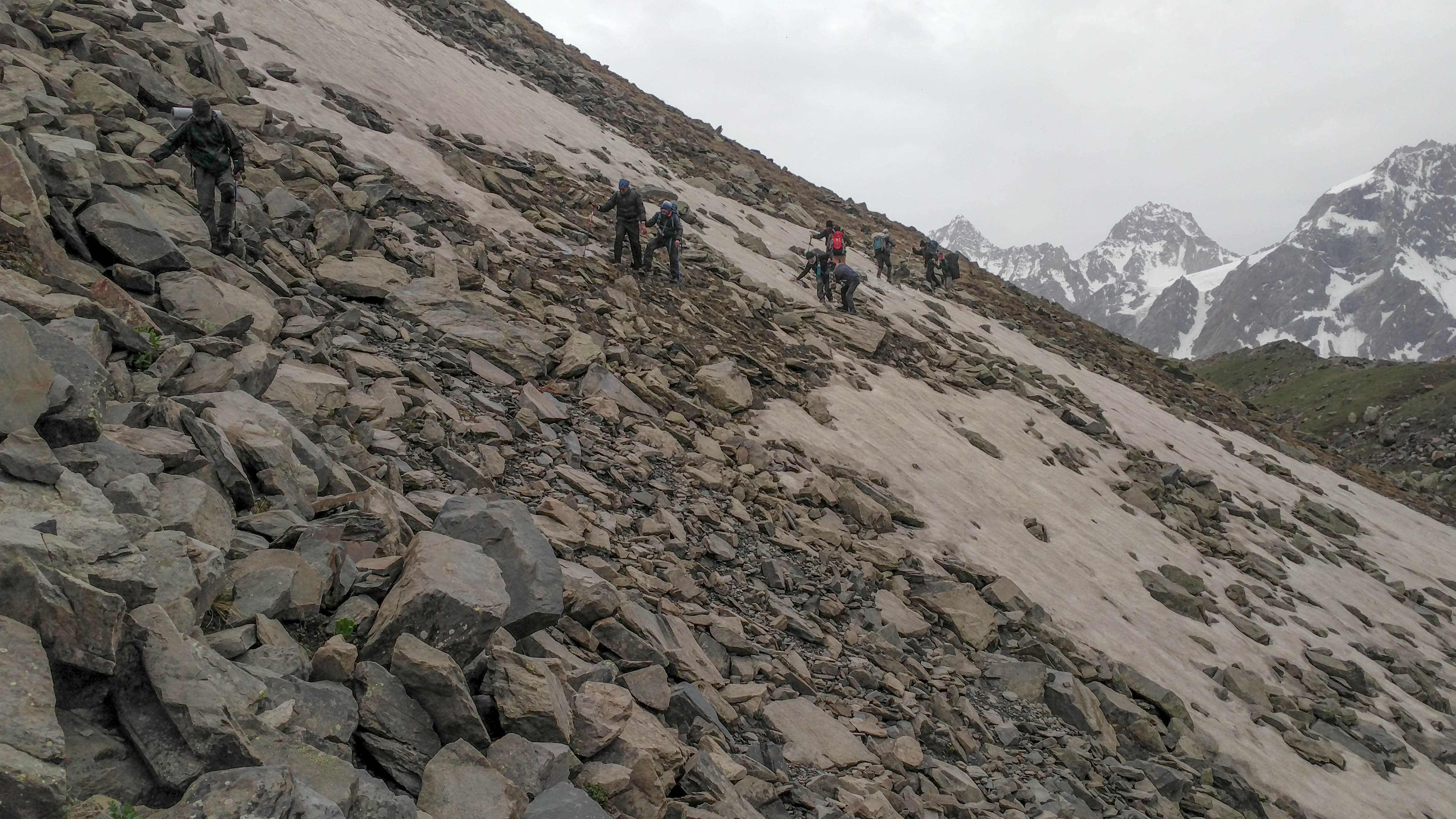
The super early climb started at 5:40. It was quite a foggy morning in the Kedar Ganga valley. After crossing a small stream, we started the incline. It was not a percent less than it looked from a distance. Initially, there was a hump that we crossed. Once after that, it was a continuous incline probably in 65 degree gradient. One can see the summit throughout but it

Foggy start of a long day. P.C. Arpan Sarkar

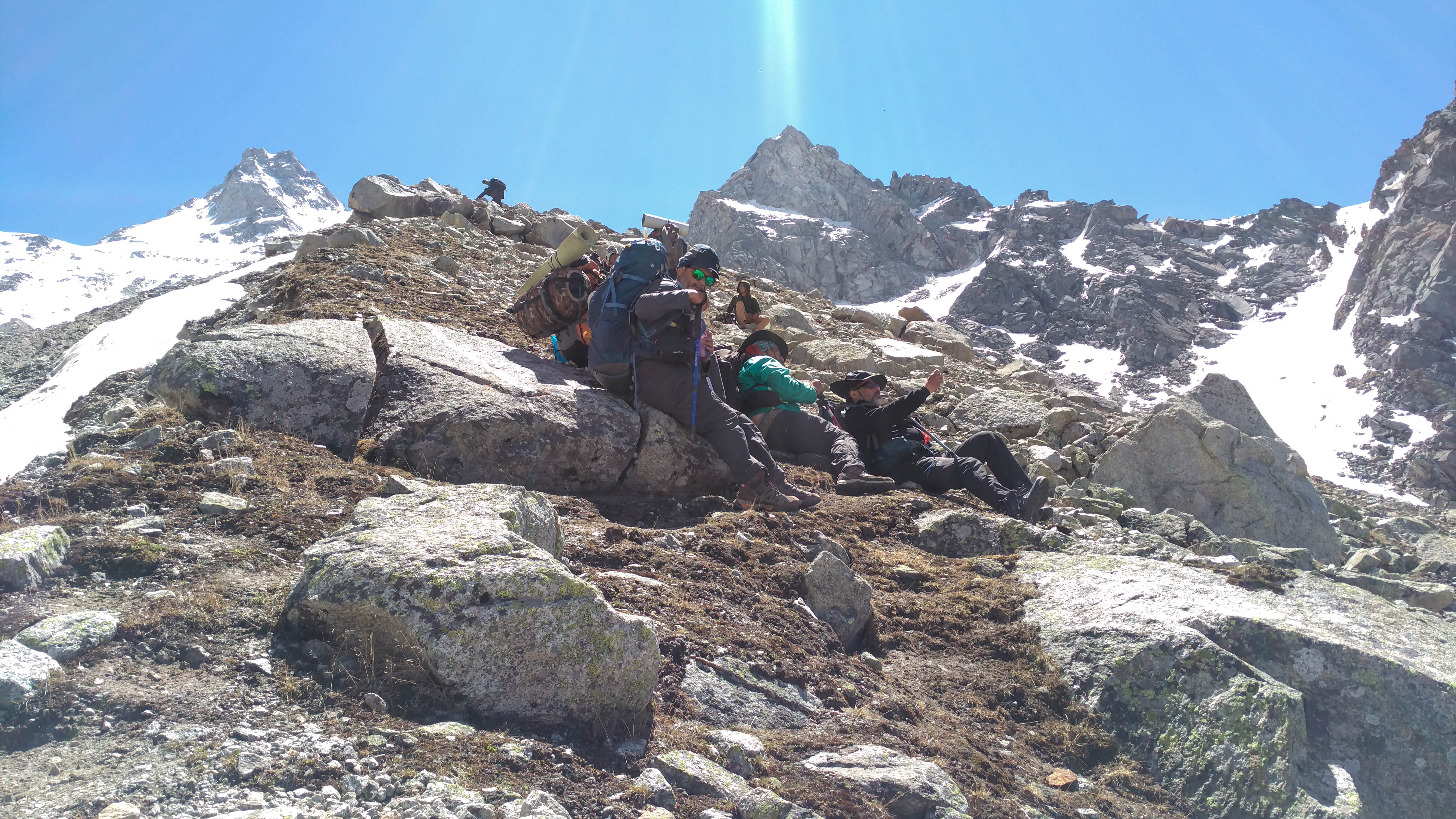
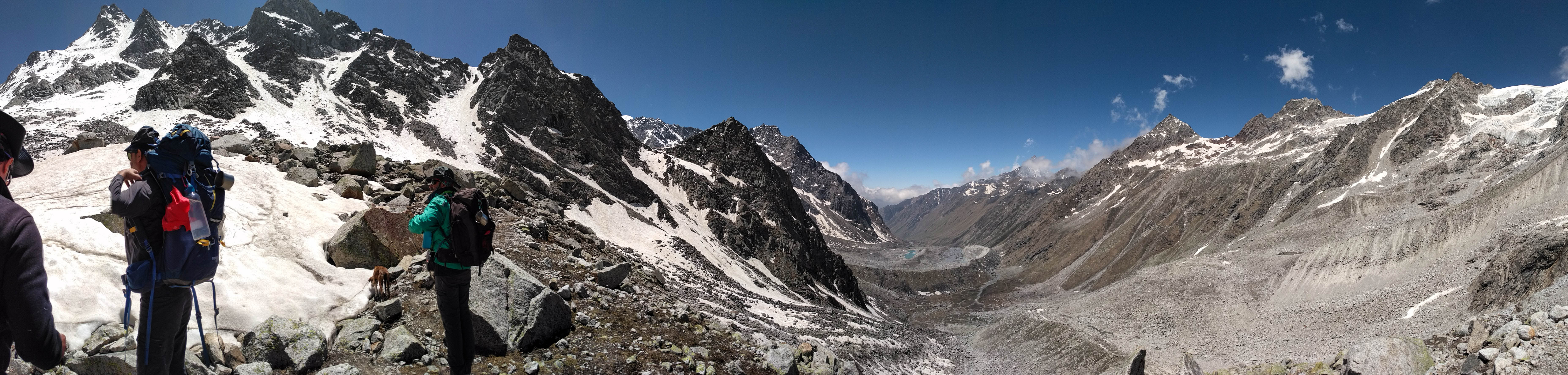
always felt far from reach. We had a plan of setting up a camp on Patanging base but only on paper. I don’t think that I have seen a place where a single tent can be accommodated. There was barely a rock to place your butt for a while. We struggled but kept climbing. Meanwhile, the weather was opening up and the views toward Kedartal were getting clearer. After a while the peaks behind Manda and the surroundings of Gangotri were in our viewing range. In climbs like this motivation is quite important as the act is monotonous. The emerging views and looking behind to see the climb I have completed, always fuel me. I did Stok Kangri in 2019 and I felt the climb of Patangini Dhar was tougher. Probably the show cover on Stok made the climb comparatively easier. Patangini was completely naked that year. After quite a struggle I reached the pass at 10.

It was a continuous incline. P.C. Arpan Sarkar
Quite a climb! P.C. Arpan Sarkar

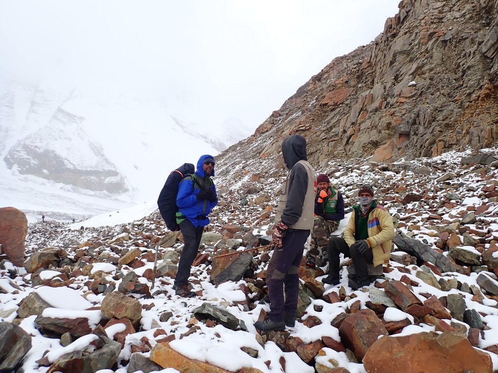
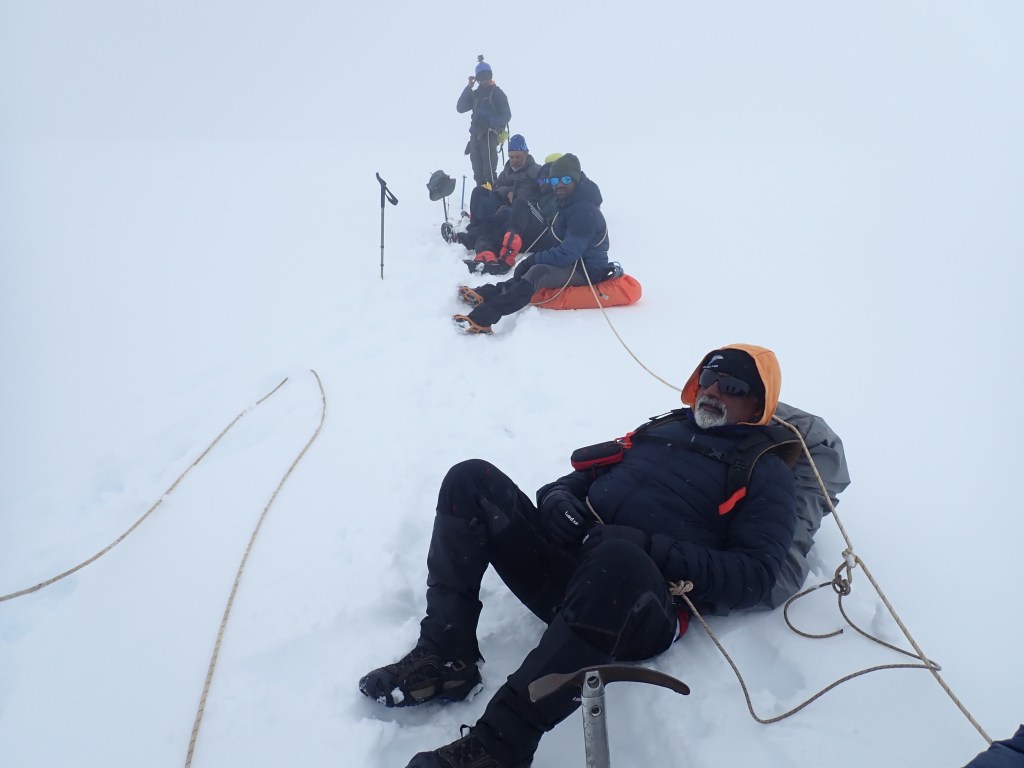
“Dhar” means sharp in Hindi. The one who named that place must have a great sense of humor and descriptive skill at the same time. By adding Dhar to Patangini, that person has described the place with great irony. It was literally a knife-sharp continuous ridge that can fit only one person on it. The only way all can fit is by standing in a queue. The Rudragaira Valley, the Gangotri group of Peaks, and the glacier were visible from there. I kept my backpack and soaked the beauty of both the valleys. It took around an hour to gather everyone on the sharp edge. Rajib, one of Sonu’s assistants had blood coming from his nose probably because of dry weather and sudden altitude gain. Dr. Sanjay treated him. We spent quite a long time on the pass.

Patangini Dhar-5190 mt. P.C. Arpan Sarkar

The support staff started the decline at 11:15 to the Rudragaira side, and we followed them. Straight from the summit, there was a 150 mt continuous drop in a significant gradient. It was a fitting downhill to the incline. Loose rocks didn’t allow us to speed up. We hit the first patch of snow after that. The knees were feeling relaxed walking on the snow after the tough toil. Once we reached a comparatively settled place after crossing a few snow patches, it was time for our

A fitting descent. Mt. Rudragaira is behind the cloud. P.C. Arpan Sarkar

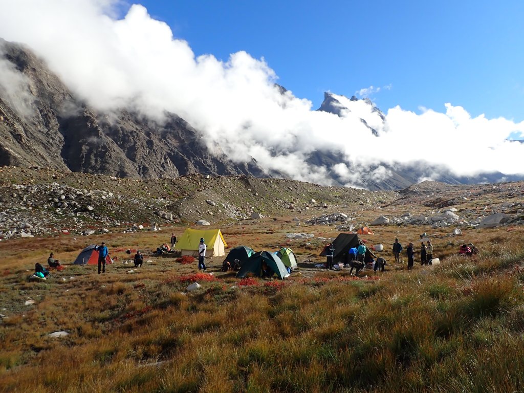
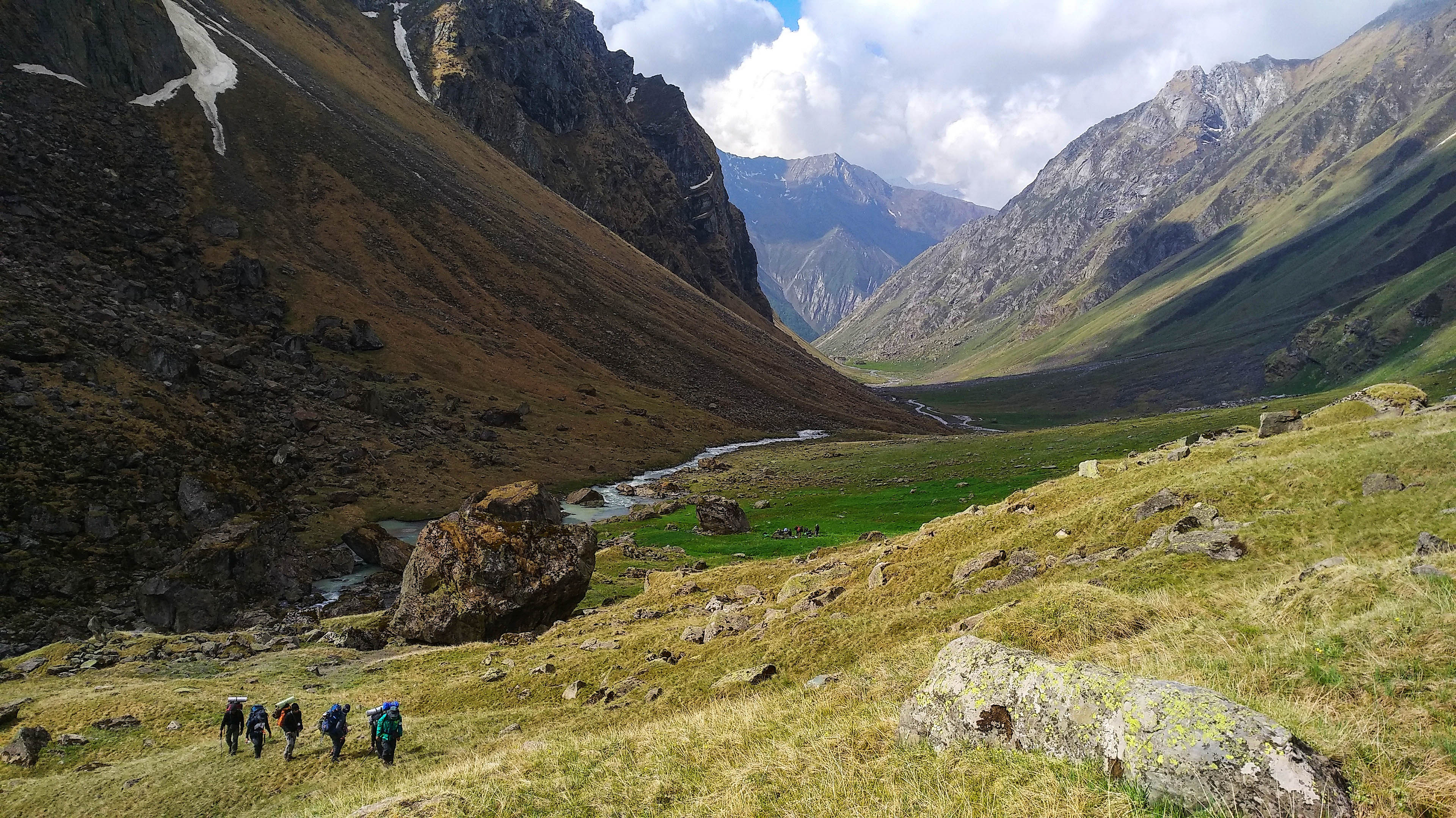
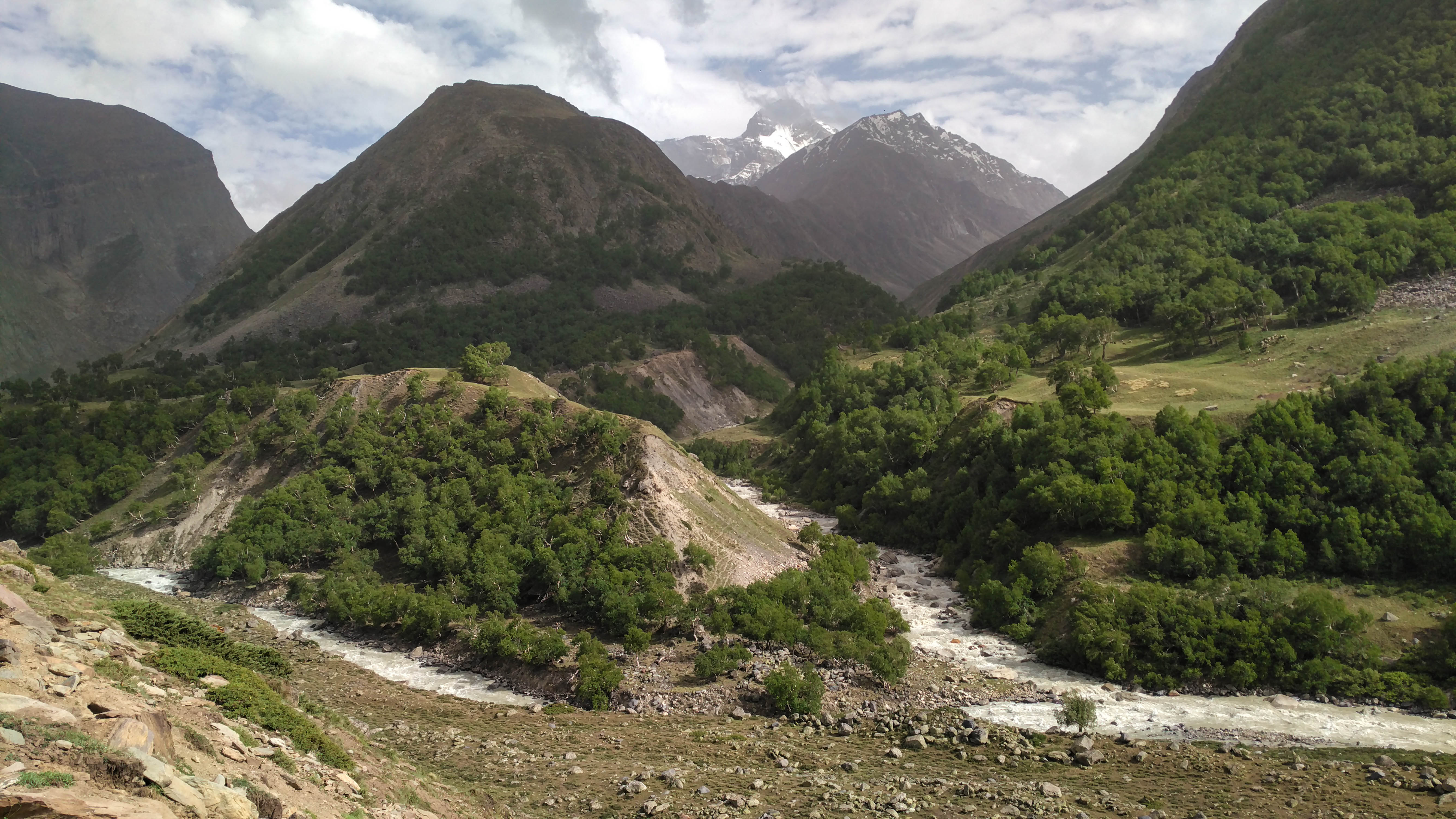
packed lunch. The first glimpse of Auden’s Col was visible from there. The Rudragaira Peak was standing straight ahead of us. The place was a moraine zone of the nearby glaciers. Hence, there was no clear visibility of the campsite. We kept tracking our support staff. At 3:30 we reached the campsite on the foothill of Jogin.

Happy camp-sight to us! P.C. Arpan Sarkar

Some freshly fried Pakoras and hot coffee saved the souls. Sonu told us that we should have been faster as the challenges ahead were not easy either. We went inside the tents and started lazy chitchats comparing the Patanging climb with our other experiences. I don’t think anyone was awake that night after 8. It was quite a long day!

Dabba camp. The peak visible is Jogin I. P.C. Arpan Sarkar

9th June 2022 (Dabba to Advance Auden’s Base Camp-4902 mt; 5.9km trek)

I went to brush my teeth by the side of a stream flowing near to our campsite. A big boulder looked quite satisfactory to settle on. I stepped on it, slipped, and fell bang on. A very thin layer of ice covered the rock. It reduced the grip of my shoe. The ice was not noticeable at all. Luckily there was no injury. In high mountains, this is a very common phenomenon in places surrounded by big elevations. The temperature drops significantly at night and creates thin layers of ice with the moisture available in the air.

The full group of members. Standing from left: Eshaan, Jitendra, Pranav, Parjanya, Raktim, Arpan, Lijo, Dr. Sanjay, Mohit, Anjan. Sittng from left: Shyam, Navtej, Rahul, Dr. Amit, Devdttt. P.C. Decdutt Lall

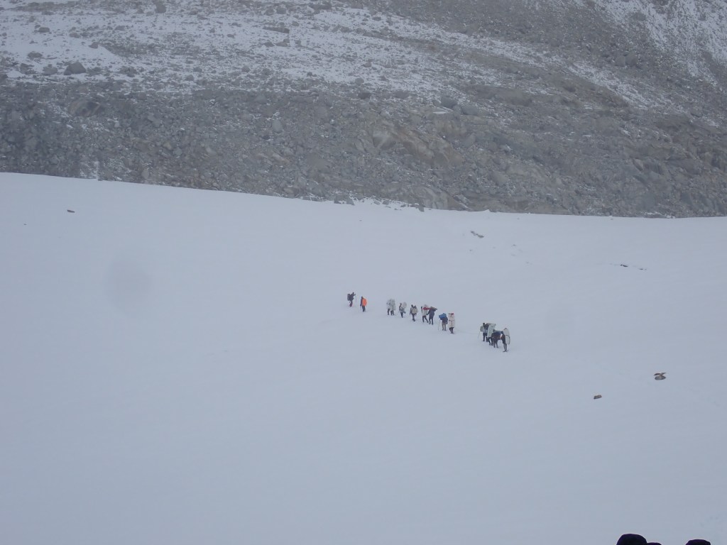
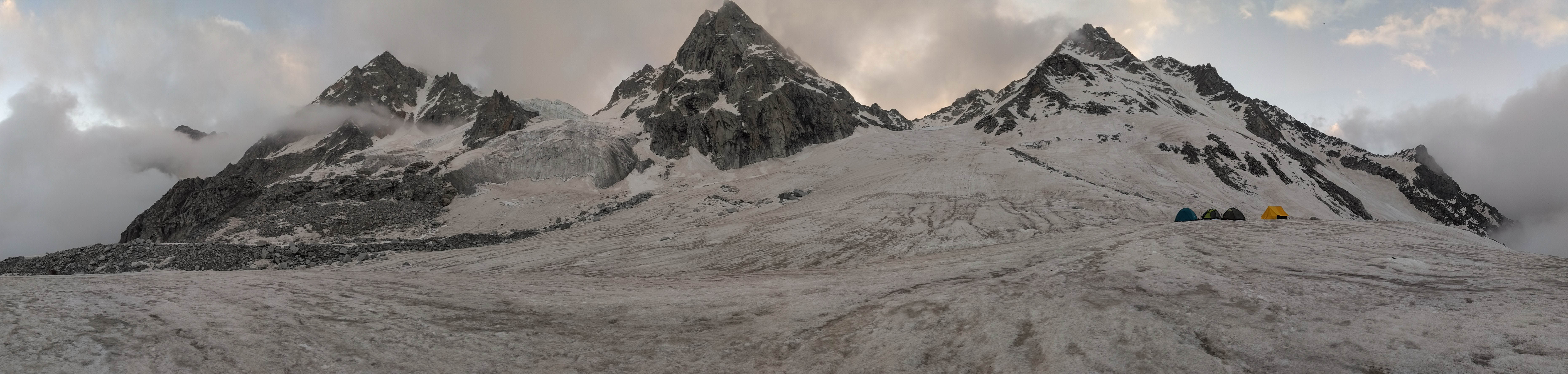
We started at 8 for Auden’s Advance Base Camp. The elevation gain was not much that day. It was mostly a walk along the glacier that is coming from Jogin I and Gangotri III. The magnificent view of the Auden’s Col was coming closer slowly toward us. The weather turned gloomy by the time we reached the crossing point of the glacier. This glacier comes in

Distant sight of Auden’s Col and Gangotri III. P.C. Arpan Sarkar

between the two routes coming to Auden’sCol from Gangotri. The other route comes along the left side of the Rudragaira River and later the glacier. The base camp and the advanced base

Down to the glacier. P.C. Arpan Sarkar

camp for Auden’s Col is set up on the west side of the glacier. So, we needed to cross the glacier to reach the campsite. It was a white icy highway. Once we stepped on it, the crunchy sound of hard ice breaking under our shoes started to come in. Toward the other side of the glacier, there was a glacial stream flowing along. A risky long jump took us to the other side. By the time we reached the campsite at 3, it was snowing heavily.

The ABC, Glacier, and Auden’s Col. About to reach the campsite. P.C. Arpan Sarkar

Our support staff was very generous. They transferred all the eatables from the kitchen tent to our tents that day. After a heavy snowfall, a starry night over the U-shaped Auden’s Col emerged before we got inside our sleeping bags. We slept early that night as the big day was waiting for us on the other side.

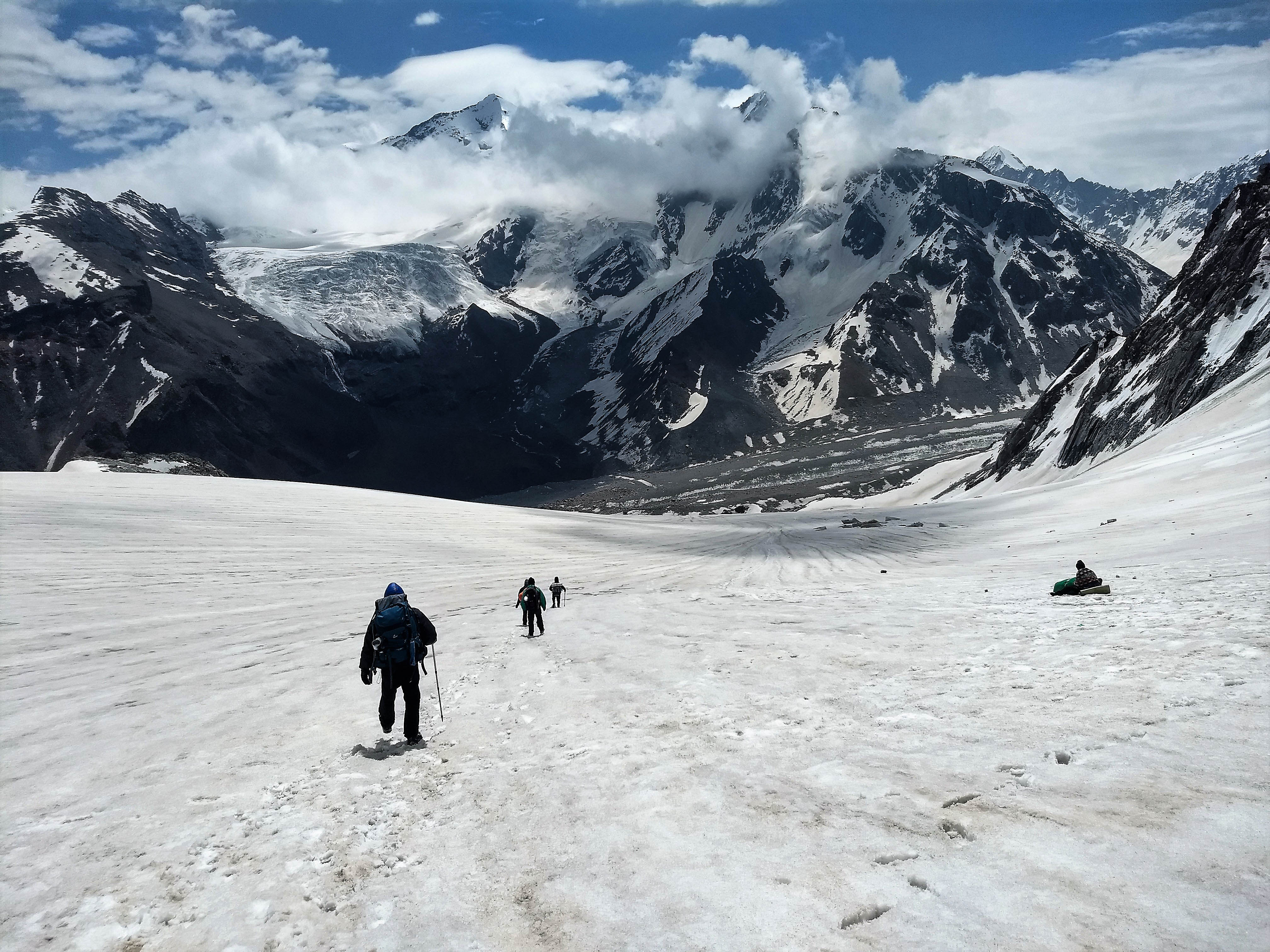
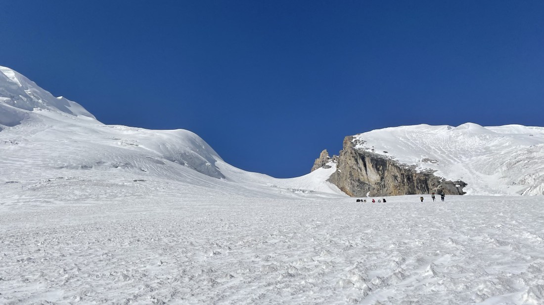
10th June 2022 (Auden’s Advance Base Camp to Khatling Glacier -4975 mt through Auden’s Col-5490 mt; 4.6 km trek)

The big day had a clear sky to offer. The time I woke up at 4:30, the sky was bluish but there was no sunlight on the peaks yet. The kitchen offered us boiled eggs, boiled potatoes, chocolates, and dry fruits as packed lunch. Sonu didn’t rope us up, as he thought that it was not important for Auden’s climb. We were wearing the crampons and the gaiters already as the snowfield started just after our campsite. It was a very brief breakfast that morning.

The picturesque Col. P.C. Arpan Sarkar

We started at 5:20. As we were camping at ABC, the incline started instantly. Sonu let us follow the middle route depending on his past experience. He often mentioned the glacier’s depreciation. Still, I personally felt that the snow was less that year. At 6:20, the sun touched the Gangotri III. We just crossed the first hump then and the support staff were still dismantling the camp far down. We touched the sunlight at 7:30 and it felt warm

Too far yet. P.C. Arpan Sarkar

straight away. The Col seemed far and we kept climbing slowly. About in the middle, there was a huge crevasse. To traverse it, we took a left turn toward Jogin. Once after that, we continued zigzagging. The number of crevasses also kept increasing once after halfway.

The huge crevasse. P.C. Arpan Sarkar
An intermediate break. P.C. Arpan Sarkar

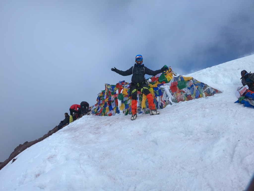
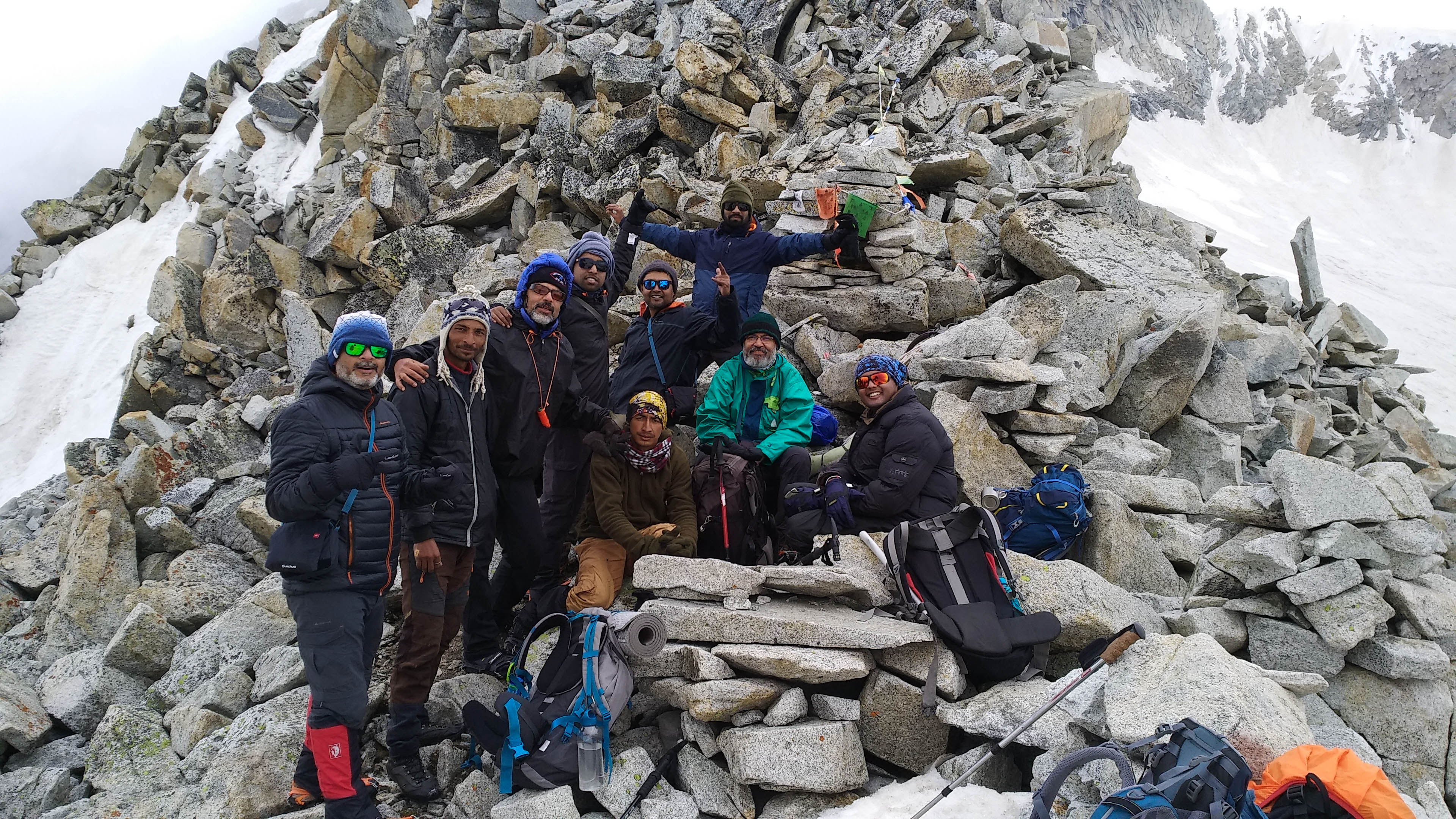
Dr. Amit was the first one to reach the summit at 10:20. I followed him. It was cloudy toward Gangotri but the surroundings of the pass seemed clear. The t-shirt I designed had a catch line “The rabbit is calling”. This is because of the two rabbit ear-like rock structures on both sides of the Col. These rabbit ears are more visible from the Khatling side. We started celebrating with joy. Everyone joined us one after another. Auden’s Col is one of the most picturesque passes. It has vast views on both sides and adequate snow cover along with emerging rock structures. Adding to all features, the Col is between two famous high mountains Gangotri III (6,577mt) and Jogin I (6,465 mt).

Panorama with both the Rabbit ears. P.C. Arpan Sarkar

The other side of the pass looked scary. The infamous Khatling Glacier was waiting for us with a sinister cover of clouds. The scar-like crevasses all over it ran a chill through my spine. We had crossed a significant height of Patangini Dhar earlier. This acclimatization allowed us to spend almost a couple of hours on the pass. We had our packed lunch meanwhile. Once all of our support staff reached the Col, we started to descend.

Auden’s Col, 5490 mt. P.C. Raktim Duttagupta

Kapil fixed a rope for rappelling. Because of less snow that year, glissade was out of the question. It was quite a sharp downhill experience. There were 3 sections of it. In the first section, we rappelled down for 150 meters in a 75-degree gradient. Then a rocky section stands in between the decline. The key challenge was to manage the grip of our shoes attached to crampons on the

Sonu guiding through the rappelling section of descend. P.C. Amit Singh

naked rocks. The 3rd section was glissade-able because of comparatively lesser gradient and thicker snow cover. The way we position our body while stepping into the 3rd section decides the future of our alignment way down. Some went down rolling, some bouncing, some somersaulting. HaHa! But most importantly everyone reached safe on Khatling.

Hint of the descend. P.C. Arpan Sarkar

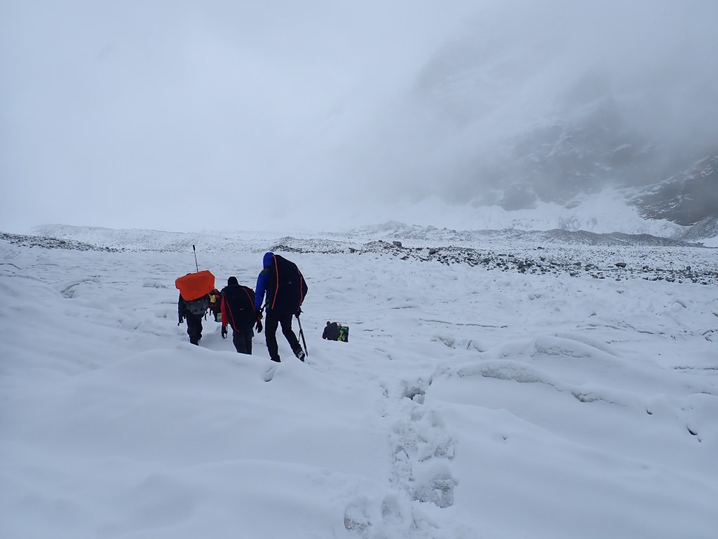
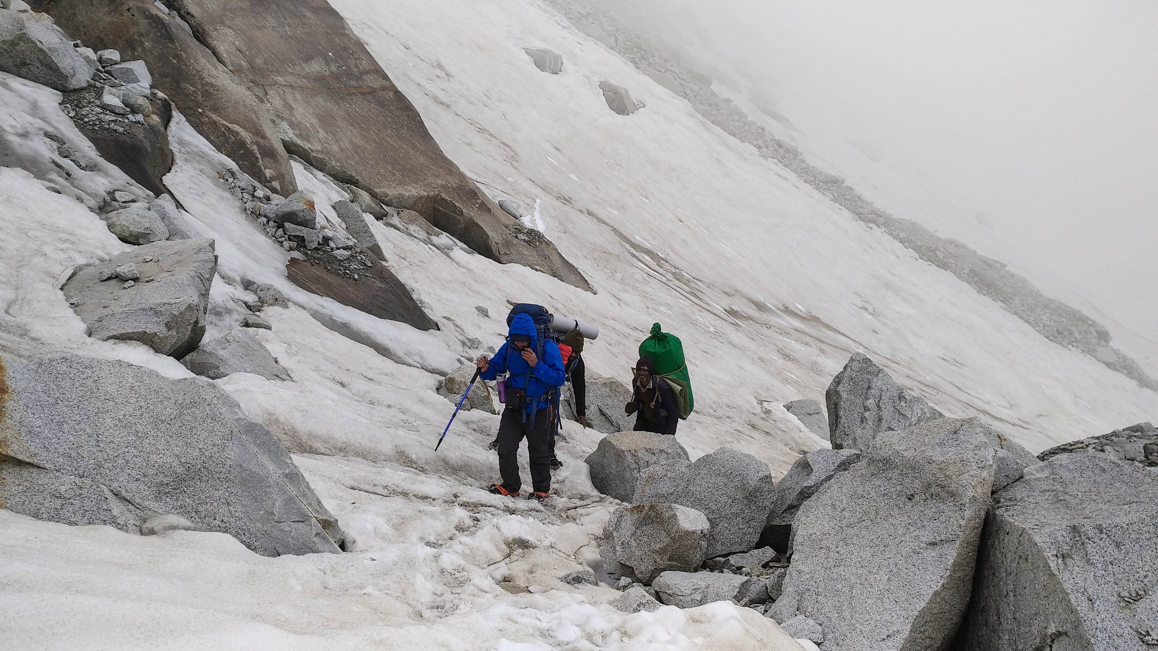
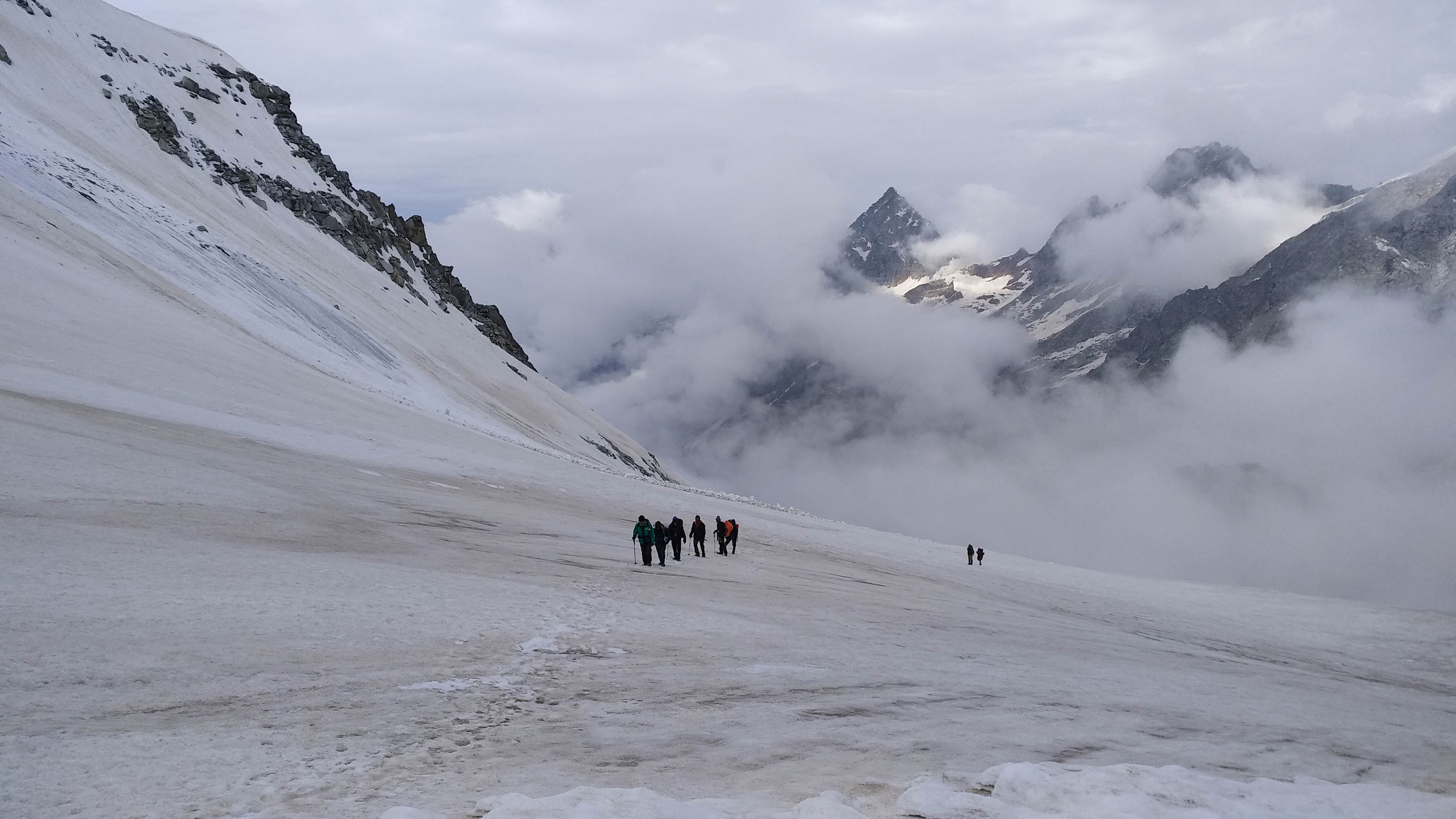
By the time we hit Khatling, it was already snowing. We started marching ahead behind our kitchen staff. The snow got heavier and our legs started going knee-deep. Luckily it was a very comfortable decline gradient through Khatling. We were all going in a queue. The only sound was of a blizzard ripping through our rain jackets and ponchos. Khatling was welcoming us in the most decent way possible. After a kilometer of walking, we encountered an agile depression. A flat ground was visible after the decline. The tents were not yet set up. We were the first batch walking, and it looked like a campsite location.

Snowing on Khatling Glacier. P.C. Arpan Sarkar

Just after the depression, one of our members fell into a hidden crevasse covered by fresh snow. All we saw was, he zipped out of sight vertically. We all gathered around the opening and took a sigh of relief to see him stuck near down. Sonu was just coming behind us. He threw his rope down and slowly we all pulled the guy out. The guy had offloaded his backpack and walked with only a nap sack. A full backpack could have saved him going into the crevasse itself.

Don’t know about the actual plan but Sonu decided to camp on the flat ground visible after that crevasse. A safe flat ground is enough for camping on an ice field. You have to melt snow for drinking anyway. It was 3:15 in the afternoon, and we got the big dining tent over all our heads. All were quite drenched. The guy who fell into the crevasse didn’t injure himself luckily. At about 4, once it stopped snowing, we pitched our individual tents. Guess what! It was sunny after the snow. The sunglasses were out again to face the crystal clear snowfield around. The dinner tasted like heaven after the day’s struggle. It was a crunchy snow-bed that night. After the rock and roll all day, our blubbering didn’t take long to stop eventually. Rahul Bhai, Raktim, and I were sharing a 3 person tent from the start. I got comfortable in my sleeping bag, sandwiched between these two fellows.

The Khatling campsite. P.C. Arpan Sarkar

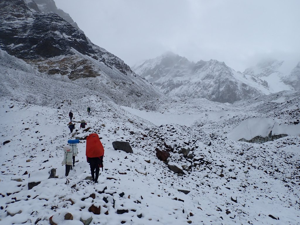
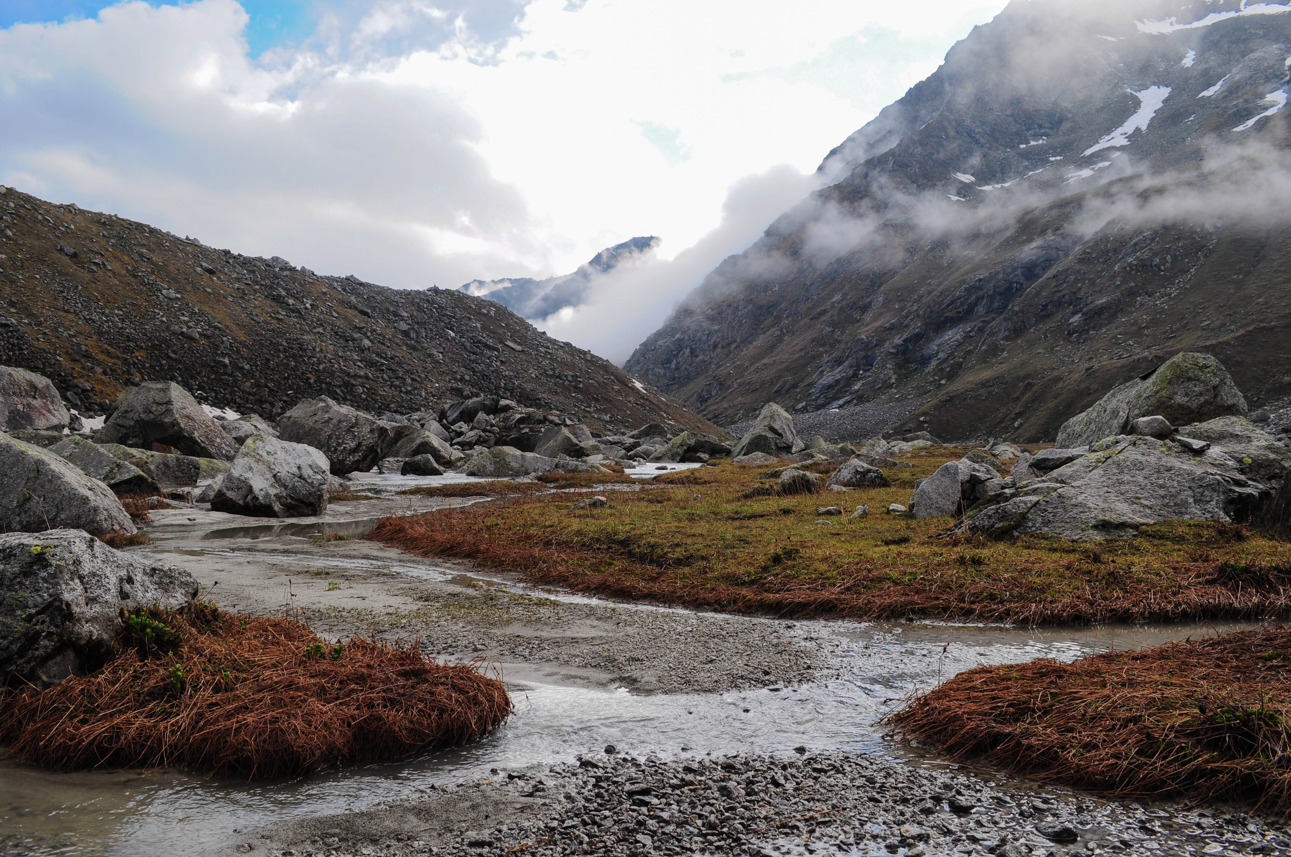
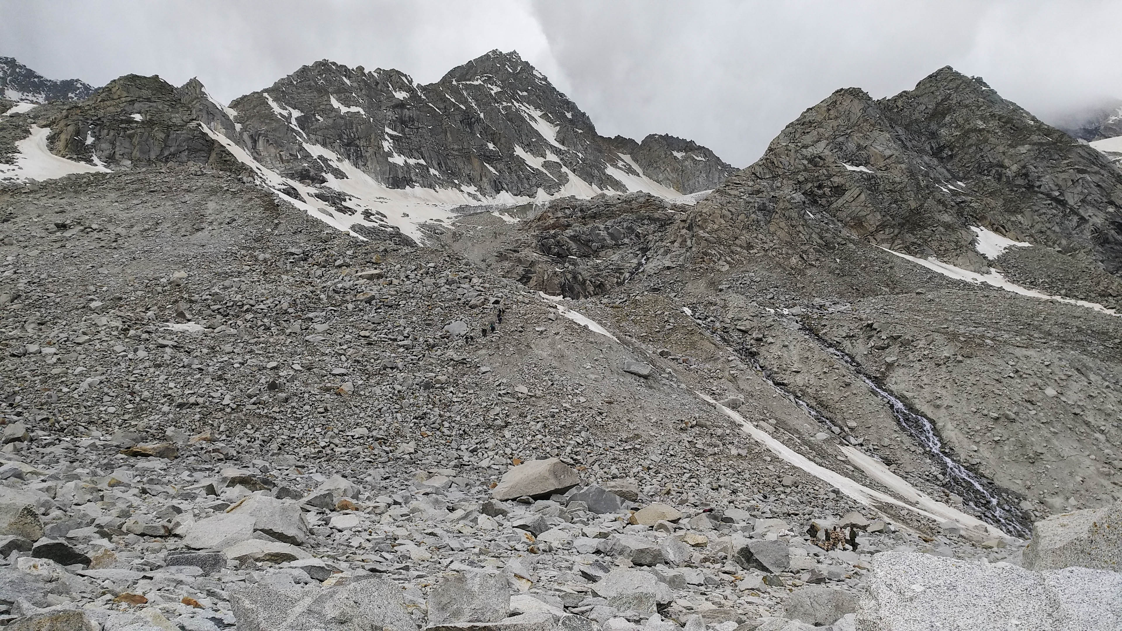
11th June 2022 (Khatling Glacier to Bheelangana Riverside Camp-4002 mt; 9 km trek)

We were camping in the safest and most settled zone of Khatling. The encounter with the deadliest section was waiting for us. I was not feeling the best because of the freezing cold till the sunlight touched us in the morning. We started at 8:45. There was no doubt that roping up

Notorious and infamous. P.C. Arpan Sarkar

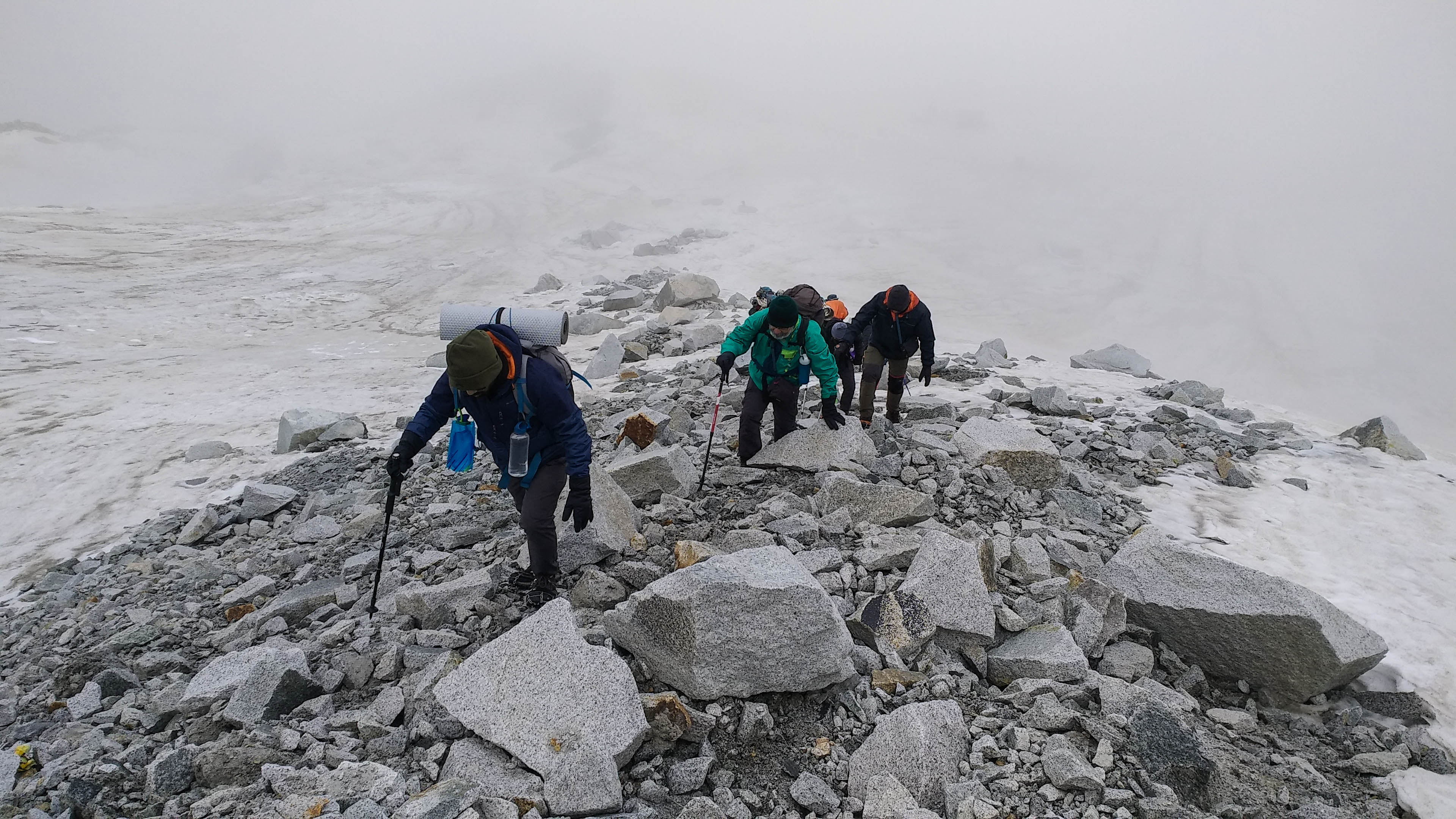
was mandatory. Kapil was leading us and checking for hidden crevasses with his ice axe on every single step. It was a dangerous territory for walking. Thick cream like Icefield had hidden crevasses on each fold. We were surrounded by broken icefalls and avalanches. The stretch continued for the next couple of hours. We barely progressed 1.5 kilometers in that time with precautions in action. Mt. Draupadi Ka Danda was a major peak visible on the west. To see Auden’s Col I looked back, the rabbit with the rocky ears was looking toward us.

Not quite a scoop of your sundae. P.C. Arpan Sarkar

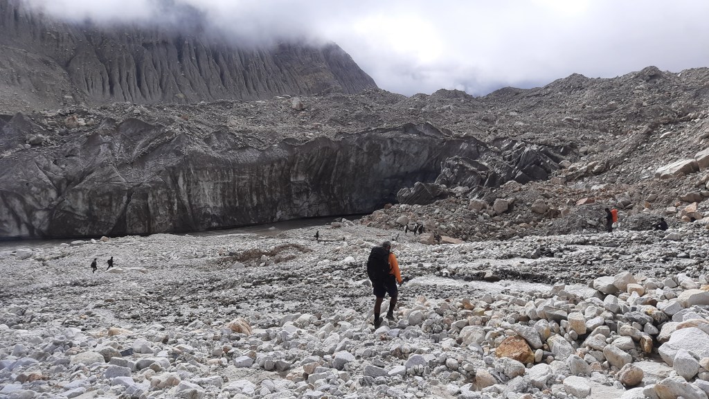
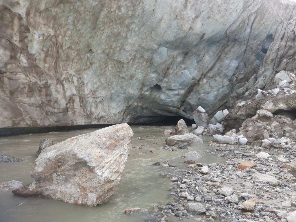
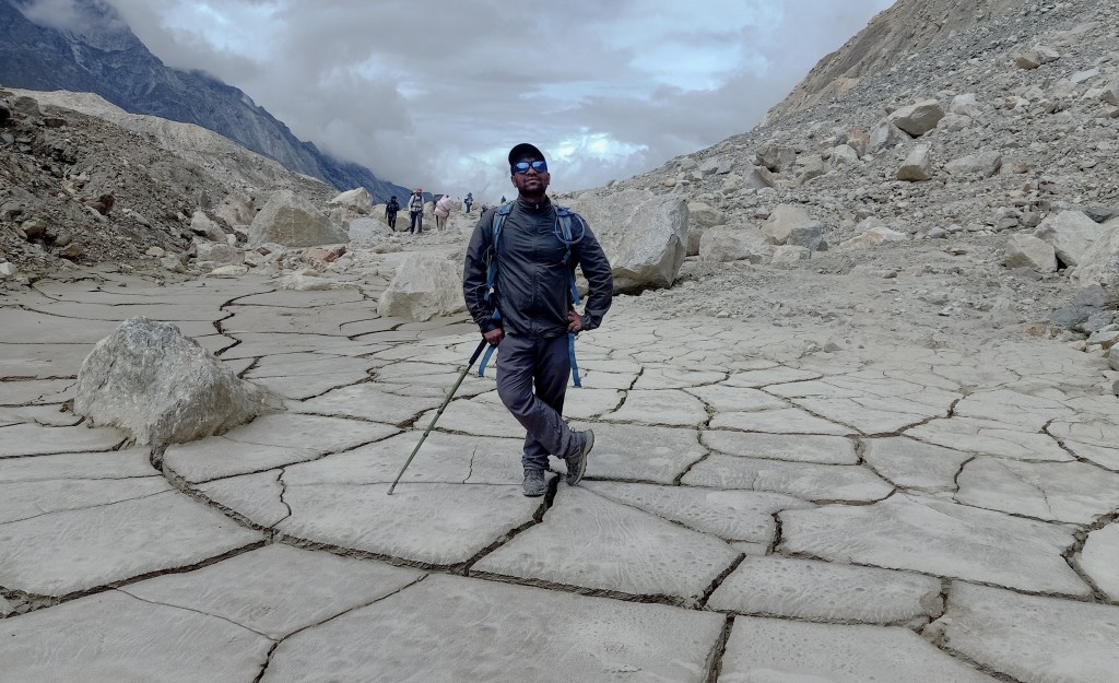
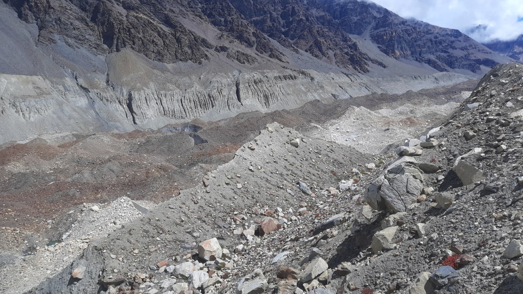
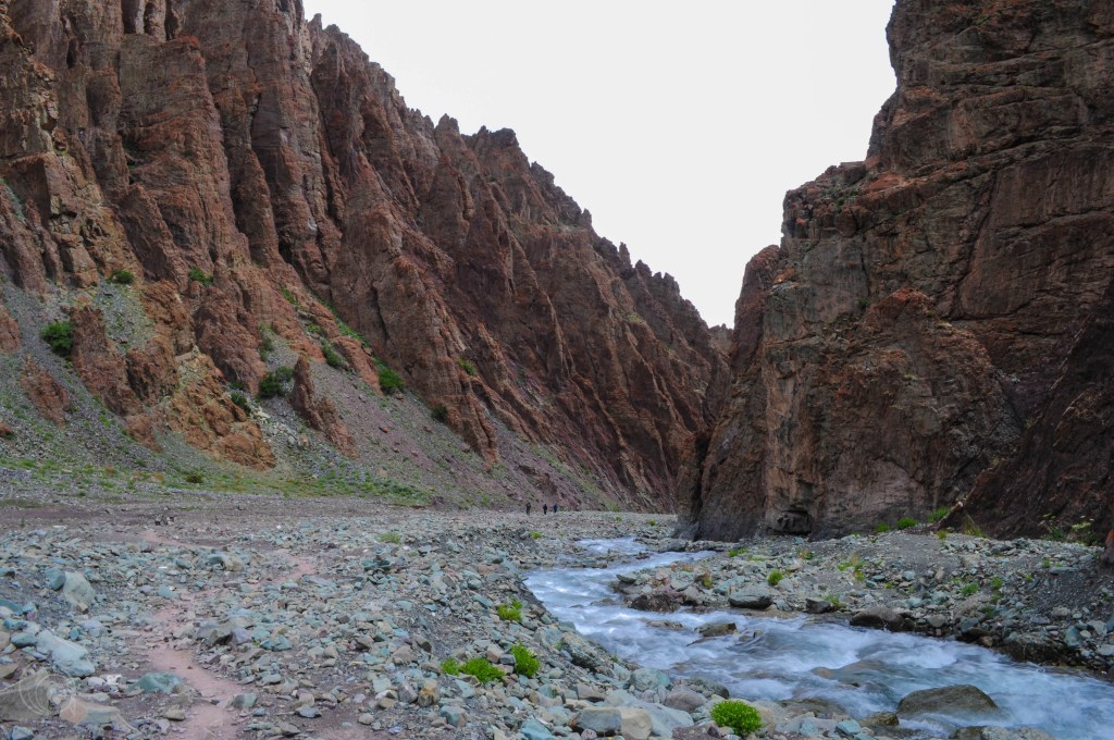
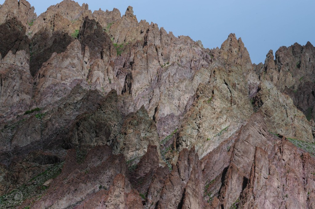
Then came the moraine zone with the underlying glacier. We were approaching toward the snout and the glacier was totally broken. I have seen some video logs before but the route was barely similar. We were going way down from the famous waterfall. The earlier route used to pass beside it. It felt that the glacier depreciated a lot there. We climbed down an unsteady section to reach the base of the glacier. It was a rocky terrain mixed with emerging black ice. Too difficult to

The moraine over the broken glacier. P.C. Arpan Sarkar

identify the slippery black ice from the rock. A few of us slipped along the way. Then we started taking every single step cautiously. We ensured the rock with the walking sticks before stepping. In the middle, there was a place that looked steadier from the surrounding. We had our packed lunch there with a few sips of fruit juices. In front of us, toward the west, we saw a huge broken portion of the glacier. It looked like a snout. Even water was flowing out of it. But, the water was entering below the glacier again. Hence, it can be called a fake snout.

Colorful us over the monochromatic Khatling. P.C. Arpan Sarkar

After lunch, it was time to climb up to the other bank of the glacier. The terrain was completely different compared to the one we were walking. It was a steady earth with patches of grass over it. The flow of the glacier rattled the place. It was not an easy climb either. We crossed the broken sections with utmost attention. The glacier went down to a deep gorge and the true snout is somewhere below there. After the broken section, we found a mud trail to follow. Maybe

Ice, rocks, and the false snout. P.C. Arpan Sarkar

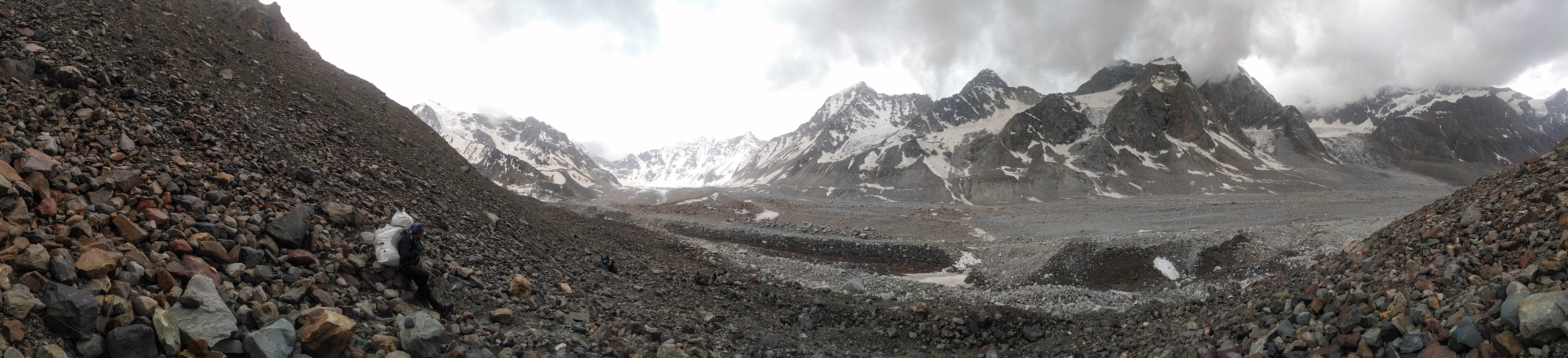
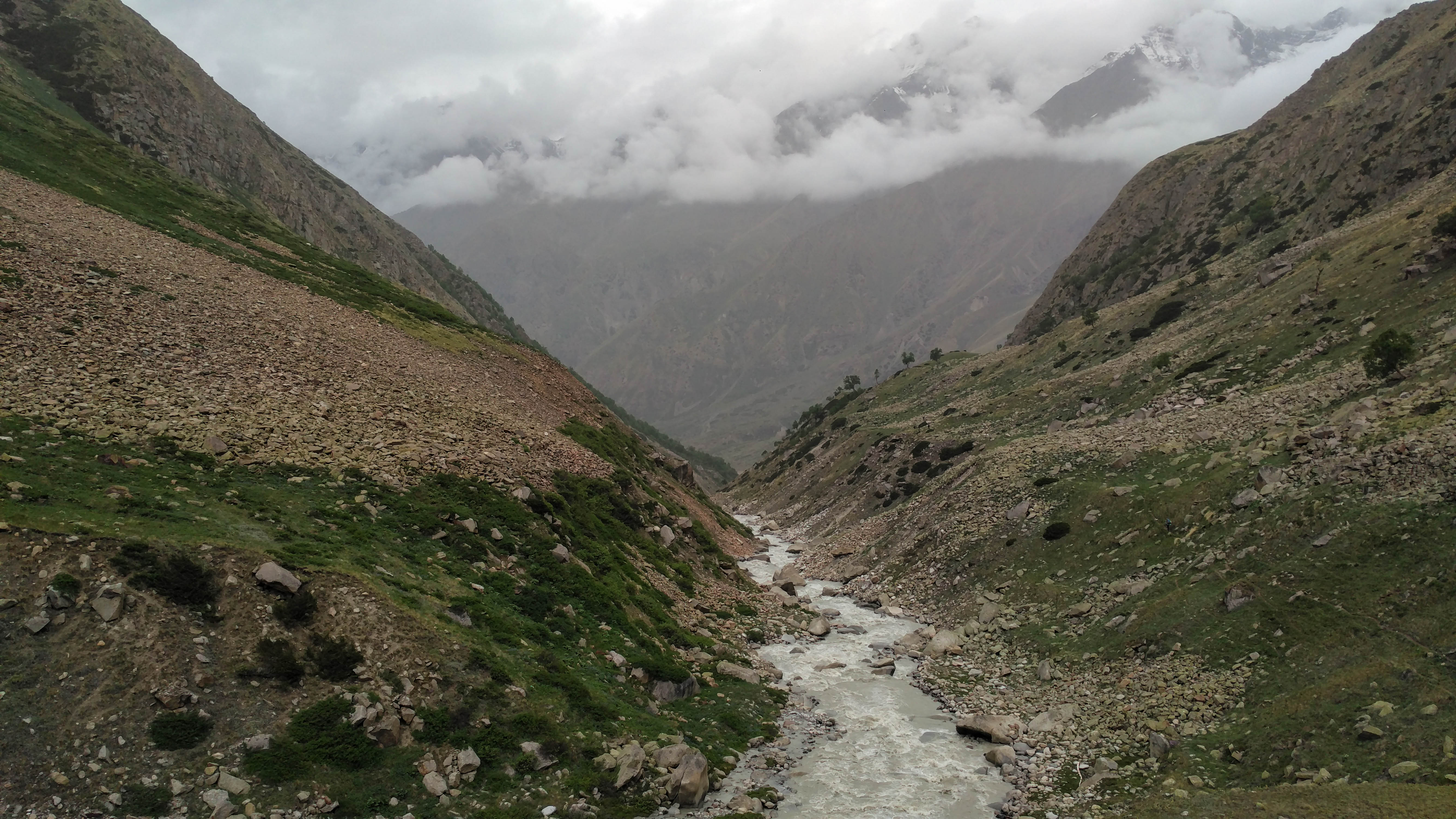
there was a trail from way back but it went down with the glacier. After a while, the trail took a sharp turn toward the south, along the gorge. After negotiating a rockfall zone on the way we came down to the riverbed. The tents were getting ready in a distance with some smoke coming out of the kitchen tent already. It was 6:30 when we reached the campsite.

Into the Bheelangana valley. P.C. Arpan Sarkar

Shallow, icy cold Bheelangana was flowing with great force toward the south-east. There was a hanging glacier way up on the other bank. This was definitely not a part of Khatling. We had some relaxed chitchats, sitting on the bank of the river with hot coffee and fries. There was a huge erect rock in our campsite. Support staff made a fire below it to dry the clothes. It was a

Pre-historic! P.C. Arpan Sarkar

prehistoric frame with people in front of the illuminated rock and the moon rising in the valley from behind the snow-capped peaks. It was one of those longest days of trekking in the wild.

Just to describe the mood of the night. P.C. Arpan Sarkar

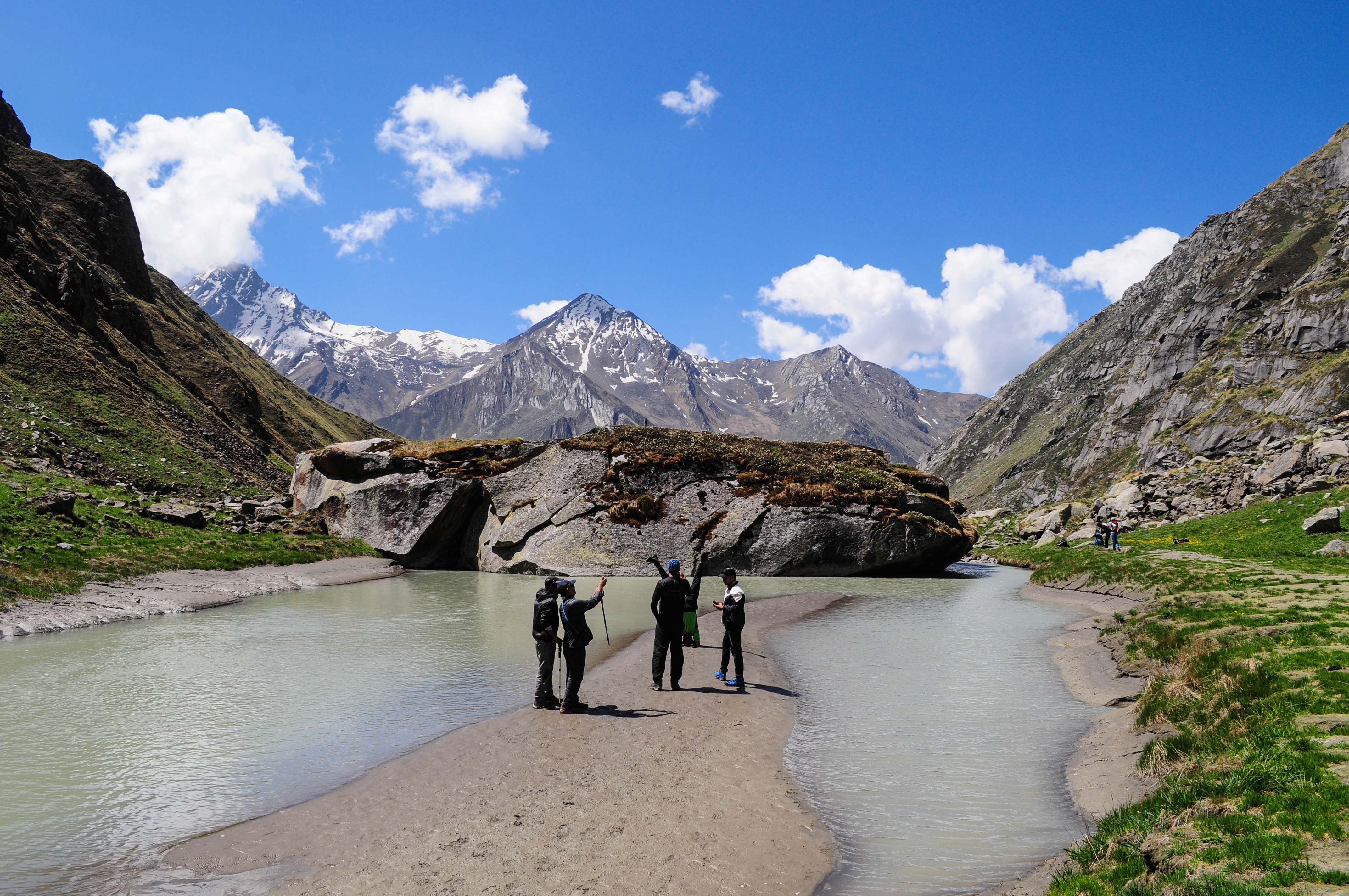
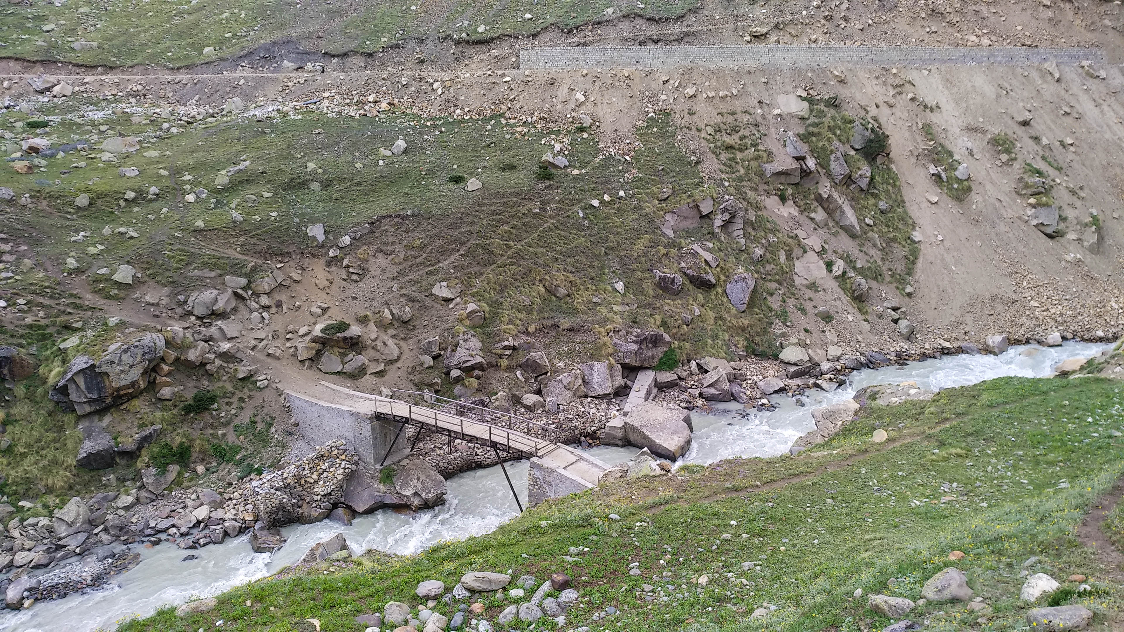
12th June 2022 (Bheelangana Riverside Camp to Chowki-3715 mt; 5.8 km trek)

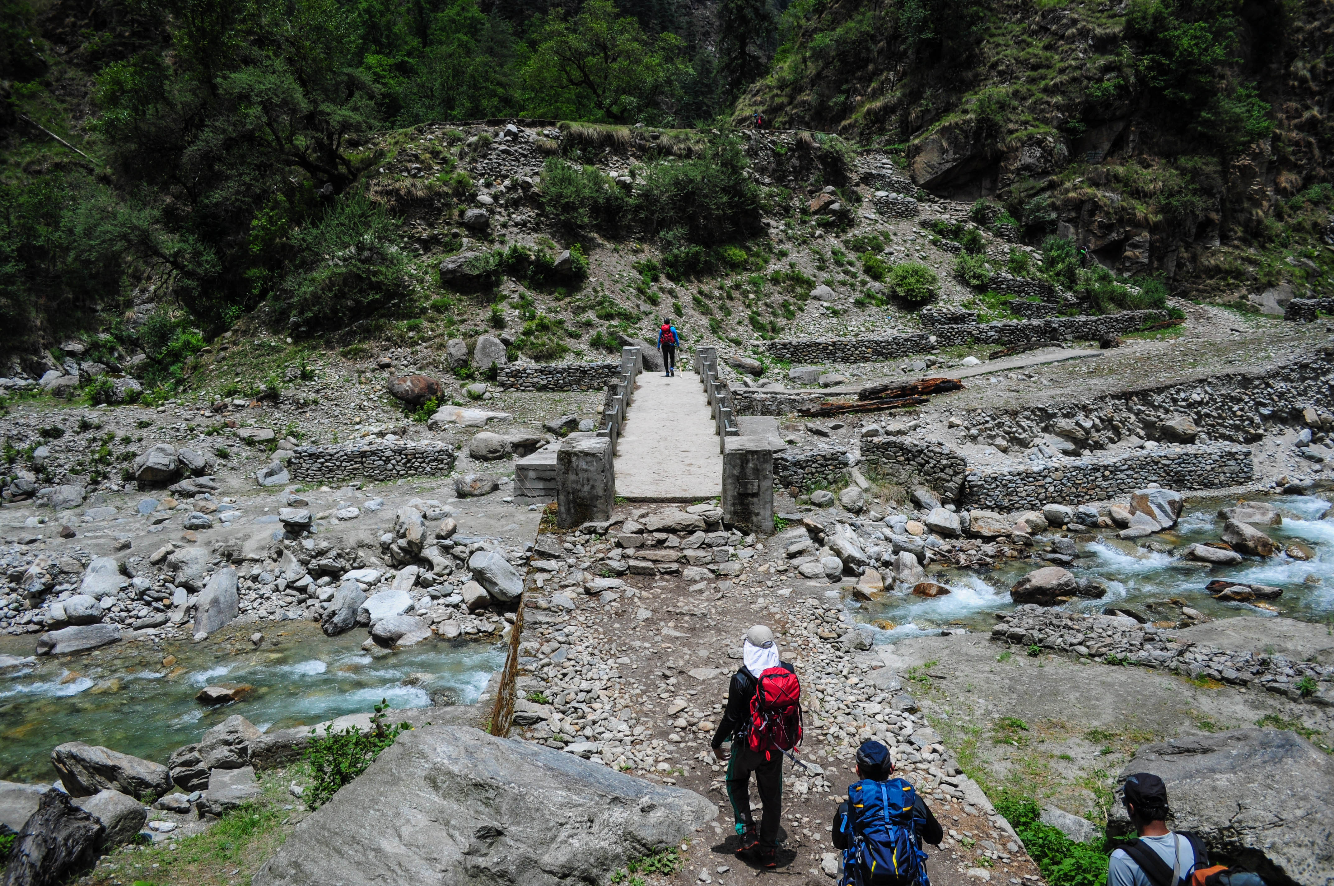
The very day decides the endpoint of the expedition. I have heard stories of a few teams. They ended the expedition in Ghuttu instead of Kedarnath due to river crossing failure. We were ready to cross Bheelangana in our shorts. The walk along the river started at 8. After an hour of walking, Sonu stopped us on a flat point. Somehow Rajiv managed to cross the river way back and was walking on the other bank. The major challenge was the ice-cold temperature of the water and the current. The depth of the river was never an issue as it was close to the snout.

Walk along Bheelangana. P.C. Arpan Sarkar

A support staff carried a line to the middle and thrown to Rajiv. Once the line connection was built, we started crossing one by one. The bags were covered by rain cover and the shoes were hanging on the neck. The key to keeping the body balanced on a shallow current is not to bring the foot out. Instead, you simply need to slide your foot underwater to take the next step. With some minor hiccups, we all crossed safely with a lifetime experience. River crossings were there in Kalindi too but not comparable to this. The other key was to gather the mental strength, that Sonu planted in us. All our legs were numb by the ice-cold water. It took about 30 minutes to get back to normal.

Bheelangana crossing point. P.C. Arpan Sarkar
Sonu, the leader fighting after all crossed safely. P.C. Amit Singh

People attempting the Mayali pass starting from Ghuttu often abandon their trek because of river crossing failure. The shepherds used to build log bridges to cross it, but there is no guarantee.

Paradise! P.C. Arpan Sarkar
Softness! P.C. Arpan Sarkar
Wild beauty! P.C. Arpan Sarkar

The other side of Bheelangana is a paradise. Lush green meadows with colorful flowers and birds chirping around made me remember Har-Ki-Dun. We had to cross 4 more tributaries on the way. The one just before Chowki made us go barefoot once more. One of our members injured himself during one of the crossings. He needed to be supported by others to walk the rest of the way to the campsite.

Tributaries running toward Bheelangana. P.C. Arpan Sarkar

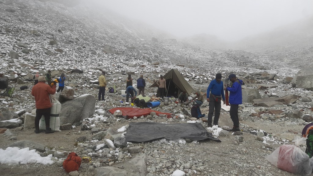
Chowki is about 6 meters elevated from the river bed. It was a wonderful campsite that can fit a big team easily. We reached by 2. The plan for the next day was uncertain because of the injured member. He thought about calling for a helicopter too. Still, we were far deep in the wild to connect the civilization. The guides and support staff did their bit by massaging but it didn’t work.

Camp with a view, Chowki. P.C. Arpan Sarkar

13th June 2022 (Forced rest day at Chowki)

We decided to give the injured member a day to recover at Chowki. The whole day was like a picnic. The highlight was Raktim, Devdutt, Lijo, and I bathed after a long time in a serene lake nearby. It was a refreshing royal bath in the wild with a view of some snow-capped peaks up north. Nobody was in the mood for an acclimatization walk as there was simply no need after all

An aerial wide on a lazy morning. P.C. Arpan Sarkar

the ups and downs. In the afternoon, support staff collected wood logs and empty vegetable crates. They made a shoulder carriage to carry the injured person. However, 4 persons would be occupied to carry that. The rest of us needed to fill the void by carrying little extra loads from the next day.

Me, Lijo, Rakim, and Devdutt after a refreshing dip. P.C. Arpan Sarkar

14th June 2022 (Chowki to Camp below Masar Tal-4415 mt; 4.5 km trek)

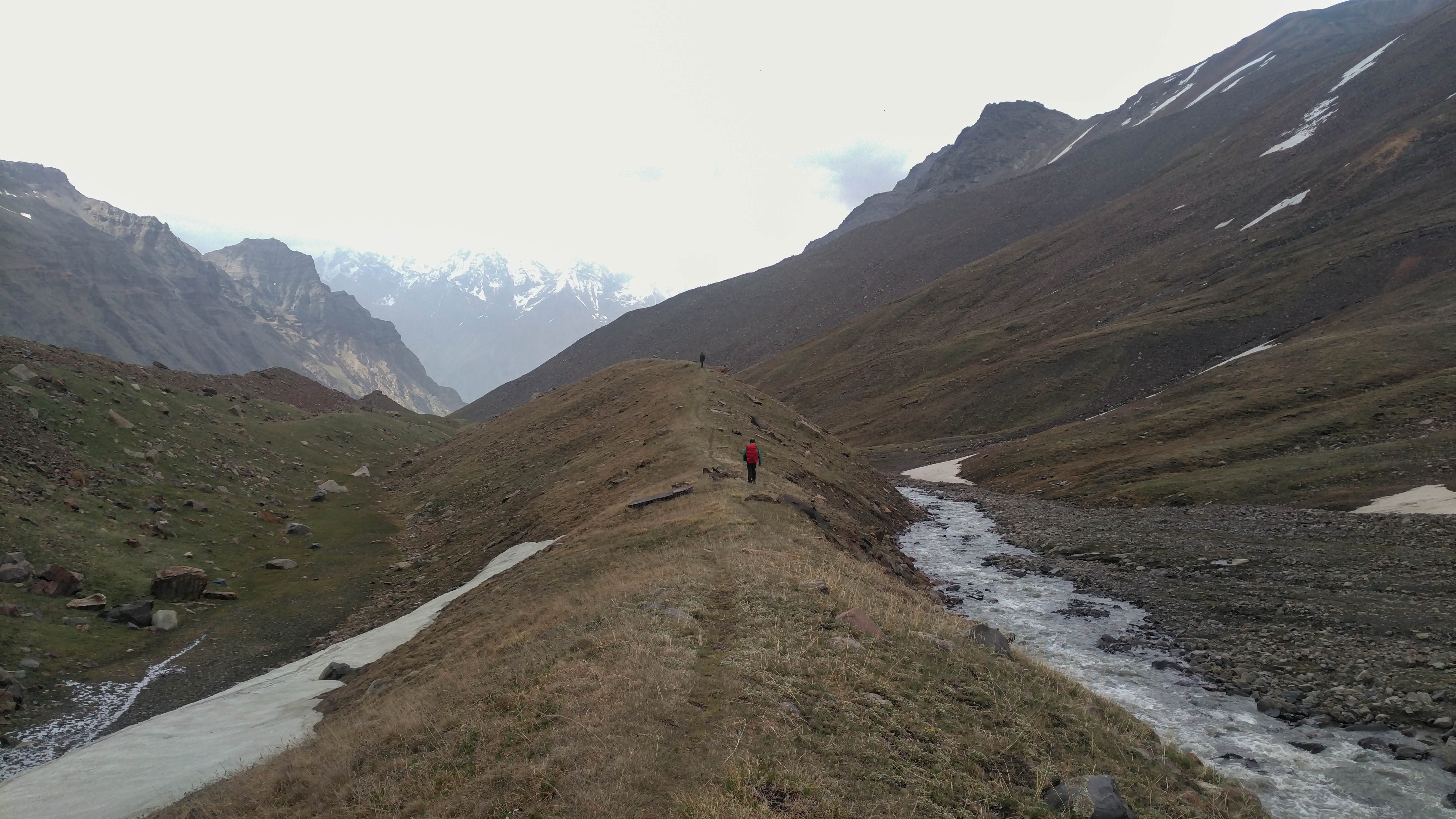
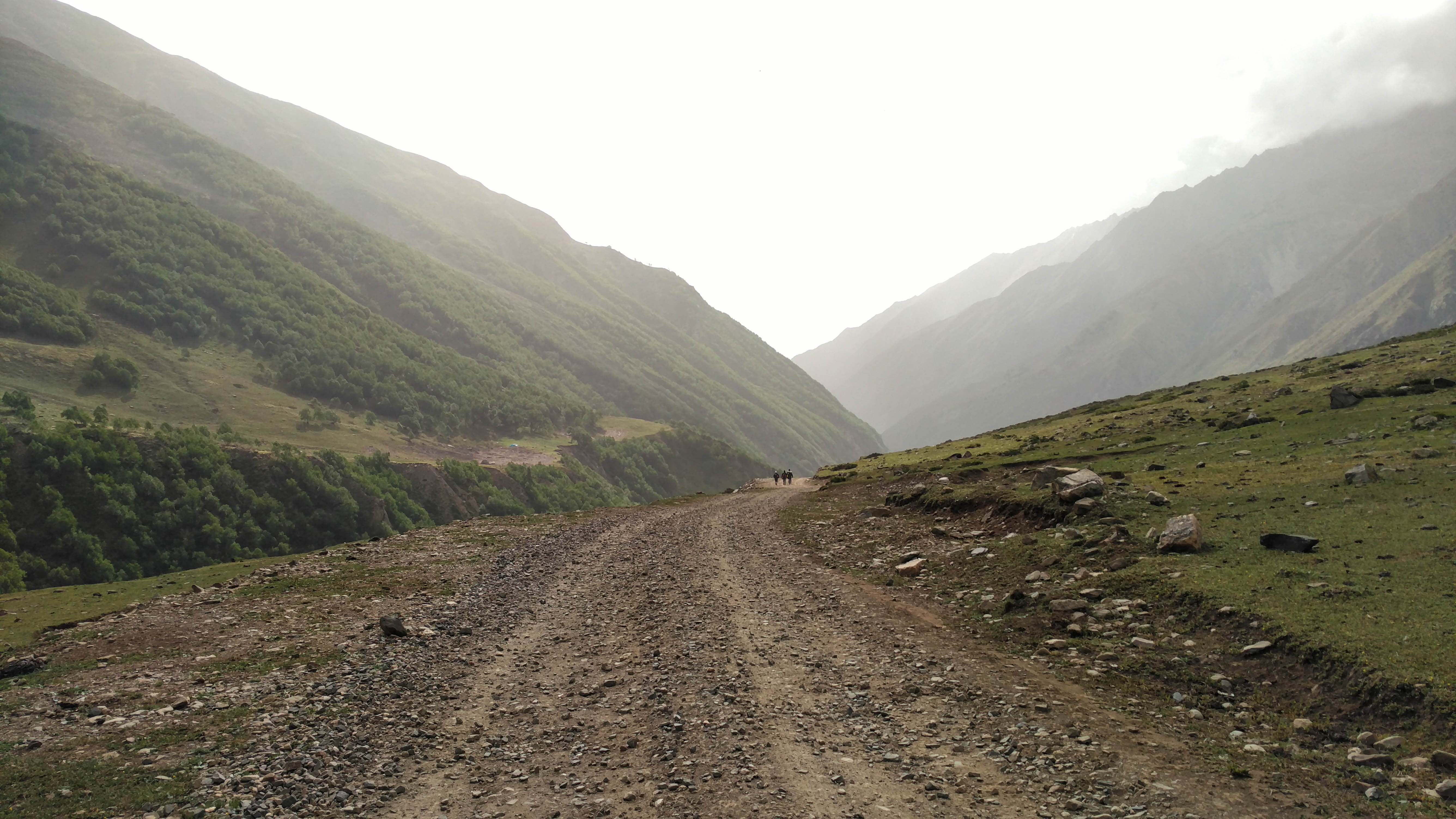
We started early at 7:10. The valley was yet to get sunlight. Our injured member’s carriage was moving before us. We initially followed the trail on the west bank of the tributary of Bheelangana. The trail was very well-defined. Ghuttu and Ghamshali villagers trek to Masar Tal every year for religious activity. Mayali Pass is also a very popular trek attempted from both sides. At 8:30 we reached a lush green meadow with the first kiss of the sunlight. The gradients were not very insignificant, but we had already been accustomed to them for the last 10 days. We passed through some signs of Himalayan bears but luckily avoided a face-to-face meeting. Normally, these wild Himalayan animals don’t confront a group of people. There is a high chance of seeing them if traveling alone.

Incline through the lush green valley. P.C. Arpan Sarkar

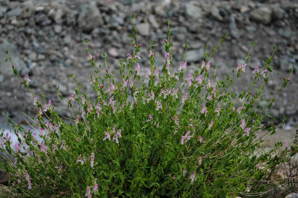
At least 4-5 waterfalls were coming down our way to enrich the tributary. Almost the whole trail that day was covered by a lush green carpet of grass. After spending days between rocks and ice, they felt heavenly. The tangy smell of wild plants and flowers was all around.

Toward the high ground again. P.C. Arpan Sarkar

A 200-meter rocky wall stood in a 55-degree gradient after a picturesque meadow. A quiet waterfall was also descending through the wall to make the climb more difficult. It took us almost one and a half hours to reach the top of it. Then came a comparatively decent gradient covered by lush green grass cover. Streams were flowing in all directions around us. There are two big and one small lake uphill. All these streams are fed by the water of those lakes. Once after crossing that gradient, we reached our destination for that day. It was a very cozy and compact campsite with grass cover. Small elevations were on both sides of that place with a narrow and beautiful stream passing through the northern side. We pitched our tent just beside the stream.

After crossing the rock wall. P.C. Arpan Sarkar

By that time, people started getting a little impatient. Civilization was just a couple of days’ walk away from us. An efficient walk could even take us to Kedarnath in one day. Ration was running on the lower side, so the dinner was brief. The burbling sound of the stream by our side took us all to sleep quickly that night.

A cozy place to spend the night. P.C. Sanjay Varma

15th June 2022 (Camp below Masar Tal to Vasuki Tal-4251 mt through Mayali Pass-5150 mt; 13.2 km trek)

Long day started very early at 5. The sky was filled with blue and the peaks toward Khatling were already golden. The first target was to reach Masar Tal. The beginning gradient was not much

Start of the super long day. Leaving the camp behind. P.C. Arpan Sarkar

difficult, just some ridges and humps to cross. We reached near to a small lake that was misidentified as Masar initially. The actual Masar Tal was reached by 6:30, which was just a few

The small Tal below Masar. P.C. Arpan Sarkar

humps away from the smaller one. Masar Tal is bigger than Kedar Tal. It was fully melted at that time. This was probably because of longer exposure to sunlight every day. We kept progressing without spending much time. The agile gradient just after the Tal was technical. It is the

Masar Tal. P.C. Arpan Sarkar

ridge between the two lakes; Masar and Paiyan. The summit of the ridge is called Masar Top. Once after reaching the top at 7:30, we start the decline toward the bank of Paiyan Tal. Snowcover started to pave our way for the first time in this stretch. Along with it, the sunlight also touched us. Once after reaching down, Kapil went to search the route. The North side of the

Toward Masar Top. P.C. Arpan Sarkar

semi-frozen Paiyan Tal looked more approachable from a distance. However, we decided to approach through the rock wall on the south of the lake. Kapil found a major gap on the other side. It needed technical training to cross. Paiyan Tal is part of the Mayali icefall itself.

Descend toward Paiyan Tal. P.C. Arpan Sarkar

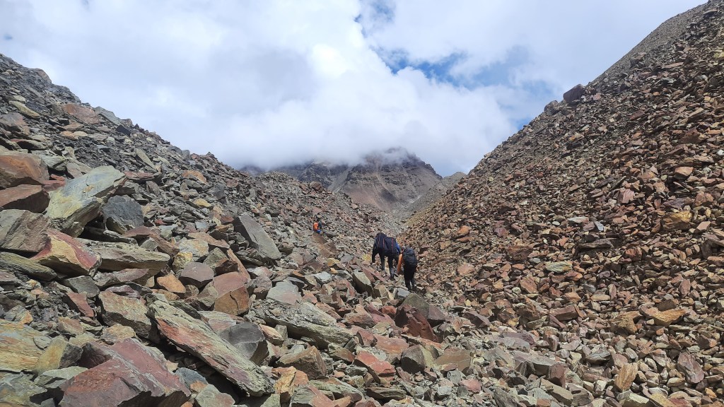
The wall on the south is almost 1.5 kilometers stretched and needed extreme attention to cross. The wall goes into the semi-frozen lake was filled with loose rocks, boulders, and patches of snow. It took about couple of hours for us to reach the base of Mayali Pass, crossing through the rock wall.

Paiyan Tal from the rock wall. Mayali Pass is seen on the right. P.C. Arpan Sarkar

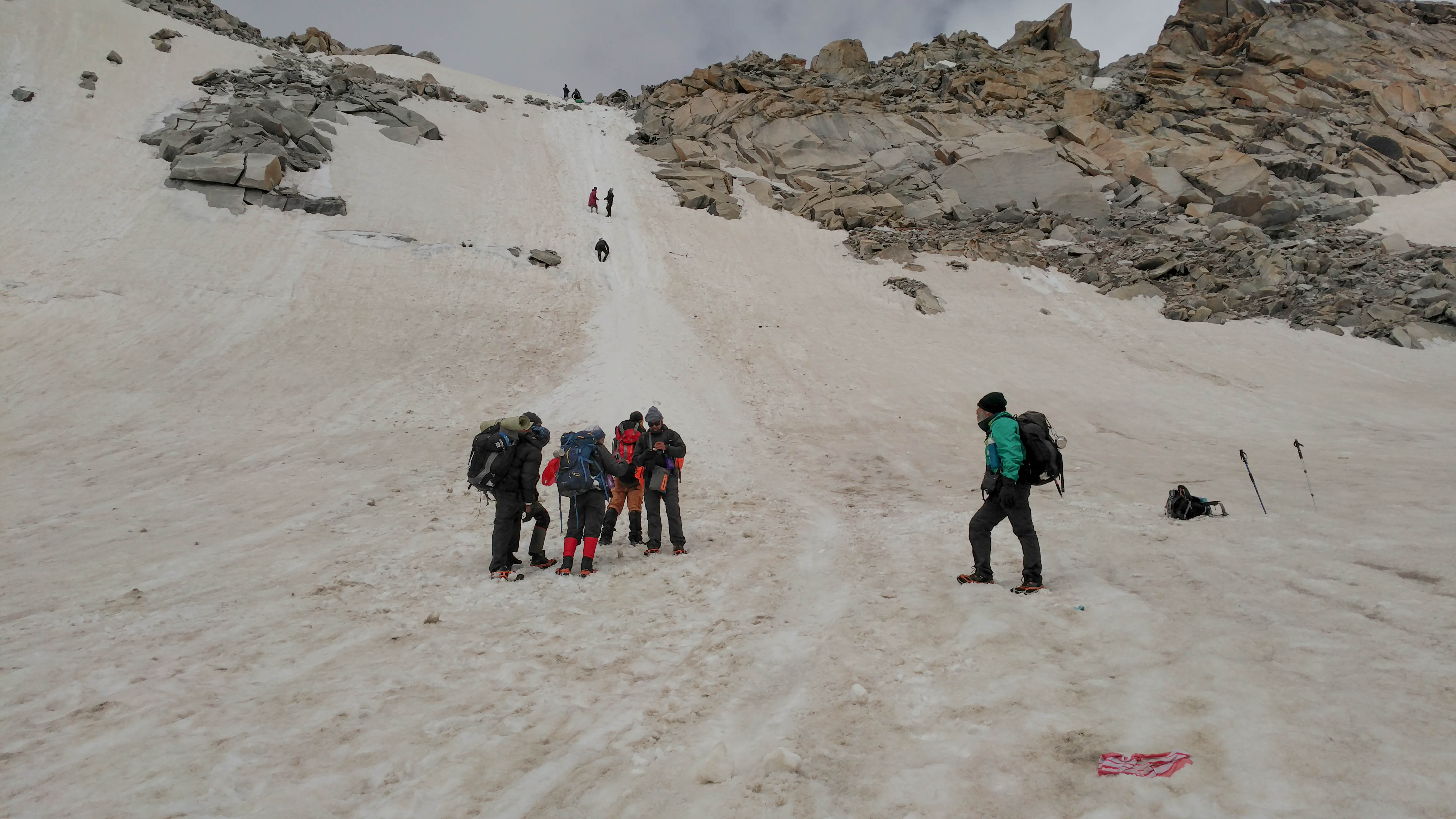
We attached our crampons to the shoes to face the last major challenge of the expedition. I broke a small part of my tooth while adjusting a rigid crampon nail. The ice field was smooth

Paiyan Tal from Mayali Base. P.C. Arpan Sarkar
Toward Mayali Pass. P.C. Arpan Sarkar
The climb of Mayali. Paiyan Tal is seen far. P.C. Arpan Sarkar

and offered a decent incline. The sun was shining brightly upon us. After the initial 500 meters, we kept zigzagging for the rest of the incline. Our injured friend was climbing with support from the shoulders of a couple of staff members. It was too difficult to manage the carriage through that incline on snow. We reached the Pass at 12.

Mayali Pass- 5150 mt. P.C. Arpan Sarkar

The weather was turning cloudy slowly. It looked like the pre-monsoon window of Uttarakhand Himalayan expeditions about to get over. A puja was organized to acknowledge the mountain god for providing us a safe passage. We started to get down quickly as the thought of reaching Kedarnath was still there in some corner of our minds. Once after descending the snow field we had our packed lunch. The dark clouds were gathering over our heads. Heavy snowfall started in

Turning cloudy. P.C. Arpan Sarkar

a while. We were crossing a rocky descent and about to step into another snowfield. Ponchos came out of the rucksack. Everything turned to white within 15 minutes. The knee-deep snow started to haunt us again. Speed of our movement was slashed by half because of the time we took for judging before each step.

Long way to go. P.C. Arpan Sarkar

A rocky decend was situated just after the snowfield. The intensity of the snowfall went down. The terrain was a wide open valley. Many small and medium streams came from elevated locations. They ran toward the south-east to meet Mandakini River somewhere. We keep approaching being on the northern walls of the valley. We were praying to get a glimpse of the campsite as soon as possible. The dream of reaching Kedarnath has vanished by then from our minds. The desired sight of the campsite came at 5 pm. We were more than happy to get into a tent that evening. We reached the campsite after 15 minutes or so. It was set just beside the Vasuki Tal. The calm and serene lake was almost fully melted with some snow patches around.

The one in the middle far away is Mt. Kedarnath. P.C. Arpan Sarkar

We came to know after reaching the campsite that Sonu and Lijo progressed straight to Kedarnath. Everything hanging from our bodies was wet. The rest of us never considered progressing ahead that day, even in our wild thoughts. Khichdi served as a life-sever that night.

16th June 2022 (Vasuki Tal to Gouri kund-1982 mt through Kedarnath-3583 mt; 24 km trek)

Leaving Vasuki Tal. P.C. Arpan Sarkar

The morning was gloomy and we made some fire to dry our wet clothes. The ration went dry and we were on our personal stock of eatables that morning. Kitchen had only coffee to offer us. With the comparatively drier version of ourselves and the equipment, we started at 8:30. The ridge called Vasuki top was visible from the camp. However, there was quite a snow cover on the way.

Kapil staring at the Vasuki Top. P.C. Arpan Sarkar

We found one more lake on the way that was completely frozen. It took us a couple of hours to reach the top. From there onward, the route went continuously down to Kedarnath. The temple came

Down to the civilization. P.C. Arpan Sarkar

to vision within 15 minutes of descent. Helicopters were ferrying people down to the valley. The entire descent took about a couple of hours including calling breaks to home after days.

Kedarnath in vision. P.C. Arpan Sarkar
Just above the Mandakini valley. P.C. Arpan Sarkar

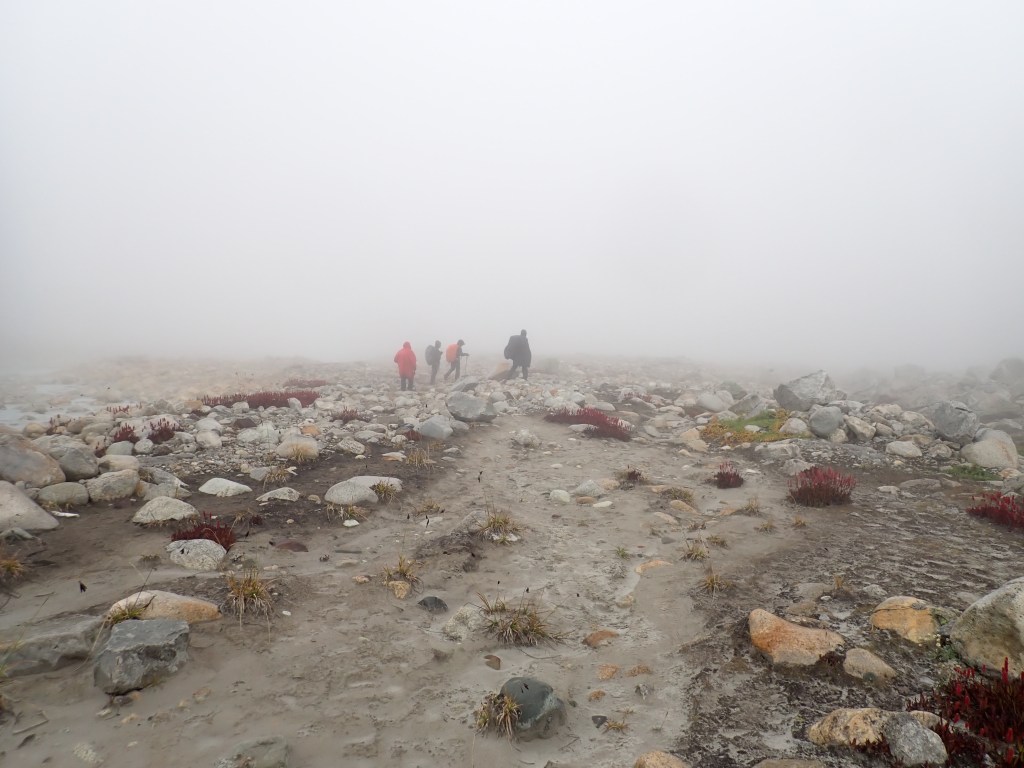
We parted with Sonu and his team. Then, we sat in a corner near Kedarnath temple. We observed the pilgrims roaming all around us. It was too contrasting with what we had for the last 12 days. Being there, we were neither overwhelmed nor disappointed at the same time. The journey that we made was a very rare and remarkable feat. It was very gracious of the ever-changing mountain weather that we crossed the significant stretch successfully. None of us wanted to spend the night in Kedarnath. Meanwhile, the 17-kilometer walk to Gourikund seemed a little too much. Me, Raktim, and Rahul Bhai tried for a darshan but failed for several reasons. Majorly, we were the only group that emerged from the mountains, the rest were registered for Yatra and Darshan. By looking into our burnt faces, people were raising their eyebrows. Some couldn’t control their surprise and asked for our whereabouts.HaHa!

Keadrnath Temple. P.C. Arpan Sarkar

We started the descent toward Gourikund at 3:30. At several points, I was disgusted by the crowds and the road full of mule shit. People were even dancing on the frozen waterfalls. At 8:30 we reached Gauri Kund.

We spent that night in a congested hotel room in Son Prayag. The next morning a SUV took us to Dehradun, and another one to Delhi from there. An early morning flight carried me and Raktim to Bangalore on the 18th.

Couple of dirty cavemen school friends. Me & Raktim. P.C. Arpan Sarkar

I count myself extremely lucky to be part of such a huge successful expedition that had so many variables. Kedar Tal is a trekking expedition by itself, we made it look like an acclimatization walk. Patangini is a hell of a climb straight away on a 3rd day. Navtej Ji attempted Auden’s Col before. He had to return from the summit because a team member was sick. There are so many similar stories. The Khatling puts you in a position where you can’t really plan the next step. Everything depends on your fate. The crossing of the Bheelangana River was extremely crucial to finish the expedition as per plan. I must give a huge shout-out to Sonu and the team for making it look achievable all the time. Many such expeditions end up in Ghuttu because of the leader’s lack of courage. The Mayali Pass and Vasuki Tal are trek routes by themselves. I guess this is the only trail in Uttarakhand that connects two Dhams of the four. It literally goes from temple to temple.

Sonu Negi. P.C. Mohit

There will always be variations in member’s performance, and we were not an exception. I think there were point of return to civilization on every alternate day in this expedition, unlike others. Still, all of our 15 members kept the mental and physical balance to continue till the end. It’s a very relaxing feeling when you start and end an expedition with the same team. I must mention Navtej Ji and Devdutt Ji. They are in their early sixties. I admire them just because of the mental fitness they have shown throughout. People call Kalindi Khal one of the most challenging crossover treks in India. I will rate this higher. You literally walk 10-12 hours every alternate day, why shouldn’t I?

The Killer Kalindi Khal

      It feels amazingly thrilling when I write these blogs after an interval from the treks. This is kind of doing the trek once again in my mind. I try to recall every detail and all the memory of struggle and joy that used to cheer me up.

               So, this time it’s Kalindi Khal, a trek that needs no introduction. As far as my knowledge goes, Kalindi Khal is one of the most glamorous treks in India, standing with a maximum height of 5985 meters between Kalindi Peak (6,102 meters) and Avalanche Peak (6,196 meters). “Khal” in Hindi is similar in meaning to pass or col which is the lowest possible crossover ridge between two tall mountains. Kalindi Khal has a spiritual angle as it connects Gangotri and Badrinath, the two shrines of four in Uttarakhand. 

               Due to COVID-19, there was no treks in 2020. Many of my trek mates had planned Kalindi Khal a few times before, but it got canceled repeatedly because of many reasons including COVID-19. Kalindi Khal is a long trek and a comparatively expensive one too. That’s why the team needed to be absolutely sure of attempting it. Some of my trek mates were planning Kalindi in June 2021. But it got canceled again because of the 2nd wave of COVID-19 in India. I always had a plan of doing Kalindi in the post-monsoon season as my study suggested more success rate around that time. I was looking for an appropriate team as per my requirement, and around March I came across a very interesting two-liner post on a Facebook group. This post led me to Amitava Chatterjee who was trying to accumulate a team of appropriate trekkers for Kalindi Khal in September 2021. I jumped in immediately. My trek mates whose Kalindi Khal trek got canceled in June also joined in. Amitava Da was looking for a team size of 12 trekkers. After various additions and subtractions, the final number stood out as 10. The itinerary was to reach Gangotri on 3rd September and end in Badrinath on 18th September including a couple of acclimatization and a couple of reserve days.

               My preparation plan is simple, 5 days a week throughout the year. There can be a special addition in the workout before the trek but the core remains the same. I cycle 4 kilometers, run 4 kilometers, and do some freehand exercise five days a week throughout the year. In special addition to Kalindi, I hiked Golkonda Fort, Hyderabad, 5 times a day on the last 5 Saturdays before the trek. I must admit, this special hike did wonders for my legs and helped me throughout the trek. The rain of July and August was mostly in the latter part of the day, not in the mornings. So, my preparation remained uninterrupted.

               The hic-up before every trek has become a regular practice now. This time it was the roadblocks and landslides because of excessive rainfall in all the regions of Uttarakhand. Along with it, the COVID-19 protocols were varying throughout the states of India. Uttarakhand was very strict about the entry of tourists from other states. An e-pass was mandatory with all details of the tour along with and COVID negative RTPCR report. With all these documents and a backpack of 12 kilograms, I was ready to board my flight to Delhi on 2nd September. Two more trek mates, Navtej Ji and Siddartha joined me at Hazrat Nizamuddin railway station, Delhi. We boarded an overnight train to Dehradun.

3rd September 2021 (Dehradun to Dharali–2680 mt; 220 km drive)

               Nanda Devi Express reached Dehradun at 5:30 in the morning. There were four queues to test RTPCR reports and rapid testing was also available for those who did not have it. The arrangement was very agile. After all the formalities we come out of the station within fifteen minutes. A pre-booked cab was waiting for us outside. Anjan Da joined us there. He reached Dehradun on the previous night. We four set out for the President Hotel where two more of our trek mates, Devdutt Ji and Apurva were staying after reaching Dehradun on the previous afternoon. We freshened up in their hotel room. In the meantime, all our bags had been tied to the top of the car. We started at 7 AM.

               There was no certainty of staying at Gangotri because of the ever-evolving COVID restrictions. The nearest possible stay could be in Dharali, 20kms before Gangotri. The weather was cloudy in the morning but it got cleared as we progressed. We were literally sitting with sunshine on our back when we stopped for the breakfast. We set out for Uttarkashi after breakfast where Amitava along with Snigharup were making the arrangements for the trek.

From the terrace of a Dhaba at Subhakholi. P.C: Arpan Sarkar

The wheel kept rolling, and so did the weather. At lunchbreak, it was raining heavily. Amitava and Snigdharup with the arrangements were following us. To make things a bit challenging, one of the front tires got a lovely sharp nail in it. We found a scenic puncher fixing shop just beside the river Bhagirathi. After a 30-minute break, we had a nice drive along the river. We met another team of guide Uttam Singh Rana and his support staff on the way. They were about to start with a team of 15 for Kalindi Khal on the 4th. We got confirmation from Amitava that authorities were not allowing people from outside the state to stay in Gangotri. So, Dharali was the nearest option, and we reached it at 4:30 PM. In about an hour Amitava and Snigdharup reached. Kunal and Utkarsh also stepped out of a different car just about at the same time. We got a deal of 5 double bedded rooms at Rs. 2000 per day. Things got unbelievably cheaper because of COVID and less tourist footprint. They even provided us a space for cooking on the ground floor without any extra charge. In full-on yatra season, these rooms even get occupied at Rs. 4000 each.

Bhagirathi roaring downstream. P.C: Arpan Sarkar

               Our cook Mahavir and his assistant Pradip also reached along with Amitava and Snigdharup. They started the arrangement for dinner. It was a get-together time before we headed to the wild. Prior to boarding the train on the last day, I only knew Navtej Ji. We did a few treks together before. The rest of the group was only known to me on Whatsapp. Amitava, Anjan, and Snigdharup were coming from Kolkata. Devdutt and Apurva were from Pondicherry. Navtej, Siddhartha, Utkarsh, and Kunal are from Delhi. I was the sole member coming from Hyderabad. The introduction was easy as everyone had only Kalindi Khal on our minds. We had the legal and financial settlement before going out on a stroll.

Rain is yet to leave the mountains. P.C: Arpan Sarkar

               Dharali is a very small village before Gangotri. One might not notice the village on the way if the significance is not known. Firstly, Dharali is the base for Mt. Srikanta (6,133 mt) expedition. Secondly, Dharali has a temple known as Kalp Kedar. Thirdly, Mukhwa temple is the winter settlement of Mata Gangotri which is just on the opposite bank of Bhagirathi. Mukhwa is connected to Dharali by a beautiful hanging bridge. So we were already in the sanctum of the Great Himalayan peaks.

Dharali in the evening. P.C: Arpan Sarkar

               Mahavir is a very well-known person in the Gangotri region. It is not only because of his cooking; he has assisted many expeditions with some well-known mountaineers. He has also done Kalindi Khal 3 times before that. The dinner tasted awesome that night with some experienced talks about the route from Mahavir. The weather was very comfortable with some chills. I and Amitava shared a double room. There used to be many members always in our room as Amitava was the organizer. The road journey of 220 km got me tired. I slept early ignoring all the disturbances.

4th September 2021 (Acclimatization Day at Dharali)

               The altitude of Dharali is 2680 meters which is about 700 meters lower than Gangotri. This brought us the challenge of acclimatization. We always wanted to stay at Gangotri only because of the altitude. But COVID came in our way. We decided to have an acclimatization climb which is at least more altitude than Gangotri. So, the Sattal (seven lakes) opted as the most convenient option.

Morning at Dharali. P.C: Devdutt Lall

               After a nice breakfast, we started for Sattal at 9:30 am. This is a kind of off-beat day hike from Dharali. Navtej Ji never liked an acclimatization walk. But this was kind of not avoidable because of staying at a lower altitude. The route is a continuous steep ascent. In starting we crossed the village segment. Almost all the houses have at least one green apple tree in them. We were moving slowly as there was no fixed target point. After hiking for a couple of kilometers, we reached the first Tal.

The first Tal of the seven. P.C: Arpan Sarkar

There are seven like this as you go up. The calm green water and the forest around it were beautiful. We kept moving and stopped beside the fourth one. The altitude was already 5300 odd meters and then we had hiked more than 4 kilometers. Hence we considered the fourth Tal as the seventh.. HaHa. Kunal was carrying his videography accessories. His drone flew high above our heads and we all waved at it. After spending a celebratory hour, we decent to Dharali around 1:30 PM.

From the left: Dr. Siddhartha, Devdutt, Navtej, Anjan, Arpan, Apurva, and Amitava. P.C: Snigdharup Mitra

               Mahavir is a great cook, and the tasty food was like a solitaire ring in the mountains. After a delicious lunch, some people went daydreaming. I was watching India vs England test match. My only worry was how will India manage to cope with the English conditions without me watching. HaHa.

Apples in a home garden. P.C: Arpan Sarkar

               At about 4:30 PM we started for the Mukwa village and winter Gangotri temple. After crossing the suspension bridge and a decent hike we got the first glimpse of Mt. Srikanta on the opposite side. The golden sun rays on its western face made it absolutely mesmerizing.

The hanging bridge and Dharali village. P.C: Arpan Sarkar

There was an open terrace just beside the temple. We even got views of Mt. Bandarpunch and Mt. Swargarohini from there. All these surrounding peaks were glowing in evening golden light. None of us expected this much from the surrounding of Dharali. After visiting the temples, we got down to Dharali when it was about to dark.

An old wooden house at Mukhwa. P.C: Devdutt Lall

               The next day was a big one, as the first day in a trek always set the tone for the rest of it. We had our dinner at 8. After a stroll around in the dark, we got to bed early.

Mt. Srikantha in evening glory. P.C: Arpan Sarkar

5th September 2021 (Dharali to Gangotri-3023 mt by Car; Gangotri to Chirwasa-3651 mt, 10.6 Kilometers trek)

               Blue skyed morning started with loading the backpacks on the vehicles. We all were ready with our packed rucksacks last night. So, we started early at 7:30 am after a brief breakfast and a packed lunch in our bags. The weather condition was looming around our minds for the last few days. But as of then, it was a clear day. We ten along with Mahavir and Pradeep were in a couple of Boleros. The road leading to Gangotri kept gaining altitude as we move on. The Bhagirathi that was flowing beside us in Dharali, went into a 200 meters deep gorge, as we were about to reach Gangotri. We stopped a little far from the temple, as the police were not allowing travelers’ vehicles nearby. The support staff team along with guide Devram joined us there.

Courtesy: Google earth

               The weight calculation for porters is a really important aspect. Porters used to run away in case of weight mismanagement which is a bad dream for an expedition like Kalindi Khal. We had missed a trick by not carrying a portable weight machine. The distribution took almost a couple of hours. We kept exploring the surroundings. The place was really empty in the COVID situation. At about 10:30 AM we started with ten members, one guide, two cooks, and thirteen support staff.

The Gangotri temple. P.C:Devdutt Lall

               The Gangotri temple was about 500 meters away from the place we were preparing with our luggage. We stopped for a darshan. A pujari from Mukhwa referred us to get an entry inside the temple, as they were not allowing the public. We had some prasad after a brief puja. After filling all the water bottles and pouches from the temple premises, we moved forward.

We are moving toward Chirwasa keeping Gangotri behind. P.C: Arpan Sarkar

The trail leading to Bhojbasa heads straight from the temple keeping the river Bhagirathi on the right. After climbing a stair, you get to the main trail on the left. Sun was shining brightly upon us. The trail was surrounded by trees on both sides. We walked about a couple of kilometers before stopping at the forest office of Gangotri National Park for checking our permission and other documents. It was time for us to talk to our families for the last time before the trek ended.

Gangotri National Park Gomukh entry gate. P.C: Arpan Sarkar

The checking took place in real quick time with less crowd around.

Enroute Chirwasa. P.C: Arpan Sarkar

               The trail was really prominent and flat. Because of the comfortable gradient, it was a smooth walk. We were gaining height from the river bed as we progressed. Some jungles in-between gave us some canopy from the sun. Gomukh-Tapovan, being a very popular route for trekkers and pilgrims, used to be buzzing with crowds. But thanks to COVID that we met very few people during the whole trail. We crossed some rock fall section but it was not that dangerous

Some rockfall zones with streams coming down. P.C: Arpan Sarkar

comparatively. Some foreigners, returning from Bhojbasa greeted us with good luck. Mt. Bhagirathi sisters were always giving us the company in front. We got a glimpse of Mt. Manda on our left. Navtej Ji, Devdutt Ji, and I were going well ahead of the team. We reached the Chirbasa forest office and started waiting for the others to come. We were still willing to camp at Bhojbasa

The team coming along. P.C: Arpan Sarkar

that day but it all depends on the guide, once you are in the mountain. A hardly couple of hours were enough to cover the 9 kilometers till Chirbasa. But Devram was determined to camp at Chirbasa as we missed the altitude advantage of Gangotri. Mahabir arrived in some time and took us down, beside the forest office to the beautiful campsite by the riverbed.

Wild flowers enroute. P.C: Devdutt Lall
Wooden bridges over the streams were very helpful. P.C: Devdutt Lall

The flat campsite was mesmerizing with enough space for even playing football. There was a dome made for a stay without camping, our support staff along with Kunal went for it. The rest of us didn’t want to miss the feeling of camping after a long time. Mahabir started cooking after setting up the kitchen tent. We pitched our tents and went to the riverbank. The Bhagirathi

Bhagirathi flowing down beside Chirwasa campsite. P.C: Arpan Sarkar

was flowing west and beyond that, it was a 75-degree wall of an unnamed snowcapped peak that is connecting Mt. Brigupanth through a high ridge toward the south. If you cross this ridge, on the other side Kedarganga valley is waiting for you. We dip our legs in chilly Bhagirathi and spent the afternoon there. After a long time of COVID restrictions, we were finally “into the wild”.

Chirwasa campsite. P.C: Devdutt Lall

               Mahabir cooked a heavy meal for our dinner, as there was barely any lunch that afternoon. We fired up a few dried blocks of wood from nearby. It was a fantastic cold and starry night to remember.

6th September 2021 (Chirbasa to Bhojbasa-3827 mt, 6 Kilometers trek)

               The lazy day began a bit late for us. My tent partner was Siddhartha and Apurva. We had a nice breakfast and started at 10AM. It was a sunny day without a patch of cloud. The

The whole group of members. From the left: Apoorva, Utkarsh, Kunal, Arpan, Siddhartha, Anjan, Amitava, Snigdharup, Navtej, and Devdutt.

distance we needed to cover was 6 kilometers, that too with only 150 meters incline. One can call this a very easy day. Devram warned us to stop before the marked rockfall zone and wait for him.

Some rockfall zones. P.C: Arpan Sarkar
Some unusual shapes of mountains. P.C: Arpan Sarkar

I, Navtej Ji, and Devdutt Ji started ahead of the group. We climbed the height that we declined last day, to get on the trail. The surrounding of the route was pretty similar to the last day. Only the rock fall zones were closer to each other and more dangerous comparatively. A couple of wooden bridges over the tributaries of Bhagirathi kept us on the trail. We reached the place Devram mentioned and started waiting for him. He arrived with other staff in 15 minutes and

Obeying our guide. P.C: Arpan Sarkar

moved on. The marked rockfall zone was not as dangerous as we thought. We reached the upper ridge of Bhojbasa by 11:30. From here, GMVN cottages, Lal Baba Ashram, and the military settlements including a dome were sitting below with Mt. Bhagirathi sisters standing tall in the far distance. People from all over the world come to Bhojbasa for yoga practices. Many yoga masters used to train people in the mighty Bhojbasa. Once the whole group got together, we walked down.

Approaching Bhojwasa. P.C: Arpan Sarkar
Bhojwasa with Bhagirathi sisters in the backdrop. P.C: Arpan Sarkar

               15-20 years back, it was possible for the trekkers to continue on the left side of Bhagirathi till Gomukh. A huge landslide divided the trail into two parts at around 2000. Since then, the route to approach Gomukh from Bhojbasa is on the right side of Bhagirathi. So, we needed to cross the river here. A manual pully transport system has been installed, roughly 5 years back to make the river crossing easy. Mahabir and Pradeep along with their kitchen stuff had been transported first, as they had to start preparing lunch. The first transport is always tricky here as the cart stop in the middle. Someone has to get down on the riverbed from the cart, cross the river and start pulling the line from the other end. Luckily there was dry space to jump on in the middle. Mahabir and Pradeep managed to make the first attempt smoothly. Similarly, all the support staff and members crossed the river successfully. This was a quite time taking process. Reaching the other side, we all helped the next batch by pulling the line. It was a muscle job for sure.

The transport over river Bhagirathi. P.C: Devdutt Lall

               A group of mountaineers from the Indian Army was camping on that side. They were on a load ferry for their Mt. Satopanth expedition. We set up our campsite 500 meters ahead of them. By the time the group reunited, Mahabir was ready with lunch. It was a lazy afternoon. Some fell asleep under the sun and some started chit-chatting. After spending a relaxing couple of hours, me and Devdutt Ji went for a stroll toward Gomukh. The landscape was rugged soil and rocks, along with patches of green. There were some thorny little plants with red, white, and purple flowers. The surrounding was beautiful and vibrant all around. We stopped after a kilometer as it was getting dark. We could see the grass line dissolving ahead toward Gomukh. The reason is not the height but the landscape of a big river being born itself.

Campsite of Bhojwasa. P.C: Arpan Sarkar

               That evening was starry as well. We spent a long time inside the tent discussing the challenges ahead. Dinner was served at 9:30. After dinner some dark clouds cover the sky and we got inside our tents.

7th September 2021 (Bhojbasa to Gomukh-4016 mt to Nandanvan-4479 mt, 8.5 Kilometers trek)

               We woke up at 6 with dense fog around us. The Indian Army’s Satopanth team had already started their load ferry by then. It’s going to be a long day for us as well, we have to cross the whole of the mighty Gangotri glacier. So, with some decent breakfast and packed lunch, we started moving toward Gomukh at 8.

March started on a gloomy morning. P.C: Arpan Sarkar
Bhagirathi flowing down in full glory. P.C: Arpan Sarkar

               Sunlight emerged when we were about to reach Gomukh. The landscape was somehow different than the rest of the trail. The last kilometer before Gomukh was totally sandy and flat with high cliffs on both sides. It was a nice and easy walk as there were no negotiations with bolder.

Nearing Gomukh. P.C: Arpan Sarkar

We stopped near Gomukh on hard ground, which is made with a mixture of sand, mud, and stones. On the east, way down we can see the snout from that place. The shape of the snout keeps changing by the time the glacier melts. Most of us kept our backpacks on some steady rock and descended toward Gomukh. The color of the ice is greyish blue.

The first glimpse of Gomukh. P.C: Arpan Sarkar
Gomukh. P.C: Arpan Sarkar

The huge wall of the glacial chunk is standing tall and from a blue snout river Bhagirathi is coming out. This is the birth of probably the most important and most worshipped river in India. Amitava, who lost his mother recently, was carrying her ashes with him. She always wanted to visit Gomukh but the wish was never fulfilled. Hence, her son decided to perform the ritual on Gomukh itself. We all prayed for peace for her departed soul. Kunal did some great camera works with his drone. He almost placed it inside the snout.

               After a good one hour, we started climbing the Gangotri glacier. Any active glacier is dynamic, so there can’t be a fixed route. We were struggling with the rough mixture of boulders, ice, and mud. Once we reach the top it was better to step on competitively. Me and Navtej Ji were hiking together. We found one trekker along with a porter descending toward Gomukh. He was Bharath from the team ahead of us. Due to early signs of AMS, he had abandoned the trek and was descending down to Gangotri. The rest of his team decided to carry on. It was a relief that this happened to him at Nandanvan. Higher camps could have been tricky to return from.

Marching on the mighty Gangotri glacier. P.C: Arpan Sarkar

               According to my study of vlogs and blogs of previous trekkers of Kalindi Khal, the hike of Nandanvan is one of the most challenging in the whole trek. Practically, Nandanvan was the first serious challenge in the trek so far. The rugged and unstable surface was very tricky to deal with. After crossing a comparatively flat surface with moderate cracks, we stopped for our lunch. The whole team got together. It was about 1PM. The weather got a bit cloudy.

Textures of the glacier. P.C: Devdutt Lall
We, standing opposite the Tapovan ridge; Gangotri glacier lying between. P.C: Arpan Sarkar
We had to reach below the cloud on the left side. P.C: Arpan Sarkar

There was quite a distance to cover. So, without taking a long break, we moved forward. After crossing a few unstable humps, we gathered below a 75-degree wall. The destination was above it. Everyone took some anticipation in their own way and Devram went for it first. One always needs to keep some distance from the one ahead in this kind of situation. Because even a rolling stone can be fatal. It was an almost 250-meter climb until we found the flat surface of Nandanvan. In between, we stopped for some breath on a small hump, which can accommodate a maximum of 3 people at a time. The view was magnificent from the edge. We could see Bhagirathi’s sisters and the mighty Shivling at the same time. The rest of the peaks toward Chowkhamaba was hidden by clouds at that point in time.

Campsite of Nandanvan. P.C: Arpan Sarkar

               We settled and pitched our tents around 4:30PM on the flat ground with two beautiful narrow streams flowing toward the Gangotri glacier. The place is heaven with a huge widescreen where we witnessed the drama of Mt. Shivling and the clouds. Every second was a new blockbuster. We managed to get a glimpse of the Kedar Dome and Mt. Kharchakund too. Bhagirathi 2 was blocking the view of her other sisters from our campsite. Dr. Siddhartha managed to convince Navtej Ji to do some stretching. It was quite an evening after a long day and more rewarding views.

Mt. Shivling in evening drama. P.C: Arpan Sarkar

I and Apurva were worried about our team in English conditions. We were expecting that the army, who were camping 200 meters from us might have information about it through a satellite phone. But Nah! Anyway, after a nice dinner cooked by Mahabir, we got inside the tent by 9 PM.

8th September 2021 (Nandanvan to Vasuki Tal-4962 mt, 7.3 Kilometers trek)

            The morning was full of sunshine and the drama of the clouds of the last evening was missing. The distance to the next camp is not much but Vasuki glacier and an almost vertical wall on the opposite side of the glacier stand as a decent challenge. We all had watched videos of trekkers reaching Vasuki Tal and it felt manageable though one has to climb gripping a fixed rope. We started around 9:30 AM. The delay happened because of some arguments happening between the porters and Devram. It was all about the weight distribution. A portable scale could have fixed all the issues, but we missed the trick.

Mt. Kharchakund and Mt. Kedardome in morning glory. P.C: Devdutt Lall
Morning preparation. P.C: Devvutt Lall

               The initial trail took us through some mid-sized grassland and some very narrow streams with crystal-clear water. We reached the famous ridge between Bhagirathi 2 and Chaturangi glacier. The visible path ahead was only the trail on the ridge. It was about a 3km long stretch. Beyond that, the fan-shaped Vasuki Parvat can be seen from that point itself. The mysterious sounds were coming from Chaturangi glacier on our left.

On the way. P.C: Arpan Sarkar

It was all about broken ice pieces falling in the glacial pools echoing on the surrounding ice walls. The feeling was surreal and very hard to explain. We marched forward on the ridge. The porters were going well ahead of us that day. Maybe they wanted to avoid further arguments with Devram. It was a well-defined trail but the indescribable views were stopping us repeatedly. The Bhagirathi 2 wall on our right was almost 80 degrees. I don’t think anyone ever attempted climbing on that. After a kilometer, we found some yellow-colored tents way down toward our right.

The mighty Chaturangi Glacier. P.C: Arpan Sarkar

I was wondering how these people will get their water as no source was seen nearby. Devram told us that near evening time a glacier-melted source opens up and that was the only way. Those people were set for Bhagirathi 2 and the summit was roughly 2-3 camps away.

The route toward Bhagirathi II summit. P.C: Arpan Sarkar
Looking back. P.C: Arpan Sarkar

               Once the ridge took a turn toward the right, we started going down to the Vasuki glacier, which originated more inside from Vasuki Parvat.

The fan of Vasuki Parvat. P.C: Arpan Sarkar

The way down was full of loose rocks, a very tricky part to handle. With the balancing act way down, as we got some window to look forward, surprisingly the opposite wall had very less similarities with the videos and images we have seen before. We couldn’t even see the fixed rope or any route to go up. Meanwhile, the weather got a bit gloomy. To add to that, a super chilly wind started blowing through the glacier.

The queue for climbing. The confluence of Vasuki and Chaturangi glaciers behind. P.C: Arpan Sarkar

None of us were prepared for this sudden shift in weather. But we were already in the middle of it and Devram was way ahead with the porters. We started to shiver and pulled out the main jacket from the backpack. Mahabir’s head popped out up on the ridge, and we took a deep breath. Through a very dangerous moraine and steep zone, Mahavir took us to a place where barely a person can stand. We could see a yellow rope hanging up and Devram was helping the porters to go up grabbing the rope. It looked way too challenging than what we were prepared for. The scene of the porters going up one by one from a very low angle was breathtaking. Devram started calling us, and I took the first attempt. He told me not to hang back and try to put as much weight as possible toward the front.

Climbers can’t be seen but the incline can be imagined. P.C: Arpan Sarkar

I followed the same. It was not that tough. But once I reach the top of that rock, which was hiding the whole thing from the opposite wall of the glacier, it was very tricky with barely any grip on my shoe. The slope was way down to the glacier, almost 350 feet. I crawled somehow and reached the ridge from where the Vasuki Tal could be seen way down on the opposite side.

Climbing successful. P.C: Arpan Sarkar

               One by one all our teammates climbed it safely. In the end, Devram came up and everyone thanked him for his support. We got to know; the previous route was completely damaged because of a huge landslide. This route was just opened by the army for their Satopanth expedition. We all gathered and clicked some snaps to remember a climb that would get our hearts in our mouths.

Vasuki Tal from the ridge. The camps of the other team are on the other side of the lake. P.C: Arpan Sarkar

               The weather was gloomier by the time we got down by the lakeside. We forgot to have lunch in the engagement of the adventure. So, before pitching the tent we settled on some scattered boulders and started eating. The place was a huge flat surface with all sides covered with height. The shallow lake, fed by the ice melts of Vasuki Parvat was situated in the middle. Both sides of the lakes were comfortable to set up camps for big groups. That is why people prefer Vasuki Tal for setting up basecamp of expeditions like Satopath. On the other side of the lake, two big groups were present with almost 7 tents each. They should be Satopanth expedition team and a group for Kalindi.

Vasuki Tal. P.C: Arpan Sarkar

               By the time we finished our meal, there were snowflakes. We all had chosen camping sites because there was no storage on a flat surface.  We had a little extended chatter that night as the next day was a rest and acclimatization day.

9th September (Acclimatization Day at Vasuki Tal)

               The late morning started with the sun picking between the clouds. Mahavir made a fantastic noodle for breakfast. After the meal, me and Navtej Ji went to the other side of the lake to meet the other teams. As assumed the last day, one of those was starting for Khara Patthar on the way to Kalindi. They were 14 members from the Karnataka mountaineering association with a big team of support staff. Uttam Singh Rana and his team were guiding them.

Sunlight on Vasuki Parvat. P.C: Devdutt Lall

We wished them all the best and moved to the other team. That was a team of successful Satopanth climbers. They just came down from the summit camp on the last day and were all set to move down to Bhojwasa that day.

Puja at the campsite. P.C: Devdutt Lall

               After we returned to our tents, Amitava called us for a puja arranged by our support team. In the mountains, these pujas are always very open and non-conservative. One can even offer chocolates and energy bars to the mountain god. We all prayed for our good fortune ahead.

Chandra Parvat. P.C: Devdutt Lall

               We again went for a stroll toward the route of Khara Patthar. We found a couple of memorial stones of climbers who lost their lives in Siachen glacier, I didn’t understand the meaning of putting the memorial in Vasuki Tal. We sat on a huge rock just beside the Chaturangi glacier. The whole place of Vasuki Tal is an elevated plain with glaciers all around. After a good sunbath, we returned to our camp and had lunch. The weather was getting dark slowly. The clouds covered the Vasuki Parvat fully by then. The rain and snow started after an hour. It was not heavy but continuous. Around 5 pm we got a break and went for a stroll towards the old route of coming into Vasuki Tal.

The Sunday feeling. P.C: Devdutt Lall

The landslide could be seen clearly.  After a good couple of hours, the rain hit back. Our dinner was served inside the kitchen tents. Till the last second before sleep, the raindrops on the tent were creating worries for the next day.

10th September (Vasuki Tal to Khara Pathhar-5140 mt, 6.4 Kilometers trek)

               The early day started with a cloudy sky and thick fog around. The night before was not of the best ones for me. Some oily food costed acidity in my stomach and got an interrupted sleep. The foggy and chilly air gave some

Into the rocks again. P.C: Arpan Sarkar

relief to my exhaustion. As it was a flat and bit crowded place, one has to walk a long way to find a place for nature’s call. By the time I came back from my temporary hideout, the weather got a bit clear. After an ice-cold splash of Vasuki Tal on my face, I felt very much relaxed. I didn’t take a risk of a heavy breakfast that morning.

Cross the glacier and take the left alley, simple. P.C: Arpan Sarkar

               We started moving on at 9AM. That morning, the management of weight among the porters was smooth accidentally. So, they were the ones leading the pack. But it was a bit late for some of us to realize that we, the members of the plains should not always follow the porters, especially when the task is to cross a mammoth glacier. Snigdha and Anjan were already down to Chaturangi when Devram called them back. I and Apurva were about halfway down.

Mt. Satopanth was hidden under the cloud. P.C: Arpan Sarkar

By the time we came up, the porters crossed a quarter of the glacier already, that too on a less recognized trail. From that ridge, we could actually see the huge head-up rock, for which our next campsite is named Khara Patthar, which means a standing rock. We again came down to the glacier where Devram wanted us to cross from. We came across some flags marked by the Army team on the Satopanth expedition. We were majorly walking on the Satopanth glacier till then. On our right, the mighty Mt. Satopanth was standing with the gorgeous tabletop shape, about a couple of kilometers away. Devram, who summited the mountain, roughly showed us the summit route. The white moraines of the Chaturangi are the contribution of Satopanth glacier. Going forward, we started walking on a glacier called Chaturangi but left only with three colors in it. It was a continuous and strenuous glacial walk. Snowflakes accompanied in several intervals along with sunshine. Around 2PM, we reached the gorge beside the Khara Patthar campsite.

Bumpy ride. P.C: Arpan Sarkar

               The complete gorge was full of huge boulders. We could see the way up to the campsite. But to reach the start of the climb, it was a kilometer of unsteady and giant boulders to deal with. That single kilometer took more than an hour. The struggle made us very hungry. We sat on the boulders before the climb and ate our lunch. The weather was playing hide and seek for the whole day. By the time we finished our meal, it decided to rain. So, the ponchos and rain cover came out and we started climbing the 150 feet vertical wall before it got too wet to grip.

Into the gorge. P.C: Arpan Sarkar

I have never seen a place like the one that came up after the climb. It looked like a meadow, but if one looks close enough, one can find out big chunks of moss on the boulders. Below the boulders, several small streams were flowing down to the gorge, which couldn’t be seen in maximum parts, but heard. Even some tiny red flowers were popping out on the mosses. The place felt like a true textbook description of Tapovan or the garden of heaven.

The mattress. P.C: Arpan Sarkar

I was the last one coming. So, without any hesitation, I pulled my poncho on my head and sat in the beautiful place. The campsite was within touching distance. As the rain got heavy, I rushed to pitch the tent.

Our campsite and the Khara Patthar. P.C: Arpan Sarkar

               In a while, hot soup has been served by Mahavir, who came up very early along with the porters. After an hour of rainfall, the sun picked between the clouds. We all came out of the tents to enjoy the golden hour. The distance was not a huge one that we covered that day, but the undefined route through the glacier took time. As the daylight dissolved, the rain resumed. We did dinner with snowflakes falling on our plates. As the night progressed, the snowfall got heavier. The tired legs and the sound of the snowflakes falling on the tight tents got me to sleep very quickly.

11th September (Khara Patthar to Sweata Glacier intermediate camp-5328 mt, 5.5 Kilometers trek)

The start of the morning was completely covered by clouds. The stones got slippery outside because of the fresh snow cover over them. People would have called it a rainy day easily if we were in school. So Dr. Siddhartha was keen to use the reserve day on the campsite. But Devram took a call to move on. Some porters were engaged in the same mess of weight distribution. Even though some of them were almost going back, Devram stepped in and solved the issue. We were in the middle of multiple glaciers, going back also wouldn’t have been easy for anyone.

Lazy morning. P.C: Arpan Sarkar

We started around 8:00. Devram warned us that it was a long day, maybe the longest of the whole trek. With moderate speed, the next campsite can be reached in 10-11 hours according to previous experiences. But as the route is completely through the glacier, the distance can vary against the previous experiences.

Initially, we hiked around a 150-meter ridge, where the Khara Patthar is located. Then a trail took us by the side of Chaturangi for about a kilometer. It was time to hit the glacier after that. A 100-meter descent through loose boulders and muddy soil landed us on Chaturangi again. Once you are on the glacier, you are on your own. There was no trace of any trail or markings. The usual drill of walking on the moraines and hard ice started, like the last few days. The weather was gloomy and there were occasional snowflakes which gave us some relief in the full-focused walk.

We took the left route after crossing the glacier. P.C: Arpan Sarkar

Chandra Parvat could have been visible with a clear sky. The route was 50 percent on the Chaturangi and then the confluence of Sweta comes in and you have to take left and walk along it. The Chaturangi was more of hard ice and had few untrustworthy boulders on it. Huge depressions of glacial ice with steep slopes down were meeting some glacial pools or snouts of aged black ice. We were walking along those steep ridges. Some loose step of someone was rolling a boulder down to the pool. The sound of it in that lonely remote place was cosmic.

The glacier welcomed us again. P.C: Arpan Sarkar

We stopped beside one pool for lunch which was middle of some boulders and reachable. So, it was expected to be less cold and drinkable. The packed lunch tasted great after the struggle of the whole 1st half.

Not a highway though. P.C: Arpan Sarkar

Everyone was a bit tired because of the long glacial walk in the 1st half. We started again after 30 minutes after lunch. All our water bottles got filled with the water of the glacial pool. The route after lunch was more on the confluence of two glaciers. The slopes we were passing through were steeper as we move on. There was one slope I remember, which can be called a technical one with almost 80 degrees slope, on a rock fall zone and we were stepping on completely loose boulders. Though we crossed it without any rope, it was a very tricky one to handle. After that crossing, we reached a place, where we realized that we were standing completely on the Sweta Glacier.  The Chaturangi could be seen behind coming from the right side. We were heading toward the left. It was already 4 pm and Devram told me that we need to walk for at least 4 more hours to reach the Sweta Glacier campsite.

How tiny are we? P.C: Arpan Sarkar

The weather was getting cloudier, on the other hand, it felt to be snowing in an hour or so. The porters were going much ahead of us. We kept walking. Around 4:30pm Mahavir said that there is a less popular intermediate camp in the middle of the glacier. Camping on a glacier is risky, but thinking of possible snow and night glacial march, we decided to camp there. The campsite was just a few minute’s walk from there.

Raw nature. P.C: Arpan Sarkar

It was not a designated campsite. It might have been used by the army, long back on their Kalindi expedition. We cleaned the small boulders and pitched our tents. A group of porters was well ahead of us. None were daring to call them shouting, as glaciers used to be fragile in places and cracks could have been triggered because of the vibration created inside the gorge. By the time Devram reached them and brought them to the camp, it started snowing.

Ice and rocks. P.C: Arpan Sarkar

The snow got heavier with time. We all got inside our tents. The elevation was already over 5000 meters. Spending some time outside would have been helpful but we had no other option. By the time dinner got ready, our surrounding was under 2.5 inch of the snow layer. But the intensity got lesser as the night progressed.

Enormous! P.C: Arpan Sarkar

We completed our dinner in groups. The only shed was the extension of the kitchen tent and a maximum of 3 people could fit at a time. The absence of a dining tent was a huge mistake by the organizer. It kept snowing all night but the intensity was low. We three, from inside kept tapping the tent the whole night in rotation.

Happy campsite to us! P.C: Arpan Sarkar

12th September (Sweta Glacier intermediate camp to Kalindi Base camp-5580 mt, 8 Kilometers trek)

The gloomy morning started early around 5. Anyway, we slept in rotation to keep the tent tapping for a while. The surrounding was fully covered by a blanket of snow. It was hard to step on the slippery boulders with the fresh snow cover on them. Finding the hide for nature’s call was a task itself as there were no big boulders nearby so we needed to walk a long way on those stones. Nothing was clearly visible on any side; it was a thick cloud covering all around.

Under a cold blanket. P.C: Arpan Sarkar

We had a brief breakfast and started moving around 7:30. It was a huge task to pack the wet tents. The intention of the early start was to avoid the snow as much as possible. The route was the same as the last day until we reach the west bank of Suralay Glacier. It was around 11:30 and the weather was a bit less cloudy than morning. Kalindi Khal could have been visible with clear weather from this place. A huge glacial snow patch was lying in front of us. This looked like a highway made of hard snow. Some shallow crevasses with ice-cold water flowing through them were lying in between the highway.

Not an easy walk. P.C: Devdutt Lall

Then the unexpected happened. On the other side of the glacial snow patch, a moraine ridge was visible. It was about 700 meters away from us. We saw a group of people emerge from the middle of a thick layer of fog, on that ridge. None expected anyone here and I was astonished by their dramatic appearance. I and Navtej Ji were waiting for others and by that time Mahavir reached. He said it had to be the group ahead of us. By the time our people gathered, the whole group become visible on moraine ridge. We get down on the glacier. The water flowing below could be heard.

We took the left after the ridge. P.C: Devdutt Lall

We crossed very carefully, Devram and Mahavir safely led our way on the tricky patch of hard ice. Once we climbed on the moraine ridge, the other group was ready to get down on the glacier. Several exited discussions and inquiries made the whole story clear to us. They started for Kalindi Khal at 8 that morning. Visibility was very less due to cloud cover and whiteout. Hence the delay. The approach was through the middle of the icefall to save time. But that enlarged the risk of crevasses. They were roped up and one of the members fell into a couple of crevasses in succession. There was no injury but the trauma of the incident made the member unstable. He was scared to move on. So, the whole team decided to go back to Gangotri. This shows great team bonding. But in my opinion, they could have decided to make the person carried up to the summit by some porters as they were very close to the summit. This could have given them an opportunity to cross less difficult terrain on the other side. From that particular place to Gangotri is comparatively tougher and there are almost 6 major glaciers to cross before they reach Gomukh. The guide was very discouraging, even with us. He even indicated that by looking at the weather around we would be unsuccessful to cross the pass too. Devram stepped up and gave us enormous courage. We didn’t even talk to that guide once after that.

Breaks were colder. P.C: Devdutt Lall

The moraine ridge was in the middle of the glacier. From the West bank, it looked like that would be the last ridge before the ascent of Kalindi. But there was another similar glacial snow-patch was waiting for us before we reach the final ridge. So, the same drill continued. Once we reached the last ridge, Kalindi Khal along with the huge Avalanche peak become fully visible. The weather was getting better toward the east side. This view gave us ample encouragement to cheer up.

Into the glacial highway. P.C: Devdutt Lall

Once we reached the last ridge, the feeling was that the campsite was nearby. But it took us two more hours to reach the base camp. The route was completely along the moraine ridge. We stopped just below the Kalindi Khal. The huge and

The speed breaker between. P.C: Devdutt Lall

scary icefall of Avalanche peak with blue ice in places was standing tall in front of us. Kunal flew his drone and got fantastic footage. We were all busy indulging in the heavenly landscape. Meanwhile, dark clouds from the West started surrounding us. Within 10 minutes it started snowing. We rushed to pitch the tents.

Cold but happy camp. P.C: Arpan Sarkar

This was the highest camp I ever spent a night at, more than 5500 meters. There was no point in standing out in the snow on a high camp like that, with the big day coming up. We all got inside the tents. Majorly, there was an indication of clear weather the next morning as a different part of the sky was showing glimpses of blue continuously. We had an early dinner. The plan was to be ready to move by 4AM the next morning.

A glimpse of Kalindi Khal. P.C: Arpan Sarkar

13th September (Kalindi Base camp to Kalindi Khal-5995 mt to Arwa Nala-5017 mt, 14 Kilometers trek)

The excitement of pass crossing and worry of the first glimpse of the weather after opening the tent zip didn’t let me sleep properly that night. I don’t think Devram slept that night at all. I was in a dizzy state and could hear Devram running around outside all night. I stopped trying at 4 and came out of the tent. The weather was opening for sure.

Blue is hope. P.C: Devdutt Lall

A glimpse of blue sky was visible on the pass side. We didn’t have that kind of sky till we crossed Gomukh. It was a sight that relaxed the anxiety inside me. Devram started calling everyone. A decision was taken to rope up everyone from start and to climb as close as possible to the southeast face of Kalindi peak. After all the arrangements we step on the ice field at 6. I must say, starting an hour before would have been helpful. Kunal and Utkarsh were in front of the row; Navtej, Devdutt, and Amitava were at the end of it. The rest of us were in the middle. It was a hard toil as we chose the toughest route to climb Kalindi Khal. The snow was less in places where the boulders were coming opening under footsteps. There were also places where up to knee it was going inside the snow.

Roping up. P.C: Arpan Sarkar

The unpracticed roping up also created some turmoil. Some of us were pulling due to their comparatively high speed and some of us were getting pulled. With all these pushes and pulls, it took 4 hours to reach the summit.

Ready for the big day. P.C: Devdutt Lall
Halfway! P.C: Devdutt Lall

At 10 am all of us including the support team reached the top of Kalindi Khal. The happy avatar of everyone came out. I was carrying the national flag. We all took a lot of photographs. Kunal took off his drone and captured fantastic footage of the summit celebration. The snowfalls of the last few days left the pass completely covered with snow.

The happy vibe on the summit. P.C: Arpan Sarkar

There was not a single stone visible in the surrounding. The side we climbed from was having clear weather. But on the other side, a huge cloud was approaching us. Because of the covering on the Badrinath side, none of the peaks like Kamet, Mana, Hathi were visible. Devram had given us a deadline of 30 minutes on the summit. We all got ourselves roped up again and started the descent at 10:30 sharp. We were happy to be on the top of Kalindi Khal but the monster-sized cloud gave us a frown in our celebration.

Kalindi Khal; 5980 meters. P.C: Utkarsh Yadav

The initial descent was moderate. The snow cover was giving us some cushion for our feet. It was an enjoyable walk after a 6000-meter pass. In an hour of descent, we got into the clouds completely. I was walking with my new microspikes. I must say, it was a completely wrong choice as it frequently came out of the shoes. The slope also got steeper and the visibility was getting less with time. We glissade some slopes and some we walked down. With the clouds engulfing us, snowfall also started. But walking along the ice field was fun. By 12 we were completely inside an absolute whiteout. All the sides were looking similar. The visibility was maximum of 10 meters.

Approaching the cloud. P.C: Arpan Sarkar
A brief gossip on the icefall. P.C: Kunal Chouhan

We were in the middle of nowhere. All of us put our backpacks on ice and sat on them. Navtej Ji tried GPS route tracking, but it conflicted with the route idea of Devram and Mahavir. Someone played a popular Kishore Kumar song and all got their attention to it as there was absolutely nothing to do or to see. Devram and Mahavir went for route searching.

Middle of nowhere. P.C: Arpan Sarkar
GPS signal lost! P.C: Arpan Sarkar

As per my calculations, we started moving from there, not before 2pm. The experience was completely out of this world. It felt like someone forgot to place the background behind us and some unknown characters are roaming around. The whiteout was also playing tricks on our eyes. Sometimes it felt like there is a huge rock wall in front of us, a minute later it turned into an ice field.

Not a planned frame! P.C: Devdutt Lall

We kept walking slowly as Devram and Mahavir led us to some unknown destination. They kept checking the depth and hardness of the ice with every step. It seemed that the cloud was standing in one place or might be moving in the same direction as us. So, there was no improvement in visibility. We crossed numerous crevasses on our way. Around 5pm we saw a valley and a wall of mountains at a far distance. Seemed like the ice field ending on the valley itself. The cloud got a bit thin and, in another hour, we reached the end of the ice field.

First glimpse of rocks after crossing the pass. P.C: Devdutt Lall

The moment we stepped on the boulders; the drizzle started. We removed the rope and without any delay started moving down. The campsite was being seen. The porters were ahead of us while descending. We all hoped that they found a suitable place to pitch the tents. The river that comes out of Kalindi icefield is Arwa. We kept moving down by the south bank of the river.

At about 6:30 the yellow kitchen tent became visible. Rainfall got a bit heavier by then. At 7 I reached the camp and found out that the groundsheet of our tent was missing. I did some arrangements with some rice bags and put up the tent with the help of Dr. Sidhhartha and Apurva. We all were wet including our backpacks. There was very little energy left that day to go to the kitchen tent and try drying some clothes. Mahavir cooked Khichdi and a sweet dish that night. Everything tasted remarkably good. A Combiflam helped me get relaxed and after a few happy discussions, I fell asleep.

14th September (Arwa Nala to Unknown camp beside Swaraswati River-4577 mt, 10.5 Kilometers trek)

The morning after, the struggling and glamorous pass-crossing was also a gloomy one. I had a sound sleep and was feeling fresh. After the experience we had after crossing, none really thought much about the weather. It was snowing occasionally. After breakfast, we started at 8:30 with a target to reach Gastoli at a stretch. Normally people camp twice after crossing Kalindi. But, with the last few days’ weather and it was mid-June already, we decided to reach the civilization as soon as possible.  The tents and some parts of the sleeping bags were still wet. But the excitement of reaching Ghastoli made us tolerate everything. The initial route made us follow the Arwa river. After a couple of

The Arwa nala camp in the morning. P.C:Arpan Sarkar

kilometers, we emerged into a vastly open valley just after the Arwa took a sharp East turn. As we progressed, behind a rock ridge the snout of Saraswati river opened up toward the West at a distance.  Many small streams were coming out of the snout. All these shallow rivers were playing around in that huge open valley. We removed our shoes and crossed the streams. Due to clouds and snowfall last night, the flow and depth of the streams were very less than expected. After the valley, we kept following the south bank of Saraswati. The gradient terrain was very comfortable to walk on. Small grasses and thorny bushes started coming under the feet. We crossed a place where we saw a mark of the designated campsite. We couldn’t see the confluence of Saraswati and Arwa as it was much away from the trail. After couple more kilometers, we reached a river that was flowing with comparatively more amount of water at a time and deeper. Shoes came out of the feet again. To cross this river usually people needed to fix rope on a sunny day, clouds saved our time in that aspect. After the river, we came to a place where many signs of camping were visible, but it was old. With some medium-sized rocks, ITBP marked their name on a sandy surface.

Arwa running toward Swaraswati. P.C: Devdutt Lall

All the indications were being very close to Ghastoli. A bit ahead of that place we came beside a small stream that was meeting Swaraswati very near to us. We crossed the stream but surprisingly there was no trail after that. We kept searching for any sign of trail but came out unsuccessful. Devram told us to climb the ridge just beside the river. We were pretty sure that the route follows the river to Ghastoli. So as there was no marked route, we stuck to the riverside and kept crossing numerous humps. There were many signs of recent landslides which might come on the old route.

The snout of Swaraswati. P.C: Arpan Sarkar

Kunal and Utkarsh were going ahead of me. Meanwhile, it got cloudier and within a span of 15 minutes, it was a partial whiteout again. I could barely see Kunal and Utkarsh. But there was no sign of anyone coming behind. I was a bit puzzled for a moment and decided to move on at speed and stay behind the two ahead of me. It was not a cakewalk over the rocky humps with slippery mosses over them. I fell and hurt my knee in the process but not losing vision of the people ahead was more important than the pain. Thick clouds around were even blocking the sound coming out of my mouth, shouting was not an option.

Hitting the whiteout again. P.C: Arpan Sarkar

We three gathered on a high ridge. It was a Y junction below. A small river was coming through a gorge and meeting Swaraswati from our right side. We all were confused about the route and started waiting for Devram. His silhouette emerged out of the thick fog after 30 minutes of waiting. We were relieved that everyone behind us was on a similar path to us. This unexpected change of route took the breath out of everyone behind. All gathered after another 15

Not lost though. P.C: Devdutt Lall

minutes. We started following Devram and saw the kitchen tent pitched in the distance after 30 minutes of walking. The visibility was getting lesser and it started raining as we were pitching our tents. None had any idea of the distance of Ghastoli from that place. Saraswati was roaring just beside the camp. A brief dinner with khichdi saved the souls that night.

15th September (Unknown Swaraswati Riverside camp to Ghastoli-3997 mt to Mana-3200 mt to Joshimath-1875 mt, 8 Kilometers trek/1.5 hours drive)

The morning was reminding us that all’s well that ends well.  It was absolutely clear without a single bit of cloud. I opened the zip of the tent with a doubtful mind about the weather and the sight was totally joyous. I woke up at 6 and started waiting for the sunlight to hit the valley. At about 7:45 a clean sunshine touched us after Bhojwasa. We gone

Sunshine atlast. P.C: Devdutt Lall

through a lot in last few days with bad weather and uncertainty looming around all the time. Now it was time to go home with a satisfied heart and a happy soul. We brought out our sleeping bags and all wet items from tents. Along with

With Devram. P.C: Arpan Sarkar

the moist gears, we sat in the sunlight. The river was looking dangerous last day in that weather but now it was soothing to sit beside. The ration was touching the bottom and only some noodles were remaining. Mahavir cooked it deliciously.

Three burnt fellas of the secret service agency. P.C: Devram Negi
We hit the trail again. P.C: Arpan Sarkar

It was feeling like a lazy Sunday morning. None were ready to move but we had to reach Ghastoli as early as possible to get an army transport for Mana. Although we had no idea of the distance to Ghastoli from that place. We start moving at 10:30. The trail was prominent beside Swaraswati. The most significant thing was the color of the river. If you mix a couple of drops of Cobalt blue in a bowl of milk, something similar may come out.

Looking back to the place that will remain in our heart forever. P.C: Arpan Sarkar

We kept descending with the amazing view of the valley. There were couple of loose rocky patches on the way. But after crossing all the glaciers in last few days, it didn’t hurt much. There were some streams coming from the ridge on South. None of them made us open our shoes at all. At around 1pm a huge ridge which was blocking the continued vision became visible through the gorge in distance. It felt like Ghastoli is situated just below that range. In another half an hour the green roofs of ITBP huts become visible. The Swaraswati is meeting another river here coming from the North and flowing down toward Mana. We crossed a small river and after a small walk got manmade road under our feet. It was feeling of rejoice that the expedition ended successfully.

Grassland!!! Just about to reach Ghastoli. P.C: Arpan Sarkar

The ITBP personnel were very welcoming. They welcomed us with tea and biscuits. After some documents checking and a photograph for their documentation, they arranged us couple of vehicles that dropped us in Mana. The road was

The actual team of heroes. P.C: Arpan Sarkar

beautiful with lust green meadows and high mountains on both sides of the road. They even stopped for us to see the amazing Swaraswati going underground in Bhimpool. We couldn’t thank them enough.

The Alakananda valley. P.C: Arpan Sarkar
Bhimpool. P.C: Arpan Sarkar

The Badrinath temple was closed for public due to restrictions. So after seeing the temple from a distance, we moved down to Joshimath in a hired car. Amitava and Dr. Siddartha stayed back with the support stuff. They were arranging to camp beside Alakananda.

Mana! P.C: Arpan Sarkar

That night we partied hard in the Joshimath hotel. The bath in hot water after 12 long days was very satisfying. None were in mood of sleeping even with the tired bodies.

Next morning, we booked a tempo traveller to Haridwar and started at 9. Kalindi Khal has always been a special trek for the trek enthusiast. So, the news of successful crossing got very positive responses. The tempo dropped us at Haridwar in the evening. Anjan and Snigdha took a train to Kolkata on the same time. Rest of us stayed in a hotel near to the station. Except Apurva, we all took a night train to Delhi. Next morning me and Devdutt took respective flights back home and rest of the people found their way home in Delhi.

Crossing Kalindi Khal is a huge achievement in my life. Firstly, it’s a 6000-meter-tall pass and secondly, I experienced so many aspects of naked nature at once. I still have dreams of walking on icefield and glacial moraine often. Luckily, all these are dreams of pleasure.

The Stunning Stok Kangri

            In the days of booming trek industry, it is quite difficult to write and get noticed about a unsucessful trekking expedition. But Stok Kangri has some exception to offer, upto 2022 no permission will be issued to climb this mighty western Himalayan peak due to environmental issues. So, people will defineitly going to talk less about it and hence I am. Internet offers a huge information about Stok Kangri, as this is one of the most popular peak climb among the trek enthuasts all over the world. I don’t have an idea about the highest trekable peak in the world, but in India, Stok Kangri is the one with its stunning elevation of 6153 meters.

            The day I felt comfortable passing Borasu (5300 meters roughly), I kept planning to climb a higher one. I was searching for interested people. In December 2018, I trekked Brahma Tal with our WeTrek group. Brahma Tal is quite a familiar winter trek in Chamoli, Uttarakhand. Unfortunately, we didn’t find any snow there, but I found a lead to a interested group for Stok Kangri – Aindril Da.

            Beacuse of some Bollywood interfarence, Leh – Ladakh became a hugely popupar tourist destination. That is why one need to book the airtickets much before than usual to get a cheaper deal. We planned the trek in August, which is considered as a peak tourist season. So, by the end of April almost all of us were all set with the airtickets. Due to lack of rain, Leh – Ladakh attracts crowd in August-September, when most of the hill stations used to be empty. We were 10 interested men, out of  them I only knew Aindril Da before this expedition. The idea was to be on the top of Stok Kangri at the dawn of Indepence Day.

            All the possible preparations were going on full swing. I was feeling confident physically and mentally. Then came the bombshell from the Govt. Of India, on 5th August. They removed the special status of Jammu-Kashmir and seperated Ladakh from it. I was about to fly on 9th and the situation was turmoil. Many confusing news and videos were getting circulated on social media. Then fortunately, just on 7th night an official broadcast came in that Ladakh was totally safe to travel. More than me, my family was relived.

            I started from Hyderabad on 9th night with my 50 liter backpack. After a half-sleepy night in the Delhi airport I boarded the flight to Leh at 6 in the morning. The dreamy ranges of Himalaya started passing below within 40 minutes. I had seen this in social media may be a thousand times, but it took 10 minutes before I bring out my camera and take the first photograph. That feeling couldn’t be expressed in words for sure.

            The whole group reached Leh one day before me. So, they had gone for a two day-one night trip to Nubra Valley. Only Aindril Da was there in the hotel acclimatizing with the Leh elevation. From the hotel full Stok Kangri range was visible.

Leh Shanti Stupa in evening. P.C: Arpan Sarkar

After a small nap and a stomatch full of lunch, me and Aindril Da set out for Shanti Stupa. It was a decent climb after inadequate rest. We spent the dusk up there. The resturant over there, served super delicious apricot juice and pan cake. Later, Aindril Da was ready to climb Shanti Stupa once more, only to have that meal again.

Leh in overcast evening captured from Shanti Stupa. P.C: Arpan Sarkar

            We got togather at dinner after the team came back from Nubra and came to know that we couldn’t start trekking the next day (11th August). The guide was pushing the team to be in Leh atleast for couple of days to be acclaimatized, as Leh is already 3500 meters. This made the itinerary a little tentetive. If we watned to be on Stok top on 15th dawn then we needed to skip the first camp of Chang Ma or we could postpone entire journey for one day. We went to bed with lot of tension. Everything was depending on the trek lead and main guide’s call, and the meeting was the next day morning.

            The meeting with the lead staffs was quite fun with all our introductions and experiences. Though the end result was a little depressing, we needed to push for the summit on 15th night. That means, no possble glory on independence day dawn. We decided to have self cooked lunch that afternoon. Amit took all the responsibilities, all other helped. After a delicious lunch me, Aindril Da and Sandy set out for Leh palace. This was easier incline than Shanti Stupa. We trekked Namgyal Tsemo Gompha too. The weather on the Stok range was clearer than the last day, we captured some clear photographs. The day ended with a grand dinner. The exitement was on its way.

Leh from Palace. Stok range is visible far. P.C: Arpan Sarkar

            It was the first time I was trekking with a hundred percent Bengali group. Beside me and Aindril Da; Amit Mallick, Deb Chattaraj, Aniskumar Maiti, Arghya Pal, Abhishek Dey, Sandeep Das(Sandy), Souvik Mondal and Sayan Sekhar Mondal were the part of the team. Out of all of us Sandy is a Karate black belt and Sayan is a first class cricketer of Bengal team. Rest of us are Govt. or privet employees in non-sporting jobs. I was counting very high on those two because of there fitness. So, here we go…

Courtesy : Google Earth

12th August, 2019 (Stok Village, 3500 mt to ChangMa, 3950 mt; 6 km trek)

            The day started with a perfect clear and sunny weather. We reached the Stok village (the start point of the trek) by two Maruti Omnis at about 10:30am. It was quite a crowd over there beacuse of a very popular trekking week of the year. One would certainly feel like, how could atleast a quater of the crowd can fit on the summit. But it dosen’t work like that.

The whole gang in Stok Village. Standing from Left : Amit, Deb, Abhisekh, Souvik, Aindril, Aniskumar, Me and Sayan. Sitting from Left : Sandy and Arghya.

            We were waiting for our guides, support stuffs and mules to arrive. They reached quite late and we almost started as the last group at 12:30pm. It was quite a prominant trail except the riverbed crossings. Almost all of us except Amit and me, offloaded backpacks to the mules. Because of the friendly altitude gradiant, mules were functional till the base camp. I always liked to carry my own backpack myself in the mountains, as it given me confidence.

Stok Village. The Journey begins here. P.C: Arpan Sarkar

            One can’t see the Stok Kangri or any other peaks on the way till the base camp. So, you can focus on the beauty of the other aspects of the landscape, snow capped peaks are quite distracting. It was a rocky vally we were approaching through. The river was by our left or right side always. This river is running down to meet the main Indus river near Leh and enriched with the melted glaciers of Stok range. The lack of trees and greens clearly suggest that the amount of rain this area receives is very less. There were small trees but the desity were very less compared to the mountains of east Himalayan ranges. The shape of the mountains around were very different too. Small and sharp hunched shapes were all over main dome. The elevation of the mountains around the valley were very steep. This area used to be under snow for maximum time of the year, the dry mosses on the rocks suggest that clearly. We were very lucky that also after starting very late from Stok village we didn’t face much difficulty to cross the river. Rivers like these normally expands in daytime beacuse the glaciers tend to melt more under direct sunlight.

Toward ChangMa. These are naturally grown trees. P.C: Arpan Sarkar

            I was going on my own rythem, Sandy joined me afterwards. The trail passed through several curves and bends between the mountains and by the river. Though the riverbed was very wide but because of the sharp and straight mountains, the landscapes were not much vast. Often mountains were obstructing the vastness.

            Me and Sandy reached our campsite of Chang Ma by 2:30 pm. Others joined us within 30 minutes. The camping site was crowded by other groups and we were sitting worried. Our guides and support stuffs were behind us, as they have stated more late. We managed to find a lower ground by the river to pitch our tents.

The ChangMa campsite. These rock formations are extraordinary. P.C: Arpan Sarkar

            After resting for an hour or so we set out for an acclaimatization walk with one of our guide Archu. It was a small but decently steep incline beside our campsite. All of us struggled to climb it, as it was only the first day of the trek and this was the most difficult climb of that day. The view from the top was quite satisfactory. We could see the valley proceed towards our destinatation on one side and Leh on the other. The river progressed through a small gap and this incline stands as a barrier between the valley. Skeleton of a mule’s head with some prayer flags around, stand as a landmark of this place.

            In the evening we sat for another introduction session with our main guide Nitesh, from Uttarkashi. Another group of 10 men attached with us here. Nitesh told us that the meaning of “Chang Ma” is Tree. In the whole trail of Stok Kangri, this is the only place where one can find naturally grown trees, that was the significance of the name. Chatter was going on with hot soups and onion pakodas. Some guys from the other group was in Africa for few years, they have trekked Mt. Kilimanjaro. One elderly person from Pune was sharing his experience of doing Kailash circuit couple of times. These types of gatherings are always very tasty, one can update their bucket list meanwhile.

ChangMa acclimatization site. P.C: Arpan Sarkar

 Dinner was served by 8:30pm with the luxory of both roti and rice. All of us had our stomatch full after a very happening first day’s trek.

            Because of the popularity of Stok, toilet tents are very common practice there. But I never used it in my life. So, when I saw the support stuffs were putting up those, I got a little tensed. Let’s hope for best experience for the next morning.

13th August, 2019 (ChangMa, 3950 mt to Mankarmo, 4350 mt; 2.5 km trek)

            The walk that day was very short. Normally trekkers used to pitch their first camp in Mankarmo, but we had to move according to our guide. We rolled our tents after breakfast and started walking around 10 am. We climbed the same ridge where we acclimatized last afternoon. Then the trail continued declining towards the riverbed. After walking about a kilometer through well-defined trail by the river on our left-hand side, we stepped into the riverbed. Though I am calling this a river, it was actually a vast moraine full of medium sized rocks and very thin streams flowing under them. So, there was not much interaction with the water while crossing the river here. We reached a Y-junction on the other side of the river. We needed to follow the left-hand side route to reach Mankarmo and the right-hand trail connects with Markha Valley. I offloaded my backpack there and waited for the whole group to arrive. We took a stroll toward the Markha gateway.

The trail continues toward the riverbed. P.C: Arpan Sarkar

            Our trek lead told us that there was no space for new tents in the actual Mankarmo campsite because of huge traffic. So, we needed to pitch our tents about a kilometer before the actual campsite. The campsite we supposed to land was only a kilometer away from the junction. Basically, the day ended with just a two and half kilometer’s trek, no wonder that people stretch their first day till Mankarmo.

Progressing through the valley. P.C: Arpan Sarkar

            Being a non-regular campsite, it was a pleasure to pitch our tents there. Clean and fresh. A long shepherd hut was in a distance and there was an unnamed snow-capped peak in more distance. A thin stream was flowing beside our campsite and only source of water in reach. The landscape was a blended shape of mountains. The unusual sharp shaped hilltops were blending with the smooth, regular looking ones. In a distance the glacial moraines started to come up toward the actual Mankarmo campsite. We reached here within 2 hours from Chang Ma. We all helped the kitchen staffs to come up with the lunch quickly. Then spent some time strolling around and clicking photographs. We were assuming our acclimatization spot. The air started getting cold as the time progressed. We saw some Tibetan Ibex on a slope for a moment but failed to photograph.

The dangerously beautiful rock formations. P.C: Arpan Sarkar

            After the lunch was well digested, Archu and Nitesh took us for the acclimatization walk. It was about a 300-meter steep climb, the steepest one we climbed so far in this trek. All of us were surprised after reaching the top, some people were talking with their cellphones. We never expected mobile network in this trek. I called my wife, of course she was not expecting my call. We could see our miniature tents from there on one side, the glacial moraine which was connecting toward right to the Stok moraine on the other side. While declining, Nitesh taught us a technique to handle the loose rocks and decline quickly. The technique came up quite handy later. The weather was getting a bit cloudy.  We had our dinner at 8 and get into our tents. By the way, the experience with the toilet tent that morning was nothing extraordinary.

Mankarmo acclimatization walk. Our camps can be seen far down. P.C: Arpan Sarkar

            I wish that it was the end of the day, but not. A strange feeling engulfed me once I tried to sleep. It was a state of mind, but it was something new for me. The height of Mankarmo is almost 600 meters less than Borasu advanced base camp, where I had a sound sleep a year back. I was continuously thinking about my family. Negative thoughts were roaming around and I was changing side inside my sleeping bag continuously. I got afraid that it might be disturbing for Aindril Da. After struggling till 3am, I came out of my tent for some fresh air and roamed around for 15 minutes. The cool breeze and lonely Himalaya settled the mind calm. At about 4 am, I got into my sleeping bag and this time I’m feeling relaxed.

14th August, 2019 (Mankarmo, 4350 mt to Base Camp, 4950 mt; 5.5 km trek)

            I woke up late, at about 8am. It was not a full fresh start of the day for me because of the disturbed sleep last night. The stretch that day was about 7 kilometers plus we had to cover one more kilometer to reach the actual Mankarmo campsite. After having breakfast, Nitesh demonstrated us few mountaineering and trekking tricks. Meanwhile we packed our rucksacks and tents. We started for the base camp at 9am.

The last sign of softness from Mankarmo. P.C: Arpan Sarkar

            The trail continued toward Mankarmo through the glacial moraines. Usually clear trail doesn’t exist in moraine area because of its uncertain nature, but that trail was an exception. One can easily find out the path he needs to follow, no wonder that Stok Kangri is a hugely popular solo trekking destination. But it can be a completely different scenario after three years of banned traffic. Nature has its tremendous healing power; this trail can be completely vanished. After walking for about a kilometer through flat moraines, we encountered a sudden incline of 50meters. On the other side of the incline, the actual Mankarmo campsite was situated. We took a sharp right turn there and invited by a 30-degree gradient. Keeping the Mankarmo campsite on our left-hand side, we approached toward the base camp. There used to be a temporary Dhaba in Mankarmo and base camp. But from 2018 onward, Govt. banned them. This Dhaba used to be quite big, like a circus tent. Trekker’s tents were accommodating in that place. We approached through the well-defined trail. The river was going far and down toward the left side. Weather in the morning was a bit gloomy but it brightened up by the time passed.

Progressing towards the Base Camp. The rocks on the mountains are loosing sharpness. P.C: Arpan Sarkar

            To reach the base camp one have to climb seven small ridges starting from Mankarmo and they gradually get stipper. Six of them came after we crossed the Stok glacial moraine. At the time when we crossed the 4th one, the sky suddenly got cloudy and started drizzeling. I got into my raincover poncho with the backpack, piped the right hand out with the trekking pole and started walking. I am writing this as walking but it was actually more of a struggling. Because of the vastness of the valley, the air was effective and walking in air with the poncho on is like walking with a parachute stuck on your back. I had the similar experience before, when it was snowing after crossing Borasu. That experience helped me a lot. I took very small steps and walked very slowly. The last ridge, on which the base camp is situated, is the most inclined one, almost 50 degree. Fortunately the drizzle stopped before that climb. One can’t see the base camp before climbing this ridge. I reached the base camp at about 1pm. The scene over there was surprising and disapointing at the same time. It was a full house, at least 60 tents were somehow accomodating in the base camp.

The ridge beside the Base Camp. Some trekkers can be seen ascending. P.C: Arpan Sarkar

            On our right side, it was visible upto Leh and behind the tents on the left side the mighty Golep Kangri (5950 meters) was standing tall. On the other side of the tents a trail was going up with a staggering gradiant toward Stok Kangri. This place is also cosidered as the Golep Kangri base camp. We could not see the Stok Kangri yet as this high ridge was standing inbetween us. Five of us reached the base camp togather and waited for the rest to come. I sat on a big rock over the ridge and offloaded my backpack. The big relief was that I would not have to carry my backpack up anymore. It would be only a light daypack for the summit night. Meanwhile, the rain came back and that time it was a heavier one. I brought out my poncho once again and sat covered with my belongings on that rock. The rain got heavier by the time. Rest of the team ran for shelter and got some roof under several kitchen tents. My poncho have given me a personal cover up. Because of steeper gradiant and rain, the mules who were carring our tents, other stuffs got delayed. The rain continued for almost an hour. Meanwhile the mules arrived with all the stuffs. As the rain dissolved, we all gathered and pitched our tents. It was quite tough to pitch the tents on the wet ground. The guys who had offloaded their backpacks to mules, got them half-wet. We all got into our tents and tried to settle down.

From the ridge beside the base camp. The Base Camp tents can be seen far down. The peak on the background is Golep Kangri. P.C: Arpan Sarkar

            We had our packed lunch on the way. So, after an hour of disaster management inside our tents, we headed the kitchen tent for a sip of hot drink. Coffee and hot onion pakoda was privilege to have on an altitude of 5000 meters. We all were happy to make it upto the base camp, the chatter continued for quite long inside the kitchen tent.At about 4:30pm Nitesh told us that it was time for the acclimatization walk. I took my water bottle, camera and started walking. That day we trekked that staggering ridge as an acclimatization walk, keeping our tents and the Golep Kangri on our left side. The climb was highly challenging with 45-degree steep gradient and very less grip on the ground but the excitement of seeing the mighty Stok Kangri for the first time was higher. Surprisingly the whole area of the base camp and that ridge was lacking the usual loose rocks beneath our feet.

Panorama over the ridge. Left peak, inside cloud is Stok Kangri. Right one is Golep Kangri. The sun-kissed valley in the far middle is Leh . P.C: Arpan Sarkar

            The first closer look of Stok Kangri from the top of that ridge was jaw dropping. We could see both Stok and Golep Kangri from the top of that ridge. From that ridge the trail went down towards the advanced base camp of Stok Kangri. The advanced base camp has a helipad for recues operation. Trekkers were permitted to put up their camps in the advanced base camp till 2016, after that it was limited up to the base camp only. We spent almost an hour on the ridge. Fortunately, mobile network was also available there, so we called our beloved ones keeping the huge Stok Kangri in front of us. The clouds were playing hide’n’seek with us over the ridge. Nitesh gave us some valuable tips for the summit night. On the way down some of us used the same old trick of descending quickly. The long day ended with some delicious dinner. The river, which was moving far on the way up to the base camp, came very near again. We filled up our bottles with the ice-chilled water of the river. The main jacket came out for everyone as the temperature dropped down to sub-zero. After a relaxed chat, we all get into our tents by 9pm. It was a good night sleep after that.

15th August, 2019 Day

            The Independence day morning started a bit late for almost all of us as the day belonged to complete relaxation. The big event was waiting for us. Three guys from our other group had carried a 365 feet long Indian flag. They carried the flag in a separate ruksack which weighted 25 kilograms. Too heavy, isn’t it? Their plan was to hoist the longest Indian flag on the highest altitude and create a world record. The process of unrolling the long flag took almost an hour itself. Then 40 people from almost all available groups hold the flag straight. We all sang the Indian National Anthem togather. It was a mervelous feeling of togatherness and gave all of us an extra bit of motivation. For their records, we recorded videos and still photographs from all angles possible to make submission to the Guniess authority. After the grand event we had our breakfast and kept strolling around the base camp. Abhishek was the only one feeling a bit dizzy in our twin group. Our guides had decided to send him back to Leh accompanied by Emit Negi, our organizing member. Last night it was raining and snowing with interruption, the groups who atttempted summit last night was yet to come back. But the weather in the morning was pretty good. The persentage of summitter hugely depends on the weather en-route. It is very difficult to predict weather on the mountains. We were sitting on the same big rock like yesterday. Sandy discovered that not only mobile network but also 4g network was available from that spot. I called Sayan and Raktim to let them know what they had missed. Aftrewards, we took a relaxed walk toward the Golep Kangri, but not far. After all we didn’t want to stress our legs out with the big night coming up. On the way back we met a trekker who sumitted Stok that morning. The weather up there last night was not at all good, so there was a very few number of sucessful summit that morning. The guy was looking extremely exhausted but the happiness of a sucessful summit was still expressive.

You are witnessing a world record of a longest Indian flag on highest altitude. P.C: Arpan Sarkar

            We had our lunch at 1pm and got into our tents for some more sleep. At 4pm Archu called us out. He was sitting with 25 pairs of climbing boots. This was very much necessery as crampons can be fitted on this. Normal hiking shoes can be fitted with a micro-spike but not crampon, they are tougher. The higher than normal snow level have forced the agencies to choose the climbing boot and crampon combination. We have given our foot size to the guides in Leh. We picked our boots according to size and wore them. Everyone, who wear a climbing boot for the first time will definitely feel some dicomfort in walking with it. The outer shell of these boots are designed such a way that the ankle can barely rotate, which gives the climber a zero chance to twist his or her ankle. The inner layer of the boot is very comfortable and compact. Archu taught us the technique to attach the crampon on the boot, it was quite simple. We all were worried about the discomfort of the boot with a huge challenge coming up that night.

            We have been taken to a nearby incline to practice walking with the boots on. A harness was also been attached to our weist.  Archu and Nitesh taught us how to rope in various mountain conditions. After a few inclines and declines, the boots felt more complimentary than complaining to me. After the training session, Debabrata, Anis and two other from the second group were not feeling confident. They decided not to move forward that night. I won’t say that Nitesh and Archu were the best guides in the business but they respected their decision. The weather was getting clear by the time. We arranged our daypacks with all necessery equipments, food and adequate water. There is no possible water source after the base camp, so you need to carry enough water to keep yourself hydrated. The guy we met that morning who was returning from the summit, told us the effective temperature after the glacier was around -20 degree celcius last night. So, I got ready with enough layering under my jackets. My daypack not weighted more than 3 kilograms. The arrangement took almost 45 minutes. We had our dinner at 6:30pm and tried to sleep as much as possible. But for me untimely sleep was lot tougher than solving a functional equation. Aindril Da might have been got some.

15th August, 2019 Night and 16th August (Base Camp, 4950 mt to Stok Kangri Summit, 6153 mt and back to Base Camp; 15 km trek)

            The big night was in front of us, locals call it as Kaal-Ratri (the cursed night). I have done all the dressings and came out of our tent with my daypack. It was 10pm and was a full moon night. The headlamp was hardly required. The Golep Kangri was literally shining in moonlight.  Aindril Da was feeling a bit dizzy because of the untimely sleep. Me too, was not in my hundred percent sharpness, as I spent the last hour inside tent in half sleepy mode. We got together in front of the kitchen tent. Our guides gave us some boost up talks and some cautionary words. The support stuffs handed us some eggs, chocolates, biscuits, fruits etc. We fiiled our  bottles and hydreation pouches with sufficient water. I was carrying a two-liter hydration pouch which I filled up with some luke warm water and a 600ml bottle with some ORS mixed up. The sipper pipe of the hydration pouch was a matter of concern, if the water get iced up inside the pipe then there was a possiblity of the pipe getting teared. To, avoid that I needed to sip the water in short intervals. The summit night of Stok Kangri said to be longer and steeper than the Everest. I came through a story which said that an Everest summiter failed to summit Stok, I have no idea it is a rumour or not. But it was easier to summit Stok, when the Advanced base was campable.

Courtesy : Google Earth

            The first step is always the most important one. I took it with all the cofidence I had. We climbed the same ridge which was standing standing tall between us and Stok. This was the first hurdle towards the summit. It took little more effort than the last day to climb that one with the climbing boots on. We were 15 members attempting the summit. Most of us felt the discomfort beacause of the pair of boots we were wearing. But the discomfort evened out for most of us as we kept walking with it. The full moon night and the trail of headlamps created a mixture of nervousness and exitement. The first thing I did after reaching above the spur was to call my wife, she wished me luck and told me to be cautious. After the whole team reached the top I got to know that Aindril Da have given up and reurned to the tent. It was bit of depressing as I got included to that trek because of him. The main reason behind his giving up was the climbing shoes. Later, in the next morning Archu told him that his own boots were crampon-ready, he just missed the chance because of Archu’s negligence.

            After a 10 minutes of break we started our journey toward the Advanced Base Camp. The trail was very narrow and progressed through a steep slope. We were following a single line. The usual high altitude loose rocks appeared again, hence the trail was not too steady either. Some small groups with higher speed were overtaking us somehow. Some of us were too slow on that rough trail which made our whole group moving slower than expected. We crossed the Advanced Base Camp near midnight. The space over there was not enough to pitch more than six three-preson tents. We didn’t stop there as the gradient was not very challanging. The rocks and stones under our feet was slowly taken over by snow. The first look of the glacier was simply breathtaking. The full moon completely poured all its glory on the snow. We all switched off our headlamps and stand still to induldge into the heavenly lanscape. The east face of Stok Kangri was standing tall on our right hand side. This face is very steep and flat, hence it dosen’t allow to settle much snow. That’s why the dark east face had given a contrast to the bright and beautiful glacier. After some realisation time, we started walking again. Archu told us that we were very lucky to get a cristal clear weather like that. The trail was going through complete snow then. The combined footmarks of the early trekkers had created a shallow U-shaped trail towards the glacier. We reached the glacier crossing point from Advanced Base Camp in 40 minutes.

            Till then we were heading south and turned toward west to cross the glacier. Scary vibrations was happening under our feet. We followed our guides and continued walking. Around the middle of the glacier there was a small stream flowing toward north-west, dividing the glacier into two. I jumped to cross the stream and got scared again due to the extra pressure I put on the glacier by landing. The glacier was hardly half a kilometer in width, but felt like very long walk. After the stream, it was just about 250 steps to reach the foot of the south-east face of Stok Kangri. After a small incline throuth the glacial moraines, we sat on some naked rocks. We ate some of our foods and take a small halt for 10 minutes. The full moon was still on and was making the whole environment magical. It was about 1:30am. We all were silent and preparing ourselvs for the next big climb. Gradiant till that point from the top of the ridge, was very decent and comfortable. The main climb was about to come. We were only 7 people left with 3 guides on that point, rest of the people gave up in the middle and returned to the base camp. Sandy, Sayan and me were the three from our group still continuing to test our spirits. Temperature was already near -9 degree celcius.

            We started for the big incline. After a 10 minutes of climbing through the mixture of rock and snow, we reached where from the hard snow started coming under our feet. Archu told us to stop there. We removed the hand gloves and put on the crampons with naked hand. There is always a chance of getting frost bite on naked hand, so you need to be fast. After Archu got satified with my crampon fitting, I started climbing again with Nitesh and Dorje. Nitesh told me to take a few number of step at a time and then stand and breath for a while. On the go I realised that 15 steps at a streatch was comfortable for me. So, I started taking 15 steps, took 30 second of rest and repeat the same. I never felt the deadly cold while climbing up. Dorje was the most fittest among our guides, though it was his first time on Stok Kangri. He was climbing higher than me and waiting till I reach him. This process went on for almost an hour. There was no big rock in that stretch which can perhaps gave us a space to sit for a while. The moon was about to set. We could see the trail of headlamps going up in front of us as the ambient light was going down. The struggle of climbing that continuous 50-55 degree incline made me forgot to look down. Meanwhile Archu whistled from far down and asked Dorje to come down in their sign language. I suddenly noticed that none except Dorje was nowhere near and some gathering of lights were moving from where the wistle sound came in. I asked Dorje about the situation, He told me that someone down might not be feeling well and needed to taken back to base. He guided me further up and after ten minutes of climbing we reached near a big rock which was a adjustable place to sit for sometime. A trekker was lying on that rock as he was senseless. We got worried about that guy and started calling him. The guy suddenly wake up and told that he had fallen asleep when he tried to get some rest and immidiately started climbing. It was strange. I got myself settled on that big rock. Dorje told me that Nitesh would come up and he hurried down. I was praying for Sandy and Sayan to come up and join me. It was 3:30am. I took out my thermometer, it showed -22 degree celcius. The sky was still dark. The headlamps were moving far down. I was sitting alone in the dark with not even a stranger around.

            The rock I was sitting on was slightly slanted toward the decline. The cold weather made me dizzy and I was feeling sleepy. I slapped myself couple of times to avoid the sleep and the possible slip down. The sky had started getting bright. A whistle blown from down, but it was still barely visible to identify anyone. I was already sitting there for 30 minutes. After sometime I realised that the headlamps were coming closer. That exitement was undescribeable. Few more minutes passed and I heard Nitesh’s voice. He was shouting that they were 3 people coming towards me, I gave him a headlamp dipper signal and waved my hand. After a 30 minutes they reach and me and sat down on the rock. Sai and Praveen from our second group were the other two, kept continuing with Nitesh. I was truely counting on Sayan and Sandy but they gave up just above the glacier. It was 4:30am and the sky got quite fair.

First photograph I managed to capture on that morning. Nitesh, Praveen and Sai are still far down, can be seen as dots.
P.C: Arpan Sarkar

            After a more 15 minutes of rest, we started for the shoulder. By then, sun was coming up behind the ranges towards Leh. It was a truly remarkable scene with the light beams spreading wide through the clouds. First 80 meters or so was the same as before. Then came the next climb, which was steepest in my life so far. It was almost a 75 meter bottle neck before the shoulder. We used all our limbs to tackle the 60 degree incline. Because of the steepness, the snow was missing in patches, leaving the sharp medium sized rocks open naked. I was not at my best and panting heavily. Somhow I managed to climb and partly crawled toward the shoulder. The last few steps before the shoulder was easier to got through.

The best view comes after the hardest climb. One of the most beautiful sunrise I have ever seen. P.C: Arpan Sarkar

            The shoulder is at the knife-edge of the east and west face. There was no snow at all and it was a horizontal saddle after a long climb. But the big boulders were uneven. It was morning already, the morning for which I was waiting and planning for so long. But I was not feeling right. Firstly I thought that I had been hit by AMS as it was 6000 meters already. But later on I realised that the 1 hour and 15 minutes I spent on that rock in -20 degree celcius temperature, sucked all the energy out of me. I was actually feeling sleepy. Praveen and Sai was walking in medium speed and never stopped for so long in one place. I was not even confident to take the next step. We left the unnecessery things on the shoulder and roped ourselves up. Just before taking the first step towards the summit, I told Nitesh that I Would be stopping there itself. Nitesh didn’t try to motivate me as we were already above 6000-meter mark. I told them that I would be waiting for them on the shoulder and we would decent togather. Nitesh, Praveen and Sai started their final ascent. The way from shoulder to summit went upon that knife-edge. I couldn’t see the summit from there but it was only 650 meters away and 150 meters elevated from there. This „only“ here is just an expression, please don’t compare it with the plains. It was tough to say „I stop“ being that close from the summit but it was for the greater good. If Dorje would have continued with me that day, I could have been on the summit by that time. They say, only 10% trekker do not continue after the shoulder, I was one of them.

From the shoulder. The knife edge progresses toward the Summit. P.C: Arpan Sarkar

            I waited there for those three to come back for more than three hours. The sunshine heated me up but I was still feeling sleepy. Many groups ascented and descented meanwhile. I could see a part of the mighty Karakoram range on the back of the knife-edge, but K2 was not visible from there. On the other side sun was shining hard on Golep Kangri. I had given my Indian Flag to Praveen, he hoisted that on the summit. They came back to shoulder at around 9am.

Praveen at Stok Kangri summit. P.C: Nitesh

Sai was not looking in great touch, he was completely exhausted. We started descending after half an hour. The sun was not so hard on the south east face as the weather got partly couldy. Hence, the descent was not too tough with the snow not melting much. After we got down to the foot of the south-east face, we removed the crampons. The small stream between the glacier got widen up. We anticipated for a bigger jump. Me and praveen were going togather. Sai and Nitesh rushed toward the base. Praveen was sharing his summiting experience. The summit was far from the point where I could see from the shoulder. We got back to the base at around 1pm. Our group was counting on me to summit, but they were happy that I could made it upto the shoulder. I was feeling exhausted and was dying for a long sleep. After some refreshment I called my wife from that big rock and had some lunch. Meanwhile I saw that Nitesh rushed for some rescue operation with one oxygen cylinder toward the Stok glacier, What a spirit! Deep sleep came over me after that.

The Glacier from the south-east face. P.C: Arpan Sarkar

In the evening we all were sitting togather with our coffee mugs and some pakodas. The weather got very cloudy meanwhile. It was looking really impossible for the summit attempters that night. Nitesh had recued one trekker near by the Advanced Base Camp. The trekker was showing symptoms of HAPE, kudos to Nitesh. That night, rain was very heavy and later we got to know that there was no summit possible on the next morning due to bad weather throughout the route.

The east face of Stok Kangri. P.C: Arpan Sarkar

17th August, 2019 (Base Camp, 4950 mt to Stok Village, 3500 mt; 14 km trek)

            We got up early to start the long walk as soon as possible. Almost all of us had packed our bags last night to be ready to move down in the morning. Last night it rained throughout and in the morning it was starting to snow. All twenty members of our twin groups somehow managed to fit in the kitchen tent and finished the breakfast while standing. We started walking down at 8am with the rain gears on. I was walking inside my poncho. Fortunately there was no strong air in the whole route. I always become little more conscious while descending, hence I was the last one to reach stok village at 12:30pm. Near Stok village I witnessed a very rare phenomenon of water flowing upward. Later I realised that it was happening because of huge pressure and force of water behind. The snow continued till Mankarmo and thereafter rain continued throughout the trail. We waited about 20 minutes in the Stok village for the Tempo Traveller to arrive, which dropped us near the hotel in Leh. We all bathed after five long days in the hotel.

In the evening rain gave us a window of couple of hours. I shopped some gifts  for my family from the Leh market. The celebration was not a grand one that night as everyone had to leave early next morning for home. We had been informed that maximum flights from Leh got cancelled that morning due to bad weather. Me, Aindril Da and Arghya were about to leave next morning on our respective flights. The rest seven people were about to travell by road through Manali to Delhi.

18th August, 2019

            No flight took off that morning due to bad weather. We had no other option but reschedule our flights. The earliest booking I got was of 21st. Me, Aindril Da and Arghya were returning toward the hotel and Amit called us and informed that due to heavy rain for last few days, Leh-Manali highway became non-operational. They also returned to the hotel within an hour. There were no option open for us to got out of Leh, as the Kashmir route was very much uncertain due to political issue. We went to Leh bus stand and kept asking the drivers about the actual Kashmir situation. Majority of them gave us green light about Kashmir. They told us that there was no problem for the tourists with a airticket from Srinagar. We all except Aindril Da planned to move through Kashmir and booked airtickets from Srinagar. Aindril Da anyway got a chance to fly from leh on 20th. I got my booking from Leh cancelled and got full refund. The air tickets from Srinagar was comparatively cheaper. All our families were worried about our entry to Kashmir in that turmoil situation. We started from Leh with two Mahindra Scropios at 8pm. Aindril Da stayed back in the hotel.

            Though the sky was cloudy, we got some glimpses of the heavenly road we were going through. I might have mistakenly saw some snow capped peaks on far horizon. We all were awake almost all the night to make sure we don’t miss anything spectaculer. I wish, we could have made that journey in daylight. We passed through Lamayeru, Magnetic hill, Zanskar valley, Kargil, Sonmarg, Gulmarg but all passed through in the dark.

            We passed through very tight security in Srinagar. Our bags had been checked several times before entering the airport. The outside of the Srinagar airport was crowded with defence personels.We all boarded our respective afternoon flights. I reached Mumbai in the evening to catch my connecting flight to Hyderabad.

            Though I was not successful to summit the mighty Stok Kangri but it was a huge learning curve for me. Later on I realised that I might have summitted that day with a partner keeping up with me. The loudest mistake I commited that night was moving ahead of everyone else. It could have been possible also, if I would have maintained the pace with Praveen and Sai. Sitting for so long near 6000 meters on that tremendous chill made me cold and my energy got drained very fast. But I was not afraid at all. I can still feel the extraordinary silence of Himalaya, what I experienced that night during the long one hour. In my opinion, the faliure made me telling the story in such details, where success can be summerised very easily.

Bold and Beautiful Borasu Pass

          Whenever I visit the Himalayas, the subconscious self of mine wakes up and starts thinking about the job options over there. I guess, everyone who loves Himalayas has the same kind of mindset. If you go through the blogs and posts of these kind of people, you can feel the strong desire of settling themselves up there and living their dream. So whenever I see or hear someone is packing for Himalayas, I feel something beneath my feet. I own this instinct biologically as my father is an adventurous kind of man who has visited Himalayas several times in his youth. They were a group of Artists who used to trek together. All their families used to stay at home. Hence, it was only stories and photographs for me from my father and the uncles. The strong desire to be in the Himalayas was stuck inside me from then.

            It was a Sunday afternoon of April 2018, I called my childhood buddies Raktim and Sayan in Bangalore to plan a short trip in June. They said that they could not make anything in June as they were set for a trek to Borasu Pass in Himalayas for ten days. And the tickling started beneath my feet. Within a week I created a situation in which even I would not have had any plans for June…HaHa…I was all set for Borasu with them. I always amaze myself with my own actions when this tickling happens beneath my feet. My family was supportive enough to let me go leaving them at home.

            Borasu is roughly 5500 meters pass, lying down in the border of Uttarakhand and Himachal Pradesh. The tallest one I trekked before this was Chandrashila, 4000 meters. So, as an inexperienced trekker I counted it only numerically. But trek routes can’t be counted only with the altitude, I experienced this while passing Borasu.

            From April to June, I spent my mornings training myself to get ready for a high-altitude Himalayan pass. I bought the necessary equipments with the help of my friends. But for the last few days I could not train enough because it rained every morning in Hyderabad. It was a bit nervous time for me in the end thinking if I could make it with my physical fitness.

            As Borasu is a state crossing trek and the pass is very near to Tibet (China) International Border, one should find permission from ITBP(Indo-Tibetan Border Police) to cross the pass. The permission is usually collected by the Organizer or the Guide one day prior to the start of the trek. In 2018, monsoon reached in India 10-15 days before the usual time . We got to know, due to heavy rainfall some casualty happened in Govind National Park and authorities were not issuing permission for almost a week. We all got little upset and started looking for alternative treks where permission would not be needed. Mandani Valley was in our bucket. But with some “connection” we got the permission to enter Govind National Park, though the ITBP permission was pending.

            Finally, the time had come to relax the tickling under my feet…

8th June, 2018

            I boarded an evening flight that took me to Delhi. As I was not experienced to board flight with a trekking bag, I needed to rearrange my backpack in the airport for security reasons. All my effort of arranging everything at home just washed away in a minute. I lost my earphones in the process. Thank God it was clear sky and the flight was on time. Again, I rearranged my bag in Delhi airport. From Delhi airport I headed to a metro and reached New Delhi station. It was then only nervousness around me…”how will be the rest of the trek-mates”…”can I do it”… I had never been to a remote place like Borasu…neither have I spent a night in my life inside a camp or a sleeping bag. All these things were roaming around my head.

            We were ten people in the group, and among them I knew only Raktim and Sayan before. A month before the journey the group assigned me to design a Logo for the group…”WeTrek”. The idea was to print t-shirts for everyone and wear them in the trek. After the design, I cracked some good deal with a printer in Hyderabad. So, I had an extra bag of all the t-shirts with me.

            I had my dinner with my favorite Butter Paneer and Roti in a Dhaba outside New Delhi station. I am always a fan of Delhi food. I was alone and was  waiting for the group to come. Rahul Bhai called me up inside the station. We met inside the Nandadevi Express which was about to take us to Dehradun. Everyone gathered within 5 minutes inside the coach and it was a celebration suddenly. The thoughts that were worrying me just vanished in the air. Everybody was happy with t-shirts I brought for them and that got me an instant relief.

            Seven of us- Navtej, Rahul, Sayan, Dr. Sanjay, Harsha, Raktim and I, were set for Borasu and end our trek in Chitkul, Himachal Pradesh. And the other three Dr.Surender, Sachin and Jitendra were set to come back from Har Ki Dun to Sankri, Uttarakhand. 

            The train started moving. The happy days were ahead…

Courtesy : Google Earth

9th June, 2018

          The very first day started with raining. It was more of a drizzling that kept us inside the platform while waiting for the Tempo Traveler to take us to Sankri. Everyone grabbed their coffee or tea and the trek stories started coming out. The train that took us from Delhi to Dehradun is a very popular one for the trekkers as it reaches Dehradun early morning. Guys like Navtej, Rahul, Sayan, Harsha are experienced trekkers. They had many experiences of reaching Dehradun the same way and head out for different parts of Himalayas.

This beautiful road through the woods take you to Sankri. P.C: Arpan Sarkar

           Birendra, our organizer reached us with a Tempo Traveler in an hour. We tied our bags on the roof of the Tempo. And next stop was…somewhere in the wild.

            We did our brunch in Mussoorie. The weather was gloomy with occasional raining. We all were hoping to have a good weather during the trek. The daily afternoon rain in Har Ki Dun valley was a well-known factor though. We met several groups of trekkers who were set for Bali pass, Har Ki Dun, and Kedarkantha.

            The ITBP permit played a tricky game with us. Cutting it to the conclusion that we didn’t get the ITBP permission. So, again the destination became bit more challenging. I brought out my camera and started focusing off the issue. This off-focus lead me to a have a serious struggle. I got detached from the group and I progressed too little on our route. The rest of the team got a headache because of me as they thought I was lost. However, they found me after a while and gave me some serious threats. Believe me, after that I always held somone’s hand for the rest of the days…HaHa. Kidding!

            On the way to Sankri we all loaded our liquors in non-breakable bottles, as after Mori village neither you can find a shop nor a mobile network. We all made calls to our families as the next contact would be after 8 days.

Somewhere near Sankri. Tons river can be seen below. P.C: Arpan Sarkar

            We saw glimpses of rivers like Yamuna, Supin, Tons and saw many brunches. Our Tempo was already surrounded by unknown snowcapped  peaks. The magical air of Himalayas (which you can buy in airtight packets now…LOL!!) made all our worries already vanished. We reached Sankri by four in the afternoon and the weather was clear. The organizing group met us in the hotel we stayed. We exchanged our introductions and experiences. Our guide Jaychand encouraged us that we could pass Borasu without permit. We just had to keep in mind some important things when we would reach the ITBP camp in Chitkul. That was enough encouragement and there was enough land to cross before Chitkul. We took small acclimatization walks as Sankri was already 1900 meters.

            That night we started a party with minimum alcohol, maximum celebration that lasted till 17th.

10th June, 2018 (Sankri, 1950 mt to Taluka, 2150 mt to Seema, 2600 mt; 8 Km drive, 13 km trek)


            Before we started the trek, there was a 12kms drive to Taluka village. So, we started at 7:30 in the morning. It was a sunny day with some patches of clouds. A landslide divided the road into two parts, 4kms before and 8kms after the landslide area. With all our belongings we boarded the Jeep. But because of the off-focusing incident last day I got the roof seat with Dr. Sanjay, Rahul Bhai and some support staffs of our team. It was the most horrible 4km-drive I ever had in my life. The slope was straight down for 500 feet minimum and I was sitting on the side of the slope. I almost had the heart on my mouth that day but the beauty of nature all around saved me. We got off the Jeep with backpacks just before the landslide area, crossed the landslide and settled on a small bridge. There were almost 3-4 groups already who were traveling to Har Ki Dun. We saw all the groups boarding their respective Jeeps and leaving. We kept on standing, clicking photos, Sachin shaving using front camera, Rahul bhai sleeping, Dr. Surender exercising, dancing, eating mangos and lots of other stuffs. But our Jeep didn’t come. More than us, Birendra was feeling disappointed. So, he decided to walk that 8kms and call the Jeep himself. In between it was time for some shower and for me it was a poncho unfolding and folding exercise. Birendra came back with the Jeep at about 11:30. This time Raktim accompanied me on the Jeep top. Dr. Sanjay was making his “not more than 30 sec” video clips in that challenging condition.

On top of the Jeep. The Govind National Park entry board can be seen. P.C: Sreeharsha K Jois

            We reached Taluka in about 40 minutes. Taluka is a beautiful small village with maximum of 100 wooden houses. We quickly had our lunch in one and only dhaba over there with dal, rice and omelette. I had an extra omelette as it was the first meal I was having from morning. And that extra omelette costed me a lot of pain in the first day’s trek.

The well defined trail continues by the Har Ki Dun Ganga till the HKD valley. P.C: Arpan Sarkar

            The plan didn’t change due to the late start. We had to cover roughly 14kms and reach Seema village and it was an easy to moderate trail. So, immediately after the lunch we started the day’s trek. The trail we covered that day was well defined and was by the river almost always. There were couple of points when we needed to cross the river through man made concrete bridges. You can also find 2-3 local tea stalls in the route. Upto Har Ki Dun, this trekking route is very very popular and we had witnessed many groups on the way. Har Ki Dun is also a very popular winter trek as well. There was not much gradient in the trail. The river is Har Ki Dun ganga, as they call it locally, that streams down and meet Tons near Sankri. The weather was clear initially but rained in the last 5-6 kms of the trek as in this valley afternoon-rain is pretty common.

There are several concrete bridges that guide the trail till Seema village. P.C: Arpan Sarkar

            Don’t ask me about my experience of the very first day. It was terrible. The extra omelette costed me a tiring and dehydrating trek. I am usually not very comfortable of walking just after a meal and that was exactly what happened that day. First two kilometers were pretty good for me but the situation changed after that. The guilty second omelette brought out the whole meal. I was vomiting in every 5 minutes. I got dehydrated and tired. My actions slowed down Raktim and Rahul bhai too. One support stuff was constantly keeping an eye on me and coming behind. Raktim doubted my preparations but I was confident and pretty sure that this happened only because I started walking immediately after a heavy lunch. Anyway we four reached the campsite almost one hour after the rest of the team had reached. It was almost 5pm. By the way, our Doctors found some good companies on the way to Seema…HaHa!

            The place where we camped at Seema, was not a usual campsite. It was an open hall with corgate celling, enough to accommodate four tents containing ten heads. The village was beautiful in the bank of Har Ki Dun ganga with maximum of twenty cottages. Seema was the last village till Chitkul in our trekking route.

            The nature was mesmerizing in the twilight. On the opposite mountain skin Osla village was visible. Many trekkers choose Osla as their campsite. Duryodhan tample is a highlight of Osla. We continued our practice of minimum alcohol and maximum celebration. Our support staffs served us extremely delicious dinner that night- paneer, dal, roti and salads. The tent-mates got decided that night. I, Raktim and Harsha were sharing one tent,Sayan and Rahul Bhai were sharing one, Dr. Sanjay and Navtej Ji in one and the Har Ki Dun return team was in one. The combination stayed the same till last day.

Seema village in the morning light. P.C: Arpan Sarkar

11th June, 2018 (Seema to Har Ki Dun, 3500 mt; 14 km trek)

            I realize now, that, there is nothing to be afraid about the tents.They are comfortable in every sense. The first positive is that you don’t have to set an alarm. So, rise and shine in the lap of Himalayas. It was reflecting light from everywhere and the air was chilled. I woke up around six and started roaming with my camera. A suspension bridge marks the end of Seema village and connects to Har Ki Dun valley.

The suspension bridge that connects Seema to Har ki Dun valley. P.C: Arpan Sarkar

            Everyone completed their morning rituals in the wild. After a decent breakfast we were all set for the second day’s trek. I was feeling much better that day. The only worry was if the same situation would follow me! But luckily it didn’t happen anymore.

Standing (L to R) Raktim, Harsha. Sitting (L to R) Rahul, Sayan, Navtej. P.C: Arpan Sarkar

            We started around ten in the morning. From Taluka to Har Ki Dun the distance is roughly 27 kilometers and we covered half of that a day ago. So, another 14kms of heavenly trail was waiting for us. After crossing the suspension bridge, we immediately gained some altitude and for the first time we saw a snow-capped peak- Mt. Swargarohini. The gradient of the day’s trek was bit more than the day before. From Seema, 2600 meters; we were approaching toward Har Ki Dun which is roughly 3500 meters. The whole valley was full of beautiful meadows, mid-sized straws, birch and pine trees. This trail also contains some tea stalls. The people hardly get 25-30 customers a day, but the smile on their faces are so real and so pure.

On the way to Har Ki Dun. Mt. Swargarohini (snow capped) in far. P.C: Arpan Sarkar

            We walked in comfortable speed through the magical nature toward the valley of God. This trail is full of small and medium streams, all flowing down to make the Har Ki Dun Ganga richer. So, there was no worry about drinking water. And once you drink that you can feel what mineral water is all about. You drink heaven, you breath heaven, you see heaven. Everywhere you look, is heaven.  We were over 10000ft but there was no lack of greenery in the environment.

Our campsite at Har ki Dun. Mt. Swargarohini can be seen on right. P.C: Arpan Sarkar

12th June, 2018 (Har Ki Dun to Ratta-tho, 3800 mt; 5 km trek)

            The plan of this day was to walk less and indulge more into nature. The Sun came out from the left side of Mt. Swargarohini. The trees were still visible on the West where we came through. Everyone was out with their cameras. The Har Ki Dun Ganga was flowing in full swing. I climbed a small ridge, just beside our campsite after crossing the river over two wooden logs. There were two small Shiva temples. Over the ridge, another valley was lying with a small stream, coming out from Swagarohini glacier that is called Jaundhar Glacier.

Morning light on the Valley of God. P.C: Arpan Sarkar

            We started around 10 in the morning. The Har Ki Dun group was little confused whether they sould come half the way with us till Morinda Tal or take a different route toward Jaundhar Glacier. Anyway they had to return Seema by evening. After a while they made up their mind to come with us till Morinda Tal. From this place there were no prominent trail, no village, no tea stall ahead. There was only “insignificant us” in the vast nature. Till 15th we didn’t even saw a single new human being. Hence, here onward we were totally dependent on our guide Jaychand Bhai. In Har Ki Dun we met a solo trekker from Argentina who was returning after getting failed to spot the Borasu Pass. It is quite difficult to spot the right one when you surround yourself with similar looking mountains, all looks like the one you are about to climb.

Boulders and rocks are taking over the lush green slowly. P.C: Arpan Sarkar

            The trek of this day, was a short one, only 4kms. Harsha was a champion runner through the ups and downs even with his 12kgs backpack. He had always reached first in the spot and captured some superb photographs of the whole group with the huge scaled nature. After crossing a small ridge, we brought ourselves in a vast lush green valley. The same river which is called as Har Ki Dun Ganga in the valley we were coming from, was flowing on the right-hand side of us. The mountains surrounding us were almost dry and snow on the caps got larger as we progressed. After a 2kms of trek we reached Morinda Tal. A big rock was blocking the flow of the river. We spend some time in Morinda Tal. Our next campsite was only 2 kilometers away. Three of our mates were about to leave us and take the return route.

Morinda Tal, we leave Mt. Swargarohini by our side from here. P.C: Arpan Sarkar

            Here onward we progressed as seven people team and two people were less in supporting-staff group who went back to Sankri with our three mates. We gently kept walking by the riverside through the meadows and reached our campsite of “Ratta-tho” by 1 o’clock. It was kind of a lazy day for us. We camped on a land that had much bigger grasses. A big red rock with green moss was lying by the side. This is the land mark of the campsite and that rock is called Ratta-tho, means a red rock. We started roaming around and found a small cave nearby.

The whole group. L to R: Dr. Surender, Jitendra, Sachin, Sayan, Dr. Sanjay, Harsha, 
Navtej, Me, Raktim and Rahul. P.C: Birendra

            According to the plan the next day was supposed to a “rest day”. But everyone was feeling well acclimatized and oxymeter was showing decent readings for all of us. So, we decided to move on next day. We had our sip of rum on a nature furnished rock stool that evening. Trek stories and future trek plans were all we had in the discussion.

Ratta-tho campsite. P.C: Sreeharsha K Jois
Jaychand Bhai joined us that evening on the rocks. P.C: Sreeharsha K Jois

13th June, 2018 (Ratta-tho to Saunibhera, 4250 mt; 4.5 km trek)

            As we had turned a rest day to move ahead, the plan was to divide a long and tough day into two. According to our original plan we were about to trek upper Lamjunga from Ratta-tho campsite. Jaychand Bhai suggested to pitch our next camp in between as upto Upper Lamjunga the distance was not much but the gradient was pretty steep.

Leaving the green behind we are approaching toward the ice and rocks. P.C: Sreeharsha K Jois

            We started little late that morning. Dr. Sanjay was not feeling completely fine. He was little tensed about his oxymeter reading last evening and triggered physical weakness, I guess. The trek also was not an easy one that day. Lots of steep glacier moraines were blocking our way. All of them were loose rocks. Be it big or small doesn’t matter, without extreme concentration mishap can happen there any second. We lost the river which accompanied us till the first day of trek, on the way to climbing a ridge. We all were concerned about Dr. Sanjay, as after that day returning would have been very stressful and with a doubtful health one could not gain further altitude too. Navtej Ji almost planned for Doctor’s return with Birendra but Doctor was stubborn enough to move forward. In mountains and as well as in life, mental strength does miracles to physical activity. By the time we reached our campsite in Saunibhera, Doc was feeling much better. Harsha, because of his high speed, was about to climb a wrong ridge. Jaychand Bhai corrected him.

Borasu range is seen between the clouds. P.C: Sreeharsha K Jois

             The campsite was full of small scattered brown grasses. We pitched our tents between few narrow streams flowing calmly toward the moraine we came through. These streams are one of the sources of Har Ki Dun Ganga. We were completely surrounded by big snowed out mountains all around. The only sound was the flowing of the streams. It was basically one big stream coming down from Borasu glacier and getting scattered on a plane ground. We were eager to see the Borasu pass but it was only visible from the next camp. Still we spotted the two peaks, between which the pass is situated. The altitude of Saunibhera is roughly 4250 meters. Layers of clouds and fogs were roaming over the mountains. No weather department can provide a forecast of a place like this. Mountain makes their own weather.

Saunibhera campsite. Many small streams are around us. P.C: Arpan Sarkar

            From this camp most of us avoided alcohol. I had consumed Diamox for last three days which, unfortunately, caused me loose motion. It was only the worry that triggered me to take medicine for this high altitude but I felt afterward that it was unnecessary. Even from that day I stopped the medicine and never felt dizzy.

The other side of Saunibhera wetland. P.C: Arpan Sarkar

            Service of the mules ends here. So, from the next day everything was to be carried by ourselves. The night was very cold because of the bowl-shaped structure of the place. We had our dinner in the warm kitchen-tent and then we went to sleep. Nobody noticed that a dog joined us here and slept outside the tent.

The last sign of softness of Uttarakhand side. P.C: Arpan Sarkar

14th June, 2018 (Saunibhera to Advanced Boraru base camp, 4900 mt; 4 km trek)

            Sunlight hit us little late that morning because of the huge mountains all around. We woke up at 7 and all were looking fresh including Doc, after a good-night sleep. Everyone was hungry for breakfast and Maggi saved the morning!!  With our packed lunch of roti and vegetables we started climbing around 10.

Climbing toward upper Lamjunga. The dog is following us. P.C: Arpan Sarkar

            The highlights of the trek began. It was not the distance we had to cover, but the steep mountain we had to climb. The gradient was 45-50 degrees constantly, sometimes more. The whole route was glacial moraine with all loose rocks. The one going forward needed to be more cautious and maintain the grip continuously. If one rock rolled down, the whole team behind could be in danger. So, we were moving slow but steady. Half of that day’s trek was sunny till Upper Lamjunga. It was maximum of a kilometer of trek but it took the best efforts out of us. From there we could still see our last campsite beneath. On the east of our Saunibhera campsite there was a huge ridge blocking our vision. A glacial lake could be seen over that ridge. This could have been another source of Har Ki Dun Ganga. We left the dry grasses behind, it was only ice and rock thereafter.

Quite a climb. P.C: Arpan Sarkar

            We had our lunch in Upper Lamjunga. This place was not enough to pitch our all five tents. Jaychand Bhai explained that there is better place to pitch all the tents and the place is just beneath the pass itself. We all had enough fuel left in us, so we started climbing again. The weather started to turn cloudy. After a 30 mins, the visibility was maximum 5 meters but the steep stays the same.

From upper Lamjunga. A glacial lake can be seen just above Saunibhera campsite. P.C: Arpan Sarkar

            Snow started to accompany the loose rocks beneath our feet. We were climbing roughly in two vertical rows. I was the last guy of one row and Sayan was the last of the other one. Suddenly Sayan twisted his right leg between rocks, fell down and started sliding. There was none to hold him or slow him down. He somehow used his other leg and hands to slow down and stop. Thank God, he was sliding head up. Jaychand Bhai ran and grab him to a comparatively stable big rock. Doc done a excellent job of wrapping a crape bandage tightly after applying some ointment around Sayan’s knee. We put on the crampons here. The concern was that if Sayan could still make it as the main climb was set the next day. Anyway, he covered the rest of the distance limping but without any help.

It is tough to deal with the hard ice. P.C: Sreeharsha K Jois

            The weather in the campsite was comparatively fair. We saw the Borasu Pass way up in the north-east for the first time. It was all snowed out there, only few big rocks were visible out of the snow. That day, for the first time, we reached campsite before our supporting team (obviously Harsha was making it everyday). We were carrying our own sleeping bags too, but all the kitchen staffs were upon them including the LPG cylinder.  They arrived after 30 mins and pitched the tents. The dog accompanied us all the way up here. But it was not comfortable on the hard snow. Its toes were reddish in the cold and it was afraid to take the next step. Sayan and Rahul Bhai set up a resting place for it inside their tent and some food was also arranged for it.

It’s even harder when clouds block your sight. P.C: Arpan Sarkar

            The campsite was shaped like tortoise’s hinge-back. The steep toward Borasu looked like 50-55 degrees. It is  very easy to get confused over here. As two-three other mountain junctions looked same as the pass. I felt sorry about the Argentine solo trekker. He should have come with an experienced guide. The wonderful thing that happened then was hot coffee and pakoras had been served on that challenging weather. Nobody was tired and all gathered inside Rahul Bhai’s tent. Sayan was taken care of by Doc again. He was feeling a bit nervous. I did not know the particular medication but a Diamox worked a lot for him to get over it. Doc made an ice-bag for him out of the snow. The coming morning was awaiting for us with the final challenge.

Sayan is getting treated by Doc. We five fit in a 2 person tent. P.C: Sreeharsha K Jois

15th June, 2018 (Advanced Boraru base camp to Borasu Pass, 5400 mt to Bonga, 4500 mt; 14 km trek)

            The excitement of the final climb didn’t let me sleep long and I got up around 5:30. Others had the same adrenaline rush too. The plan was to start as early as possible, as the sunlight makes the snow melt and the climb challenging.

Borasu Pass and our insignificant camps at Advanced Borasu Base Camp. P.C: Arpan Sarkar

            We had breakfast and started by 7:30. First 15 minutes was a decent slope. Then came the climb that we were longing for. It was a continuous 50 to 55 degrees climb till the pass. The weather was quite fair all the way up. We all struggled but it was quite a challenge for Sayan with a wounded leg. There was proof of avalanche by the right-hand side of our route. Snow was looser than expected and our steps were submerging inside.

The final climb starts. P.C: Sreeharsha K Jois

            Jaychand Bhai guided us through the safest route possible. He even made some steps on the ice with his axe. There was 50-60 meters bottle neck just before the pass, we all needed to put our best there. As usual, Harsha was the first one to reach the pass. We all made it to the pass one by one. Jaychand Bhai was carrying Sayan’s backpack. But It was quite amazing mental strength that Sayan showed up and climbed up that challenging mountain without any help.

Jaychand, our guide. P.C: Sreeharsha K Jois
The final climb. P.C: Sreeharsha K Jois

            The dream of reaching a high Himalayan pass turned real. The whole group was cheering, hugging each other, clicking photos. But none of those celebrations felt enough. It was a very narrow rocky space on the pass where you can rest a little. We could see the support staffs beneath as dots, who started a little late. There is a small temple on the pass, which is made of loose rocks. Our support staffs came up within 30 minutes. They were superfast with their heavy loads. All of us offered puja as it a ritual of crossing any Himalayan pass. The Himachal part was almost fully snowed out as far as we could see. The joy of getting up there, dissolved the thought of getting down. After an hour of celebration when we peeped our heads to see the slope down on the Himachal side, it looked scary. It was a 70-75 degree decline. Before today, each one of us asked questions to Jaychand Bhai about the struggle of getting up there, but none asked a single question on the struggle of getting down.

Success and smile. On the top of Borasu Pass. P.C: Sreeharsha K Jois

            Birendra was carrying a rope with him, and it was finally the time to use it. They fixed the rope on a big rock. We started glissading down with the support of the rope. Navtej Ji was the first person to go down. Then it was Harsha’s turn. His left leg got stuck in soft snow in-between and when he pulled it up,the shoe was lost inside the snow. We all came down one by one glissading on that adventurous snow slope. The support staffs tried searching the lost shoe but ended up unsuccessful. One can easily imagine about the challenge of walking barefoot on snow.

Still searching for Harsha’s shoes. P.C: Arpan Sarkar
The Borasu snow field. The mountains far are indicating the international border with Tibet. P.C: Sreeharsha K Jois

            The next kilometer was fun. It was a snow field. Some glissaded, some walked with stretched legs. Then came the toughest part of the whole trek both mentally and physically. Within a kilometer the snow started to dissolve. We detached the crampons and started climbing down. What looked like a smooth surface a 500 meters back, then turned into rough glacial moraine. This was Borasu glacial moraine of Himachal side which meets other neighboring glacial moraines in next 1 kilometer and creates a huge stretch of loose rocks.

            As we progressed, some figures in camouflaged cloths started becoming visible far down. Birendra and some support staffs were ahead of us. One of them came near us and told that they were ITBP guys waiting with a dead body for their team to arrive. It was shocking.

Insignificant we are coming down. ITBP personnel can be seen on the bottom right. P.C: Sreeharsha K Jois

           The body was wrapped in a camouflaged raincover. The dead guy was one of those who crossed Borasu on 13th. He was heavily panting while climbing the pass (probably having some signs of AMS), and then sipped water in that situation and chocked immediately. The other teammates and support staffs somehow dragged his body down and informed the ITBP camp, which was almost 30 kilometers away from there. We all were scared that a guy passed away while crossing the same mountain we had just crossed.  Later after we got back in civilization, Rahul Bhai found out that the guy was from Mumbai and named Harshad Apte.

The vast field of glacial moraine. P.C: Arpan Sarkar

             It was 1 o’clock already. We somehow ate our packed lunch sitting on the next rock to the dead body. Harsha left his other shoe there, he came that far by wrapping his one leg with some spare plastic bags. We started walking again on the unsteady moraine. It took us more one and half hour to cross that terrific moraine stretch. Then we climbed a small ridge that was comparatively steady. With the borrowed slippers Harsha was still well ahead of us.

What a long day!!! The right side river is flowing down to connect Baspa near Chitkul. 
P.C: Arpan Sarkar

            We reached our campsite of Bonga at about 5pm.  A chilled river needed to be crossed barefoot before we reached. The camps were already fixed as the support staffs were well ahead of us. The weather was still very cloudy. We had crossed the Borasu Pass successfully but it was a quite cumbersome day till we saw the dead body.

Our campsite at Bonga. P.C: Arpan Sarkar

            The dinner was getting cooked and meanwhile we finished our dry fruits of stock. Some trek stories and some good food got us back in our normal self. It was the longest day in the whole trek.  We slept early after the dinner.

This guy survived. P.C: Arpan Sarkar

16th June, 2018 (Bonga to Chitkul, 3450 mt; 24 km trek)

            The river we camped beside was connected to Baspa 6-7 kilometers before Chitkul. This place is called Rani Kanda. Altitude is 3700 meters. Snow patches were all around us. The morning was sunny. There were a tension in some of our mind that if the news of Harshad Apte’s death had been published already, it would be a tough time going on for our families. The information of today’s trek we had was a little confusing. There is a motorable road within 12 kilometers, which connects the Tibetian border to Chitkul. So, we started our trek a little late in relaxed mood at about 10am. Everyone had a dream of refreshing shower and a warm blanket in their mind. But we ended up walking 25 kilometers in the end. Rahul Bhai booked a decent dormitory in Chitkul before starting off the trek. But inbetween it got canceled because of some unknown reasons and we didn’t have any idea as we were far away from mobile network.

Not a easy day either. P.C: Arpan Sarkar
Running toward Baspa. P.C: Arpan Sarkar

            The first 12 kilometers of trek was beautiful. The bugyals we were crossing were heavenly. It was birch trees and meadows all over. Sayan, with his injured leg, was walking on a good pace. Harsha borrowed slippers from a support staff and was literally running. The gradient was not much that day.

Beautiful bugyals and birch trees en route. P.C: Arpan Sarkar

            We saw the road from the valley on the other side of Baspa and realised that there was no way of crossing the river without a bridge. So, we had to walk on the opposite direction of Chitkul for roughly 2 kilometers to reach a small concrete bridge. We waited there for some time with a hope that some vehicle would give us a ride upto Chitkul. But it did not happen. We walked roughly 10 kilometers from there to reach Chitkul. The dog accompanied us from Saunibhera camp, found some good company and was set there.

The bridge over Baspa, that made us walk 4 more kilometers. P.C: Sreeharsha K Jois

            The ITBP checkpost stands 3 kilometers before Chitkul. Doc and Navtej Ji talked to the defense officials there and the issue was solved. It was easy enough to make the personnel on the post understand our difficulty even after a death couple of days back. They noted down our personal information and let us pass the check-post.

The motorable road that connects Chitkul to Tibet border. P.C: Arpan Sarkar
The river we camped beside last night is connecting to Baspa (left). P.C: Arpan Sarkar

            Chitkul used to be a very beautiful last Indian village on its route. I have heard many stories of Chitkul from many people who have left eying beautiful natural surroundings of here. But these days hotel construction and commercialization are the demons every hill station are facing. More of, after being in the wild for a week Chitkul was no fun. Our guide Jaychand, organizer Birendra and the support stuffs separated from here. We fortunately found a small room against Rs 500/- where, though all of us fit but it was with some struggle. Rotis and chicken curry saved seven hungry souls that night.

Approaching Chitkul. P.C: Arpan Sarkar


          The experience of Borasu is a shiny highlight of my life so far. I guess this will last really long. The group never let me realize that it was almost my first great Himalayan trek. All of the four mates, with whom I have never met 10 days back, are now great friends. Navtej Ji is in his late 50’s and me, Raktim and Sayan are in our early 30’s. But the age difference was not a concern. That is how the Great Himalayan air and wilderness effect on us.

            On 17th morning we boarded a early morning bus from Chitkul to Sangla. From Sangla we booked a cab that took us on a long drive to Chandigarh, through the beautiful roads of Himachal Pradesh and the super crowded Simla. The traffic jams inbetween were killing us. It was so so frustrating to have such long traffic jams after a long 100 kilometers marvelous trek. It was a long weekend because of Eid. So, Shimla was already overcrowded. We reached Chandigarh at 11 pm. I separated from there and took a ride to Delhi that night. The rest of the team stayed in a guest house in Chandigarh.

            On 18th June morning when I was sitting on that Delhi to Hyderabad flight, so many thoughts were clouding my mind. The most prominent of them was the glimpses of standing on the Borasu Pass, and that is what it should be like. We had everything that a successful trek can have. For me Borasu was a very challenging trek. The experienced boys like Navtej, Rahul, Sayan and Harsha was also on the same page with me and that gave me huge confidence. After I returned home, it was 4 and half kilogram less.

            Rahul Bhai rightly mentioned the definition of Borasu; “jo pass karne mein bade bado ki ansu nikal jaye” (the pass which make the big guns end up crying) …. HaHa…Hilarious!!!